Maps of Germany

Germania Augustiniana
1 : 3700000 Mollova mapová sbírka Seutter, Matthäus Seutter, Matthäus
Post- & Reise-Karte von Deutschland und den nachbar Staaten
Evropa střední Handtke, Friedrich Flemming, C. C. Flemming
Post- & Reise-Karte von Deutschland und den nachbar Staaten
Evropa střední Handtke, Friedrich Weber, H. C. Fleming
Deutschland
Neuer Handatlas über alle Theile der Erde Kiepert, Heinrich Verlag von Dietrich Reimer
Post Karte von Deutschland und den angraenzenden Laendern vorzüglich der preussischen Staaten
1 : 1700000 Evropa střední Mollo, Tranquillo T. Mollo
Allemagne. Politique et économique. n133
1 : 2600000 A. Taride Paris : A.Taride
Deutschland von 1649 bis 1792.
1 : 3800000 Spruner von Merz, Karl
Telegrafenlinien, Eisenbahnen und Dampfbootfahrten in Deutschland und den Nachbarstaaten
Evropa střední Raffelsperger, Franz Franz Raffelsperger
Deutschland 1803 nach dem Reichsdeputationshauptschluss
Deutschland Reichsdeputationshauptschluss Kunz, Andreas ; Moeschl, Joachim Robert
Deutschland
Plastischer Schul-Atlas über alle Theile der Erde : in 24 Karten Woldermann, G Verlag von P. Eckerlein
Deutschland nach seiner neuesten Grenz-Berichtigung
1 : 2350000 Evropa střední Mollo, Tranquillo T. Mollo
Deutschland nach seiner neuesten Grenz-berichtigung
1 : 2350000 Evropa střední Mollo, Tranquillo T. Mollo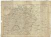
Deutschland nach seiner neuesten Grenz-Berichtigung
1 : 2370000 Evropa střední Mollo, Tranquillo bey T. Mollo
Neueste Post-Karte von Deutschland und dem grösten Theil der umliegenden Staaten oder Mittel-Europa
1 : 2350000 Evropa střední Fried, Franz List, C. Artaria
Deutschland 1792
Deutschland Kunz, Andreas ; Moeschl, Joachim Robert
Das Sprachgebiet der Deutschen in Mitteleuropa
1 : 7500000 Mitteleuropa Deutsche, Sprachkartografie
Germaniae Veteris, typus. [Karte], in: Theatrum orbis terrarum, sive, Atlas novus, Bd. 1, S. 316.
1 Karte aus Atlas Blaeu, Joan Blaeu, Willem Janszoon
Deutschland, Übersicht des Deutschen Reichs
Handatlas über alle Theile der Erde und über das Weltgebäude Stieler, Adolf Justus Perthes
Post und Eisenbahn Reisekarte von Central Europa

Carte générale d'Allemagne
1 : 3760000 Evropa střední Mentelle, Edme Tardieu, Pierre François
Deutschland 1648
Deutschland Kunz, Andreas ; Moeschl, Joachim Robert
Germania [Karte], in: Gerardi Mercatoris Atlas, sive, Cosmographicae meditationes de fabrica mundi et fabricati figura, S. 327.
1 Karte aus Atlas Mercator, Gerhard Montanus, Petrus
Deutschland um 1378
Deutschland Kunz, Andreas ; Moeschl, Joachim Robert
[Mitteleuropa]
1 : 2500000 [S.l. : s.n.]
Mitteleuropa. Völker
1 : 9000000 Mitteleuropa Ethnische Gruppe
Deutschland 1555
Deutschland Kunz, Andreas ; Moeschl, Joachim Robert
A new map of the German Empire...

Germaniae Veteris, typus. [Karte], in: Novus Atlas, das ist, Weltbeschreibung, Bd. 1, S. 291.
1 Karte aus Atlas Blaeu, Joan Blaeu, Willem Janszoon
Deutschland um 1500
Deutschland Kunz, Andreas ; Moeschl, Joachim Robert