Maps of Europe

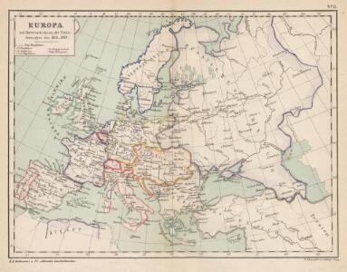
Europa mit Berücksichtigung der Veränderungen von 1815 - 1870
Europa
Charte von Europa
Europa
Europa, Fluss- und Gebirgskarte
1 : 24000000 Europa Physische Geografie
Europa

Oro-Hydrographische Charte von Europa
Europa Orohydrografie
[Recto], uit: Europa / [aardrijkskundig medew. G.J. de Vries]
1 : 25000000 titelvariant: Landen van Europa met de hoofdsteden; Annotatie: Titel boven de krt.: Landen van Europa met de hoofdsteden; Verso: register van landen met de hoofdsteden Gerben Johannes de Vries 1886-1968 Sneek : Tonnema & Cie
Politický přehled Evropy
Volksdichte von Europa
1 : 30000000 Europa Bevölkerungsdichte
Kaart van Europa
1 : 10000000 uitg. door de Maatschappij tot Nut van het Algemeen C. van Baarsel & Zoon del. & et sculps. Leyden [etc.] : Du Mortier [etc.]
Bevölkerungsdichtigkeit von Europa
1 : 23500000 Europa Bevölkerungsdichte
Nieuwe kaart van Europa na de alderlaatste ondekking int licht gebracht, te Amsterdam by Isaak Tirion
1 : 18000000 Europa Tirion, Isaak, http://d-nb.info/gnd/1031543473
Europa
Volksschul-Atlas über alle Teile der Erde Lange, Henry Druck und Verlag von Georg Westermann
Europa 2003 [Blattschnitt bis zum Ural]
Europa Kunz, Andreas ; Moeschl, Joachim Robert
Europe relief du sol
Vidal de La Blache, Paul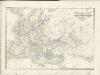

Religionskarte von Europa
1 : 23500000 Europa Denomination
Versuch einer Übersicht der geographischen Verbreitung der Gewitter
Erster Band, enthaltend in vier Abtheilungen die Erscheinungen der anorganischen Natur: 1. Meteorologie und Klimatographie. 2. Hydrologie und Hydrographie. 3. Geologie. 4. Tellurischer Magnetismus Humboldt, Alexander von Verlag von Justus Perthes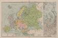
Politische Karte von Europa
1 : 20000000 Europa
Europae [Karte], in: Theatrum orbis terrarum, S. 22.
1 Karte aus Atlas Ortelius, Abraham
Europa während des Zeitraums der Reformation und der Übermacht des Hauses Habsburg 1492 - 1618
1 : 15000000 Europa
Europa nach dem Weltkriege
1 : 7500000 Evropa Carl Flemming und C. T. Wiskott Aktiengesellschaft für Verlag und Kunstdruck
Politická mapa Evropy
1 : 15000000 Evropa Wolf, R.
Europe relief du sol
Vidal de La Blache, Paul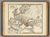
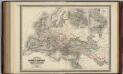
Imperium Romanorum inde a Constantini Magni tempore.
1 : 15500000 Menke, Th.
Übersicht der europæischen Seeküsten
1 Karte : Kupferdruck ; 60 x 49 cm Bowles; Schrämbl F. A. Schraembl
Neubertova podrobná politická mapa Evropy

Europa-Karte
1 : 5000000 Evropa Jro-Verlag München Carl Kremling
Europa-Karte
1 : 5000000 Evropa Jro-Verlag Carl Kremling
Carte d'Europe dressée pour l'usage du Roy sur les itineraires anciens et modernes et sur les routiers de mer assujetis aux observations astronomiques
1 : 570000 par G. Delisle, premier geographe de S.M. de l'Academie Royale des Sciences J. Condet f[ecit] À Amsterdam : chez J. Cóvens et C. Mortier