Maps of Europe

Europae [Karte], in: Theatrum orbis terrarum, S. 22.
1 Karte aus Atlas Ortelius, Abraham
[Europa]
Evropa
Europa nach seinem politischen Zustande im Jahr 1828
Historisch-genealogisch-geographischer Atlas von Le Sage Las Cases, Emmanuel Auguste Dieudonné Marius Joseph de Johann Velten, Kunsthändler
Evropa
1 : 6000000 Evropa Melantrich
Europa um 1740
1 : 15000000 Europa
Karte von Europa und dem Mittelländischen Meere
1 : 4300000 Evropa Stülpnagel, Friedrich von Bär, Johann Christoph Justus Perthes
Karte von Europa und dem Mittelländischen Meere
1 : 4300000 Evropa Stülpnagel, Friedrich von Bär, Johann Christoph Justus Perthes
Kaart van Europa voor schoolgebruik bewerkt / door H. Blink
1 : 3000000 Annotatie: Met: Lengte en vermogen van eenige stroomen onderling vergeleken; Annotatie geografische gegevens: Schaalstok van 300 km; Legenda; 3 bijkaarten 1: Typisch voorbeeld van ligging en profil der fjorden in Noorwegen, 15,5 x 19,5 cm. 2: Simplonpas en St. Gothardspoorweg, schaal 3:500.000, 15,5 x 18,5 cm, resp. 24,5 x 9,5 cm. 3: Kaart van de Alpen, schaal 1:1.500.000, 34 x 49 cm Ten Brink, Meppel Meppel : H. ten Brink / (Groningen : J.H. van de Weijer)
Europa
Handatlas über alle Theile der Erde und über das Weltgebäude Stieler, Adolf Justus Perthes
Europa 2003 [Blattschnitt bis zum Ural]
Europa Kunz, Andreas ; Moeschl, Joachim Robert
Europa
Hypsometrischer Atlas Ziegler, Jakob Melchior Topogr. Anstalt v. J. Wurster u. Comp.
Europa
1 : 12000000 Evropa Kiepert, Heinrich Bishoff, C. Geographische Verlagshandlung Dietrich Reimer
Europa
Plastischer Schul-Atlas über alle Theile der Erde : in 24 Karten Woldermann, G Verlag von P. Eckerlein
Hauptverbindungslinien von Europa als Mittelpunkt des Welverkehrs
Geographischer Atlas über alle Theile der Erde Ziegler, Jakob Melchior Verlag von Joh. Wurster um Comp.
Europa zur Uebersicht der Flussgebiete und Höhenzüge
Hand-Atlas über alle Theile der Erde nach dem neuesten Zustande und über das Weltgebäude Stieler, Adolf bei Justus Perthes
Politický přehled Evropy

Carte générale orographique et hydrographique de l'Europe, qui montre les principales ramifications des montagnes, fleuves et chemins avec les principales villes
1 : 4600000 dressée d'aprés les meilleures cartes des auteurs les plus acredités par le Général Baron Sorriot de L'Host gravée par Joseph List. Vienne, [s.n.]
Europa.
1 : 12000000 Stein, Christ. Gottfr. Dan.
Europa gegen Ende von Justinians Regierung (um 560 n. Ch. G.)
1 : 15000000 Europa, Mittelmeerraum, Justinian I., Byzantinisches Reich, Kaiser
[Neuer Atlas der ganzen Erde nach den neuesten Bestimmungen ... : II.] Europa
Entworfen und gezeichnet von F.W. Streit H. Leutemann sc. Leipzig : J.C. Hinrichs'sche Buchhandlung
Nova Europae Descriptio [Karte], in: Gerardi Mercatoris Atlas, sive, Cosmographicae meditationes de fabrica mundi et fabricati figura, S. 64.
1 Karte aus Atlas Mercator, Gerhard Montanus, Petrus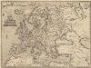
Europae [Karte], in: Theatrum orbis terrarum, S. 52.
1 Karte aus Atlas Ortelius, Abraham Vrients, Jan Baptista
Ewropa
1 : 32000000 Evropa Merklas, Václav
Europa Post Bellum Triginta Annorum. (1650-1700)
Europa Westfälischer Friede
Europe d'apres les derniers traites de paix.
1 : 12400000 Picquet, C.
Europa zur Zeit des dritten Kreuzzuges 1190
1 : 15000000 Europa Kreuzzug <1189-1192>
Europa vom Westfälischen Frieden 1648 bis zur Zersplitterung der grossen spanischen Monarchie 1700 (Zeitraum der Übermacht Frankreichs)
1 : 15000000 Europa, Westfälischer Friede
Europa
Volksschul-Atlas über alle Teile der Erde Lange, Henry Druck und Verlag von Georg Westermann

![Europae [Karte], in: Theatrum orbis terrarum, S. 22.](https://images-2.georeferencer.com/images/iiif/294171922476/full/,300/0/native.jpg)

