Maps of Europe

Maps of Europe

$title$

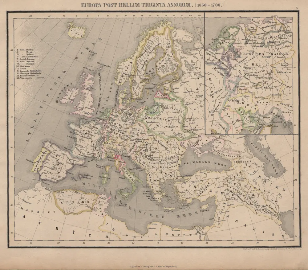
Europa Post Bellum Triginta Annorum. (1650-1700)

Europa Westfälischer Friede
$title$

Europam, Sive Celticam Veterem [Karte], in: Theatrum orbis terrarum, S. 453.

1 Karte aus Atlas Ortelius, Abraham Vrients, Jan Baptista
$title$

Europa ad magnae Europae Gerardi Mercatoris P. imitationem [...] [Karte], in: Atlas, sive, Cosmographicae meditationes de fabrica mundi et fabricati figura, S. 65.

1 Karte aus Atlas Mercator, Gerhard
$title$

Europa

Geographischer Atlas über alle Theile der Erde Ziegler, Jakob Melchior Verlag von Dietrich Reimer
$title$

[Karte von Europa, Zur Übersicht der Regen-Verhältnisse in diesem Erdtheile]

Erster Band, enthaltend in vier Abtheilungen die Erscheinungen der anorganischen Natur: 1. Meteorologie und Klimatographie. 2. Hydrologie und Hydrographie. 3. Geologie. 4. Tellurischer Magnetismus Humboldt, Alexander von Verlag von Justus Perthes
$title$

Europa. Staaten

1 : 24000000 Europa Politische Geografie
$title$

Europa. Staaten

1 : 24000000 Europa Politische Geografie
$title$

[Karte von Europa, Zur Übersicht der Wärme-Verbreitung in diesem Erdtheile]

Erster Band, enthaltend in vier Abtheilungen die Erscheinungen der anorganischen Natur: 1. Meteorologie und Klimatographie. 2. Hydrologie und Hydrographie. 3. Geologie. 4. Tellurischer Magnetismus Humboldt, Alexander von Verlag von Justus Perthes
$title$

[Übersicht der Verbreitung der wichtigsten Kultur-, Baum- und Strauchgewächse in Europa]

Zweiter Band, enthaltend in vier Abtheilungen die Vertheilung der Organismen: 5. Pflanzen-Geographie, 6. Thier-Geographie, 7. Anthropographie, 8. Ethnographie Humboldt, Alexander von Verlag von Justus Perthes
$title$

Der europäische Raum

1 : 6000000 Afrika severní Richard Schwarz, Landkarten-Handlung und Geogr. Verlag
$title$

Der europäische Kontinent

1 : 7500000 Evropa Verlagsanstalt List und von Bressensdorf
$title$

Europa nach seinen ethnographischen Verhältnissen in der Mitte des XIX Jahrhunderts

1 : 15000000 Europa ethnische Gruppe
$title$

Europa Übersicht der politischen Verhältnisse und Hauptverkehrswege

1 : 20000000 Europa Verkehrsnetz
$title$

Das Deutschtum in Europa

1 : 36000000 Europa Ethnische Gruppe, Deutsche
$title$

Europa um 1740

1 : 15000000 Europa
$title$

Europa. Bodengestalt

1 : 24000000 Europa Physische Geografie
$title$

Machtverhältnisse der Europ. Staaten

1 : 14000000 Übersichtskarte Block, Maurice Justus Perthes
$title$

Europam, Sive Celticam Veterem [Karte], in: Theatrum orbis terrarum, S. 362.

1 Karte aus Atlas Ortelius, Abraham
$title$

Europa zur Uebersicht der Flussgebiete und Höhenzüge

Hand-Atlas über alle Theile der Erde nach dem neuesten Zustande und über das Weltgebäude Stieler, Adolf bei Justus Perthes
$title$

Europa zur Zeit Napoleon's I. (um 1810)

1 : 15000000 Europa Napoleon I., Frankreich, Kaiser
$title$

Hyetographic or Rain Map of Europe

The physical atlas Johnston, Alexander Keith William Blackwood & Sons
$title$

Europe.

1 : 21542400 Lucas, Fielding Jr.
$title$

Völkerkarte von Europa

1 : 36000000 Europa Ethnische Gruppe
$title$

Europa nach dem Wiener Congress 1815

1 : 15000000 Europa
$title$

Europa um die Mitte des Vierzehnten Jahrhunderts

1 : 15000000 Europa
$title$

Europa

Schul-Atlas in 36 Karten Völter, Daniel Verlag der J.M. Dannheimer'schen Buchhandlung
$title$

Europa ad magnae Europae Gerardi Mercatoris P. imitationem [...] [Karte], in: Gerardi Mercatoris Atlas, sive, Cosmographicae meditationes de fabrica mundi et fabricati figura, S. 61.

1 Karte aus Atlas Mercator, Gerhard Montanus, Petrus
$title$

Europa

Atlas der Geologie Zittel, K.v. ; Berghaus, Hermann Justus Perthes
$title$

Europa vom Westfälischen Frieden 1648 bis zur Zersplitterung der grossen spanischen Monarchie 1700 (Zeitraum der Übermacht Frankreichs)

1 : 15000000 Europa, Westfälischer Friede
$title$

Europa

Schul-Atlas in 36 Karten Völter, Daniel Verlag der J.M. Dannheimer'schen Buchhandlung
© MapTiler © OpenStreetMap contributors
How does it work?
These instructions will show you how to find historical maps online.
Getting started
Type the place name in the search box to find the exact location. You can further adjust the search by zooming in and out.
Zoom
Zoom in and out with the buttons or use your mouse or touchpad natively.
Exact Area tool
Click here and draw a rectangle over the map to precisely define the search area.
Set filters
Narrow your search with advanced settings, such as Years (from/to), Fulltext, Publisher, etc.
Results
See the results of your search on the right side. You can scroll down to find more maps of this location.
?

Download OldMapsOnline Mobile