Maps of Europe
Evrope
1 Karte : Kupferdruck ; 18 x 23 cm Sanson; Winter s.n.
Europa
Handatlas über alle Theile der Erde und über das Weltgebäude Stieler, Adolf Justus Perthes
Europe
1 : 11099000 Johnson, A.J.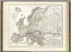
Orograph. Europa.
1 : 8900000 Weiland, C. F. (Carl Ferdinand), d. 1847
Composite: Europe.
1 : 4800000 Kitchin, Thomas
[Ethnographic Map of Europe]
The physical atlas Johnston, Alexander Keith William Blackwood & Sons
Neueste Karte von Europa
Grosser Hand-Atlas über alle Theile der Erde in 170 Karten Meyer, J. Verlag des Bibliographischen Instituts
Europe en 1789.
1 : 12300000 Picquet, C.
Kaart van Europa voor schoolgebruik bewerkt / door H. Blink
1 : 3000000 Annotatie: Met: Lengte en vermogen van eenige stroomen onderling vergeleken; Annotatie geografische gegevens: Schaalstok van 300 km; Legenda; 3 bijkaarten 1: Typisch voorbeeld van ligging en profil der fjorden in Noorwegen, 15,5 x 19,5 cm. 2: Simplonpas en St. Gothardspoorweg, schaal 3:500.000, 15,5 x 18,5 cm, resp. 24,5 x 9,5 cm. 3: Kaart van de Alpen, schaal 1:1.500.000, 34 x 49 cm Ten Brink, Meppel Meppel : H. ten Brink / (Groningen : J.H. van de Weijer)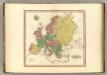
Europe.
1 : 11100000 Tanner, Henry S.
Composite: Europe.
1 : 6000000 Lizars, Daniel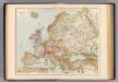
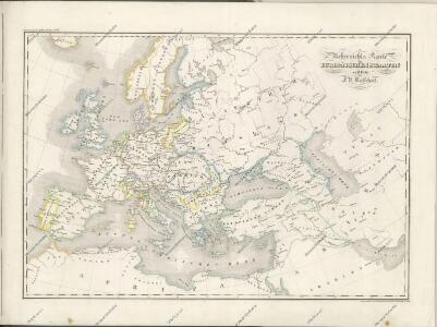
Europa politisch.
1 : 12000000 Andree, Richard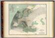
Hyetographic map Europe.
1 : 10600000 Johnston, Alexander Keith, 1804-1871
Carte générale de l'Europe en 1789 / redigée pour l'étude de l'histoire du Moyen Âge, par A. Br
1 : 12400000 1 Karte : Kupferdruck ; 37 x 51 cm Brué, Adrien Hubert chez l'auteur ... et chez les principaux m.ds de cartes géographiques
Europa mit politischer Begränzung der einzelnen Staaten
Stieler's Hand-Atlas Stieler, Adolf bei Justus Perthes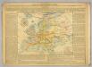
Klima- und Naturproducten-Karte von Europa.
1 : 12500000 Desjardins, Constant
Europa
Neuer Handatlas über alle Theile der Erde Kiepert, Heinrich Verlag von Dietrich Reimer
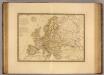
L'Evrope
1 Karte : Kupferdruck ; 39 x 51 cm Duval chez l'auteur prez le For l'Evesque
General Karte von Europa, worinnen die Gestalt dieses Erdtheiles zu ersehen ist, wie selbe nach seinem Höhensisteme und Wasserzuge angeordnet ist
1 : 9500000 entworfen von Freyherrn v. Sorriot [...] gestochen v. J. List Wien, [s.n.]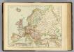
Europe.
1 : 12000000 Andree, Richard; Times (London, England)
L'Europe
1 Karte : Kupferdruck ; 40 x 54 cm Sanson; Sanson chez l'autheur au galleries du Louure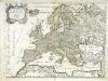
L'Europe
1 Karte : Kupferdruck ; 41 x 54 cm Sanson; Sanson chez l'autheur
Europe.
1 : 16600000 Sharpe, J.
Europe
A new general atlas of modern geography, consisting of a complete collection of maps of the four quarters of the globe Wyld, James James Wyld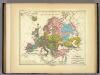
Europa in Geologischer Beziehung.
1 : 17000000 Berghaus, Heinrich
Europa zur Uebersicht der Flussgebiete und Höhenzüge
Stieler's Hand-Atlas Stieler, Adolf bei Justus Perthes
L'Europe 800, 1500.
1 : 16500000 Lapie, M. (Pierre), 1779-1850