Maps of Europe

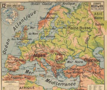
Europe relief du sol
Vidal de La Blache, Paul
Europa
Volksschul-Atlas über alle Teile der Erde Lange, Henry Druck und Verlag von Georg Westermann
Charte von Europa mit der Nordküste von Africa und einen grossen Theile von Asien
1 : 9000000 Afrika severní Marco Berra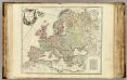
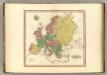
L'Europe divisee en ses principaux Etats.
1 : 9500000 Robert de Vaugondy, Gilles, 1688-1766
Evropae
Ortelius, Abraham [Aegidius C. Diesth]
Europe relief du sol
Vidal de La Blache, Paul
Composite: Europe.
1 : 4800000 Robert Laurie & James Whittle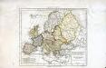
Europæ antiquæ tabula geographica
1 Karte : Kupferdruck ; 23 x 27 cm Delamarche; Delahaye s.n.
Storchova nejnovější politická, cestovní, železniční a paroplavební mapa Evropy

Europa-Karte
1 : 5000000 Evropa Jro-Verlag München Carl Kremling
Europa-Karte
1 : 5000000 Evropa Jro-Verlag Carl Kremling
Neue Wandkarte von Europa

Europa.
1 : 12000000 Stein, Christ. Gottfr. Dan.
Europe.
1 : 2350000 Finley, Anthony
[Evropa]
Evropa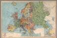
Europe
1 : 13100000 Geographia Map Company
Versuch einer Übersicht der geographischen Verbreitung der Gewitter
Erster Band, enthaltend in vier Abtheilungen die Erscheinungen der anorganischen Natur: 1. Meteorologie und Klimatographie. 2. Hydrologie und Hydrographie. 3. Geologie. 4. Tellurischer Magnetismus Humboldt, Alexander von Verlag von Justus Perthes
Karte von Europa
1 : 9350000 Evropa Handtke, F. Carl Flemming Verlag Buch- und Kunstdruckerei A.-G.
Oro-Hydrographische Charte von Europa
Europa Orohydrografie
L'Europe
1 Karte : Kupferdruck ; 40 x 54 cm Sanson; Sanson chez l'autheur au galleries du Louure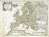
L'Europe
1 Karte : Kupferdruck ; 41 x 54 cm Sanson; Sanson chez l'autheur
Evropa
1 : 6000000 Evropa Melantrich
Ewropa
1 : 32000000 Evropa Merklas, Václav
Wandcharte von Europa
Krümmer, H. Grüson
Europa
Plastischer Schul-Atlas über alle Theile der Erde : in 24 Karten Woldermann, G Verlag von P. Eckerlein
Europa.
1 : 15000000 Berghaus, Hermann
Europe.
1 : 11100000 Tanner, Henry S.
Accuratissima Europæ tabula
1 Karte : Kupferdruck ; 48 x 56 cm Wit; Ottens; Ottens ex officina R. et I. Ottens