Maps of Herzegovina-Neretva Canton
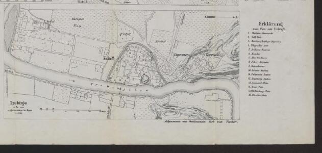
Trebinje
1 : 2500 Bosnien-Herzegowina Trebinje Gefechtsfeld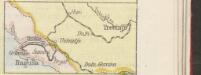
[Eisenbahnnetz Ragusa-Trebinje]
Kroatien Dalmatien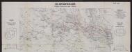
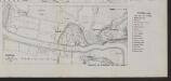
Die Gefechtsfelder Trebinje, Grančarevo und Klobuk
Bosnien-Herzegowina Gefechtsfeld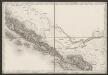
[Umgebung von Dubrovnik]
Kroatien Dalmatien Ragusa (Dalmatien) Umland
Ragusa.
from Spezialkarte der osterreichisch-ungarischen Monarchie.
Bileca.
from Spezialkarte der osterreichisch-ungarischen Monarchie.
Trebinje und Risano.
from Spezialkarte der osterreichisch-ungarischen Monarchie.
Dalmatien
1 : 80000 Dalmácie (Chorvatsko) Oesterreicher, T. Hydrographisches Amt der K. u. k. Kriegsmarine, Seekarten-Depot
Okolí Kotoru
1 : 140000 Kotor (Černá Hora) Bedřich Sandtner
Okolí Kotoru
1 : 140000 Kotor (Černá Hora) Fáborský, Jan B. Nipočić, Vasilij Bedřich Sandtner
Dubrovnik - Kotor
1 : 200000 Dubrovník (Chorvatsko : oblast) Kartografska radionica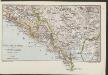
Südl. Dalmatien und Montenegro
1 : 600000 Kroatien Montenegro Dalmatien
Bezirke von Montengro
Kroatien, Montenegro
Generalkarte von Bosnien und Herzegovina

Generalkarte von Bosnien und der Hercegovina
1 : 300000 Bosnien-Herzegowina Montenegro
Oestlicher Theil von Dalmatien
1 : 445000 Chorvatsko Santini, P. Engelman, J. W. F. A. Schraembl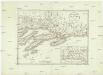
Oestlicher Theil von Dalmatien
1 : 450000 Chorvatsko Santini, P. Engelman, J. W. F. A. Schraembl
Crnagora
Černá Hora Hofmann, A.
Eiszeitliche Vergletscherung der Gebirgsgruppen von Prokletije bis Durmitor
1 : 200000 Durmitor (Černá Hora) Cvijić, Jovan des K. u. k. Militärgeographischen Institutes
Railway-System in South-Dalmatia and in South-Eastern Herzegovina
Kroatien Dalmatien
Carte de la partie d'Albanie occupé par le Bacha de Scutari. le District des Montenegrins, et partie des territoires des Rep. de Venise, et de Raguse
1 : 490000 Albánie
Carte de la partie d'Albanie occupée par le Bacha de Scutari, le district des Montenegrins, et partie des territoires des Rep. de Venise, et de Raguse
1 : 490000 Albánie
Generalkarte von Zentraleuropa

Adriatisches Meer, Küsten-Karte
1 : 180000 Jaderské moře (oblast) Oesterreicher, Tobias von Hydrographisches Amt der k. u. k. Kriegs-Marine
Karta Crnegore
1 : 285000 Albánie Karacsay, Fedor de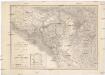
Karta Crnegore
1 : 285000 Albánie Karacsay, Fedor de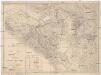
Karta Crnegore
1 : 285000 Albánie Karacsay, Fedor de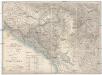
Karta Crnegore
1 : 285000 Albánie Karacsay, Fedor de
Geologische Übersichtskarte von Montenegro
1 : 450000 Černá Hora Tietze, Emil Ernst August Alfred Hölder