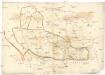
Maps of Dubrovnik
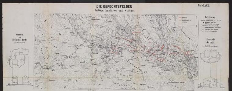
Die Gefechtsfelder Trebinje, Grančarevo und Klobuk
Bosnien-Herzegowina Gefechtsfeld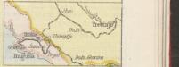
[Eisenbahnnetz Ragusa-Trebinje]
Kroatien Dalmatien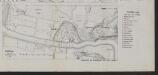
Trebinje
1 : 2500 Bosnien-Herzegowina Trebinje Gefechtsfeld
Klobuk
Bosnien-Herzegowina Gefechtsfeld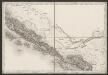
[Umgebung von Dubrovnik]
Kroatien Dalmatien Ragusa (Dalmatien) Umland
Plan goroda i zaliva Raguza
Kroatien Dubrovnik Seeschlacht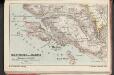
Umgebung von Ragusa
1 : 75000 Kroatien Dubrovnik
Dalmatien
1 : 80000 Dalmácie (Chorvatsko) Oesterreicher, T. Hydrographisches Amt der K. u. k. Kriegsmarine, Seekarten-Depot
Trebinje und Risano.
from Spezialkarte der osterreichisch-ungarischen Monarchie.
Ragusa.
from Spezialkarte der osterreichisch-ungarischen Monarchie.
Bileca.
from Spezialkarte der osterreichisch-ungarischen Monarchie.
Übersichtsblatt zum Kriegsspielplan der Umgebung von Cattaro
1 : 12500 Kotor (Černá Hora) K. u. k. militär-geographisches Institut
Skize jenes Theiles des Kreises Cattaro in welchem die nördliche Gränze zu ersehen ist, wie sie gegenwärtig besteht, - und wie sie diplomatisch in der Richtung der Nr.24_33_34_35 und 36 bestehen sollte
1 : 84222 Boka Kotorska, Kotor (Region), Grenze Jabornigg von Altenfels, Rudolf
[Umgebung von Dragalj, Montenegro ; Titel]
Montenegro Orjen Umland
Dubrovnik - Kotor
1 : 200000 Dubrovník (Chorvatsko : oblast) Kartografska radionica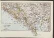
Südl. Dalmatien und Montenegro
1 : 600000 Kroatien Montenegro Dalmatien
Bezirke von Montengro
Kroatien, Montenegro
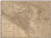
Generalkarte von Bosnien und Herzegovina

Generalkarte von Bosnien und der Hercegovina
1 : 300000 Bosnien-Herzegowina Montenegro
Railway-System in South-Dalmatia and in South-Eastern Herzegovina
Kroatien Dalmatien
Carte de la partie d'Albanie occupé par le Bacha de Scutari. le District des Montenegrins, et partie des territoires des Rep. de Venise, et de Raguse
1 : 490000 Albánie
Carte de la partie d'Albanie occupée par le Bacha de Scutari, le district des Montenegrins, et partie des territoires des Rep. de Venise, et de Raguse
1 : 490000 Albánie
Generalkarte von Zentraleuropa
Karta Crnegore
1 : 285000 Albánie Karacsay, Fedor de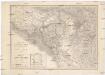
Karta Crnegore
1 : 285000 Albánie Karacsay, Fedor de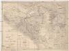
Karta Crnegore
1 : 285000 Albánie Karacsay, Fedor de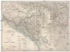
Karta Crnegore
1 : 285000 Albánie Karacsay, Fedor de
Hercegovina
1 : 400000 Hercegovina Daneš, Jiří Viktor Královská česká společnost nauk
Mappa swobodné obce Černohorské
Černá Hora Šafárik, Jan