Cataloged map
Trebinje und Risano.

Full title:Trebinje und Risano.
Depicted:1914
Physical Size:20 x 30 cm

Bocche di Cattaro
1913
1:150k
Carte, plan et vue des bouches de Cataro et de la forteresse de Castel-Novo, occupés par le Russes en 1806.
1806
Köb, Kajetano

Skize jenes Theiles des Kreises Cattaro in welchem die nördliche Gränze zu ersehen ist, wie sie gegenwärtig besteht, - und wie sie diplomatisch in der Richtung der Nr.24_33_34_35 und 36 bestehen sollte
1834
Jabornigg von Altenfels, Rudolf
1:84k

Busen von Cattaro
1913
1:500k

Buchta Boko-di-Kataro
1911
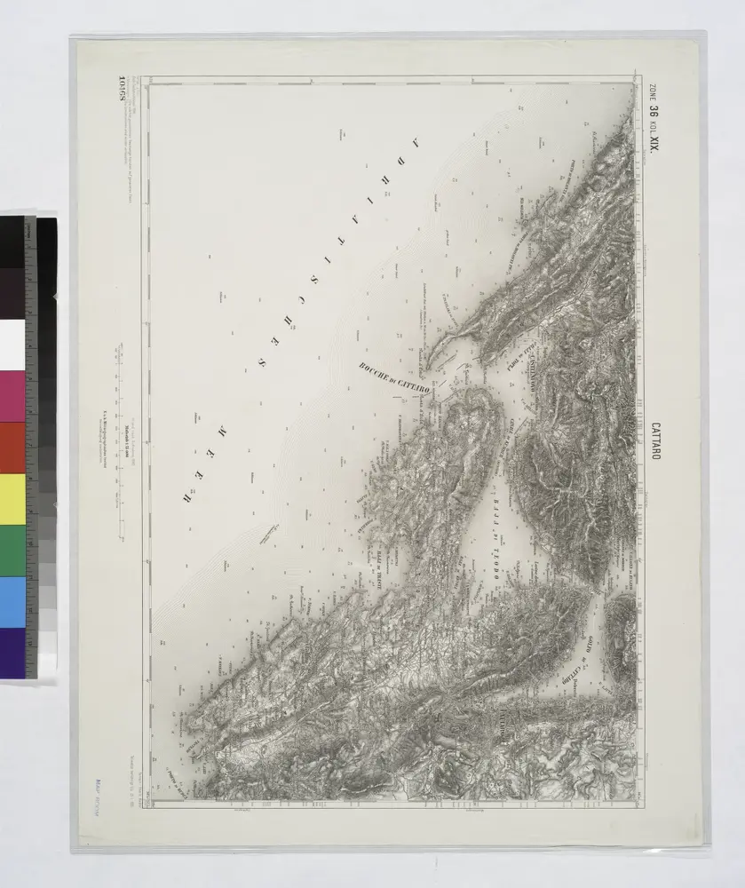
Cattaro.
1914
[Umgebung von Molunat ; Politische Einteilung]
1869
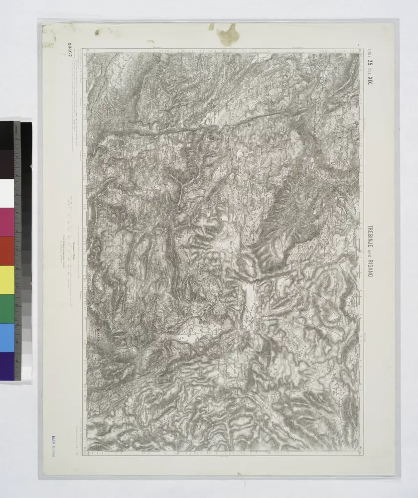
Trebinje und Risano.
1914

Mappa del Cordone Sanitario del Circolo di Cattaro
1834
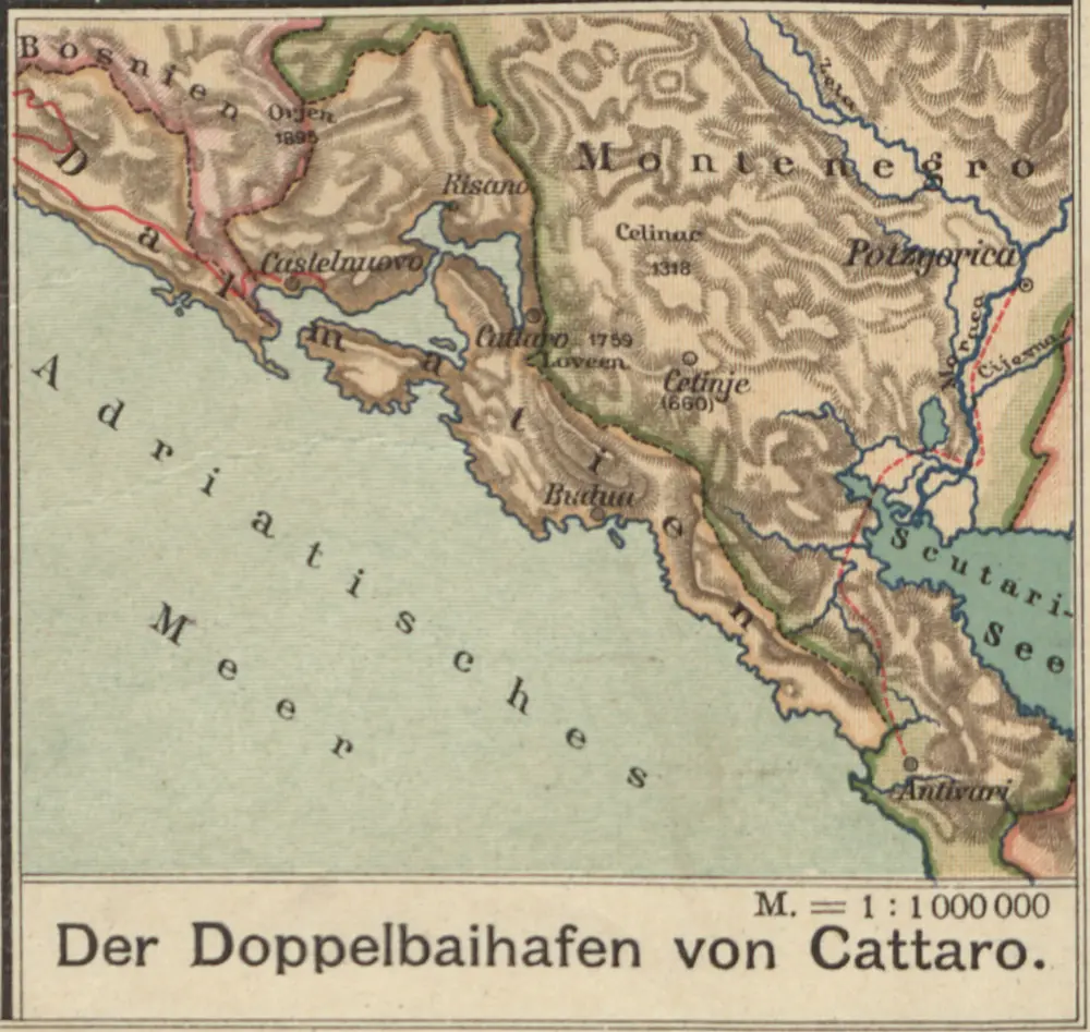
Der Doppelhafen von Cattaro
1913
1:100k