Mapa catalogado
Bezirke von Montengro

Título completo:Bezirke von Montengro
Año de ilustración:1849
Fecha de publicación:1849
Tamaño físico:20 x 30 cm
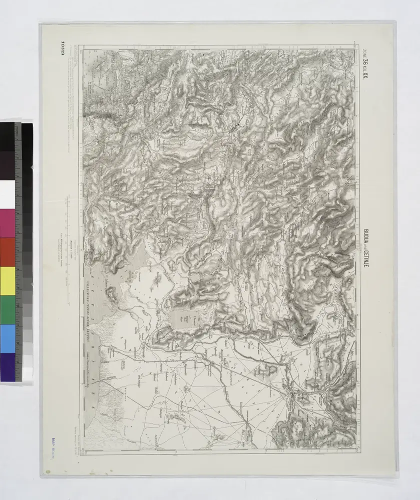
Budua und Cetinje.
1914
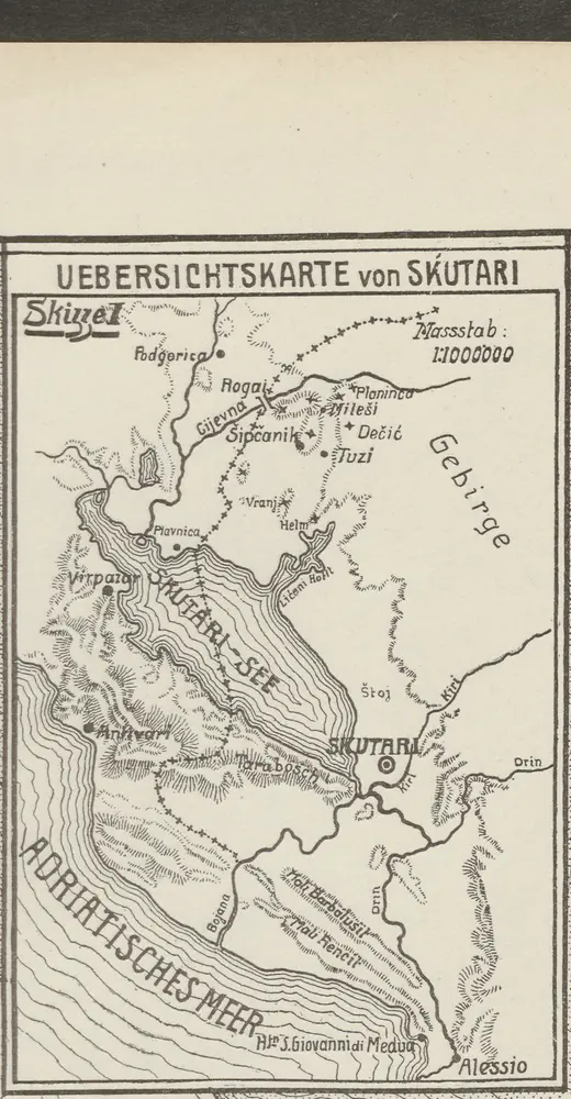
Übersichtskarte von Skutari
1913
1:1m
Okolí Kotoru
1865
Fáborský, Jan B.
1:140k
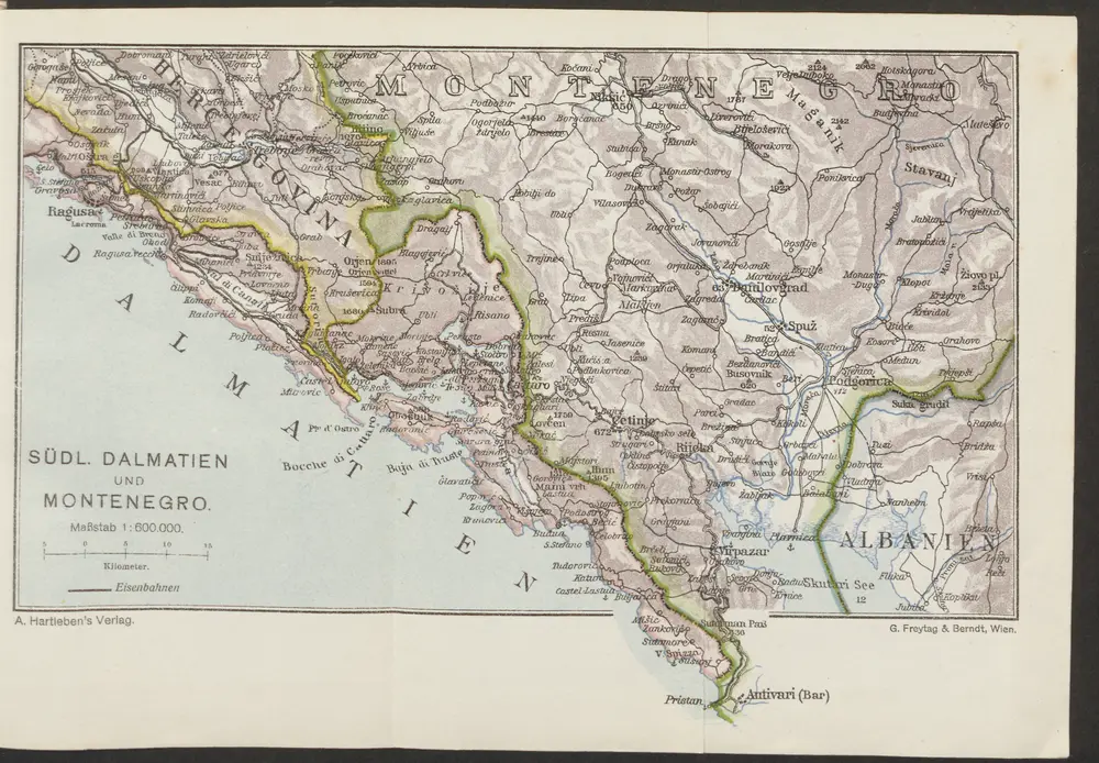
Südl. Dalmatien und Montenegro
1913
1:600k
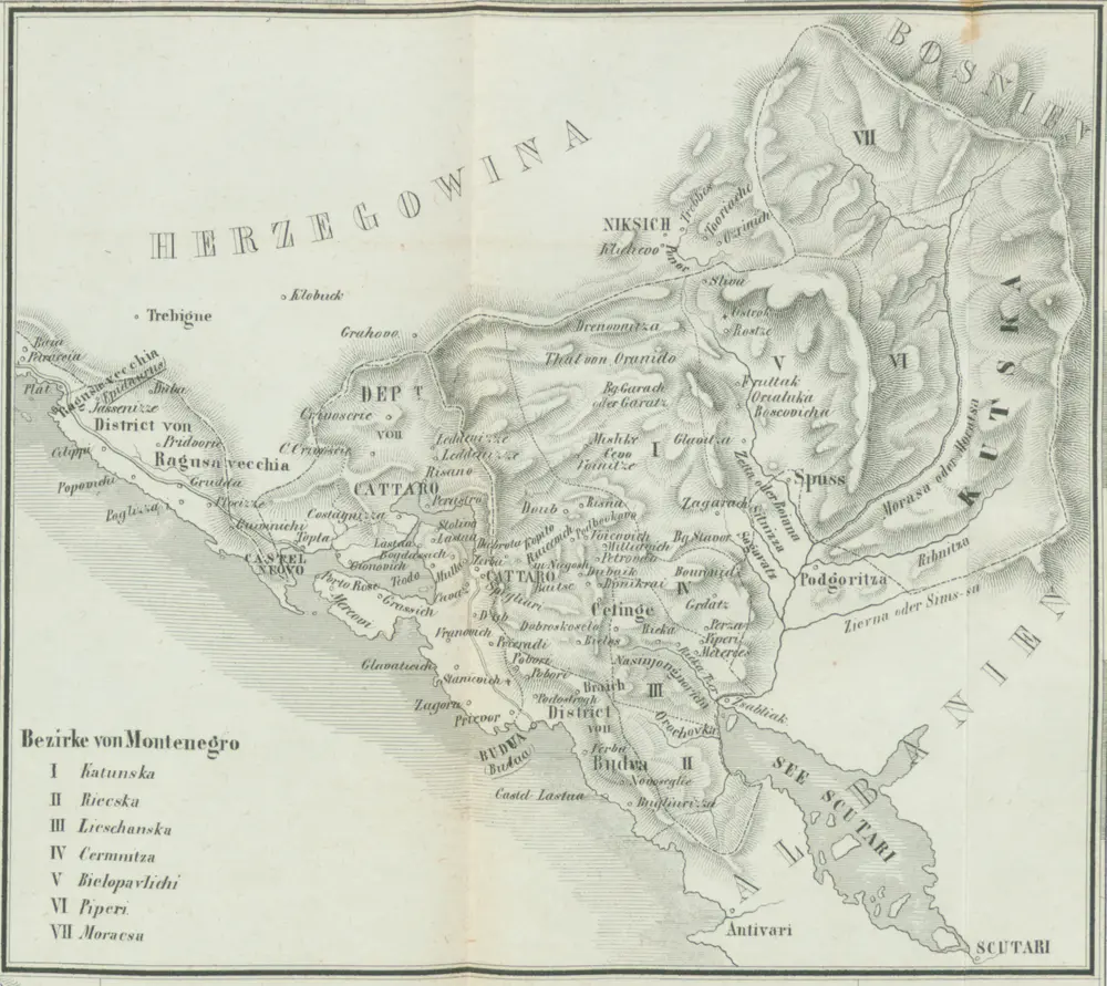
Bezirke von Montengro
1849
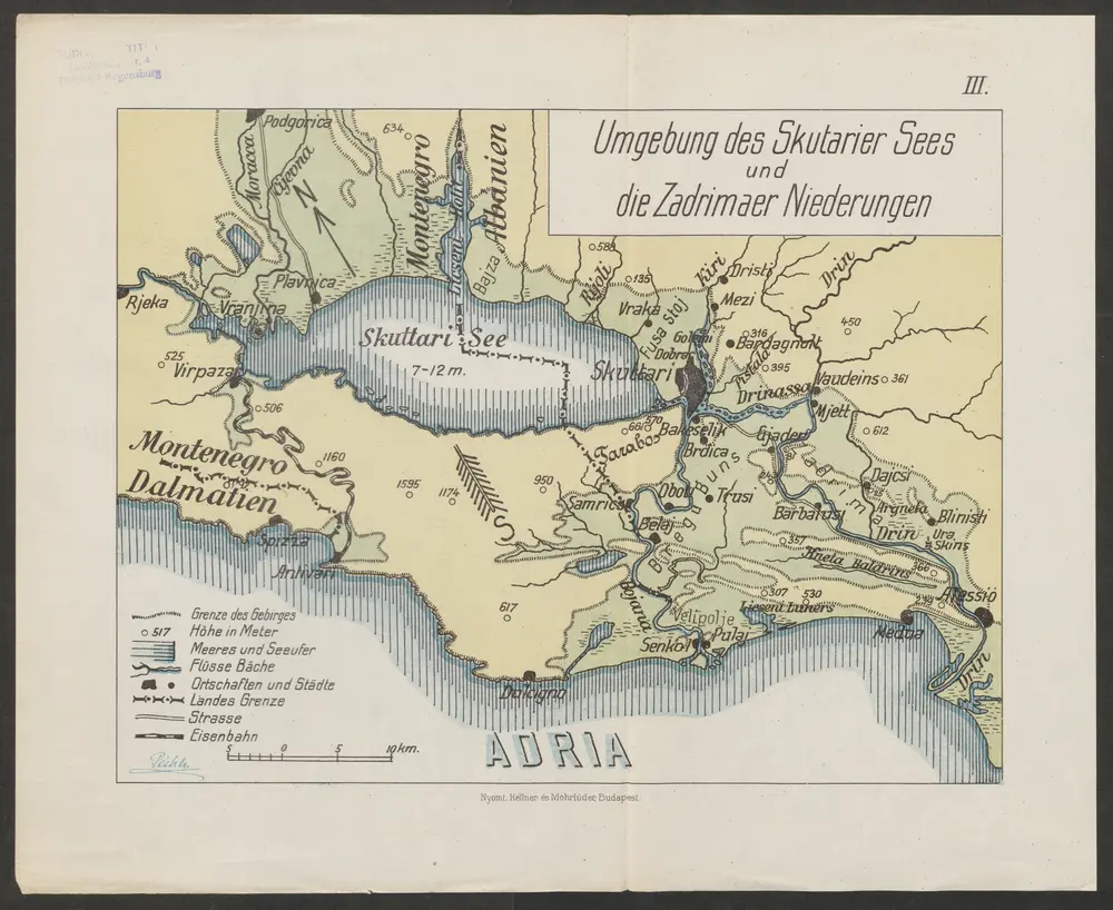
Umgebung des Skutarier Sees und die Zadrimaer Niederungen
1914
Péch, Béla
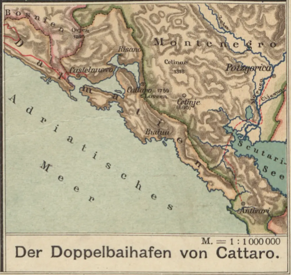
Der Doppelhafen von Cattaro
1913
1:100k
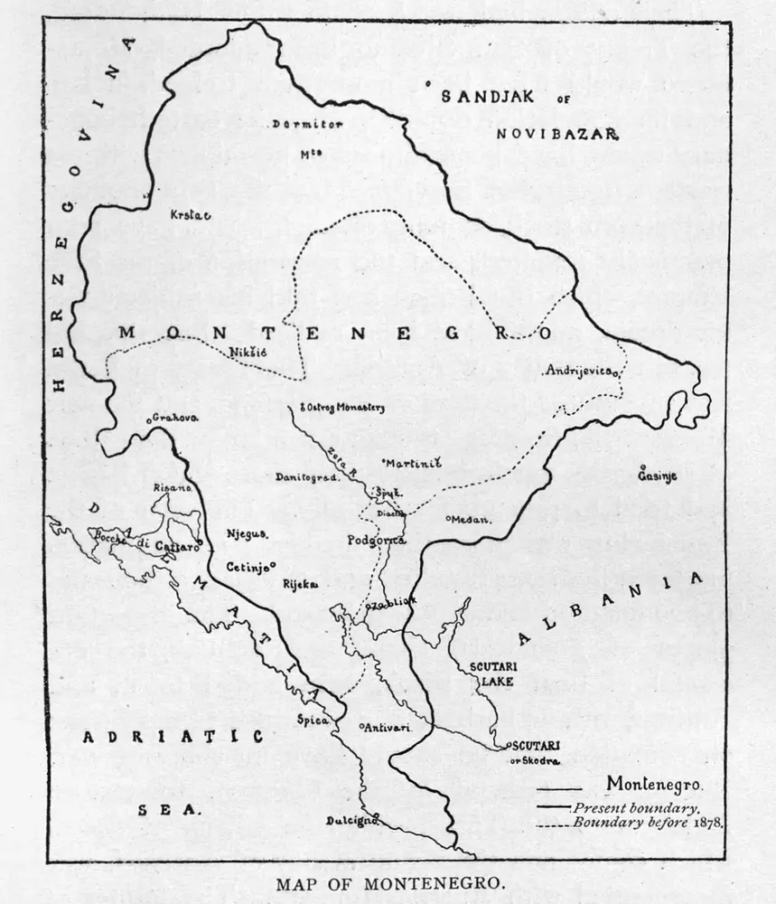
Map of Montenegro
1923

[Umgebung von Kotor]
1869
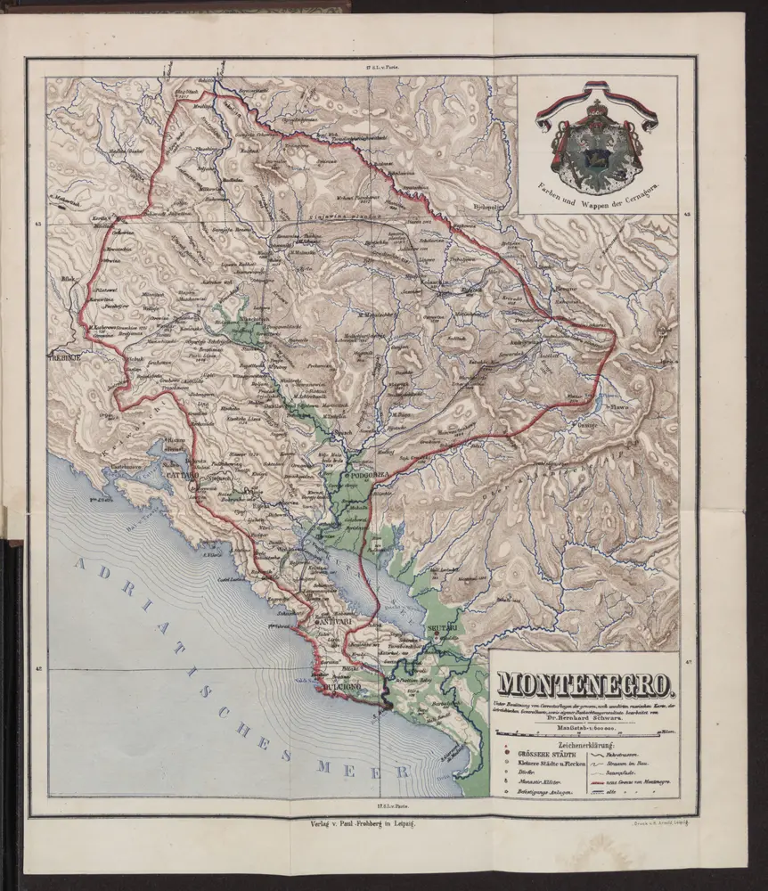
Montenegro
1888
1:600k