Maps of Grand Est
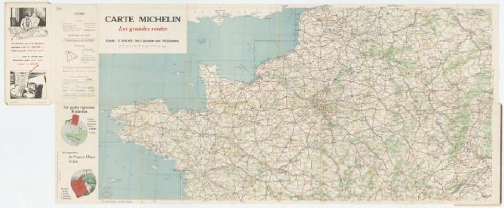
Carte Michelin 98: France - Nord, uit: Carte Michelin au 1:1.000.000e (1 cm = 10 km) : les grandes routes de France
1 : 1000000 Clermont-Ferrand : Michelin
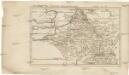
Carte de la France suivant sa nouvelle division en departements et disricts, 1
2 Blätter : 64 x 117 cm s.n.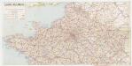
[Kaart], uit: Carte routière / dressée et dessinée par Foldex
1 : 1000000 titelvariant: Carte routière de la France; Annotatie: Omslagtitel: Carte routière de la France : section Nord Foldex, Parijs Paris : Foldex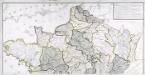
Carte générale des fleuves, des rivieres, et des principaux ruisseaux de la France, 1
1 Blatt : chez l'auteur Dupain-Triel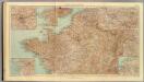
32-34. Francia nord.
1 : 1500000 Touring club italiano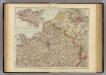
France N.
1 : 1750000 Andree, Richard; Times (London, England)
France Canaux
Vidal de La Blache, Paul
France Canaux
Vidal de La Blache, Paul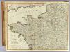
N.W. France.
1 : 1000000 Robert Laurie & James Whittle
France Régionale Bassin de Paris Région du Nord carte physique
Gallois, Lucien
Severovýchodní Francie

Map of the Seat of War in France.
1 : 2600000 Carey, Mathew
Map of the Seat of War in France, with the Country divided into its Several Departments.
1 : 2700000 Carey, Mathew
Map of the Seat of War in France, with the Country divided into its Several Departments.
1 : 2700000 Carey, Mathew
[Frankreich in 4 Blättern, Blatt 1]
Handatlas über alle Theile der Erde und über das Weltgebäude Stieler, Adolf Justus Perthes
[Frankreich, Blatt 1]
Adolf Stieler's Handatlas über alle Theile der Erde und über das Weltgebäude Stieler, Adolf Justus Perthes
France 1.
1 : 1774080 Letts, Son & Co.
Frankreich NW.
1 : 1700000 Handtke, Friedrich H.
Karten des französisch-belgischen Kriegsschaplatzes
1 : 1000000 Belgie Velhagen & Klasing
V, uit: General-Karte von Mittel-Europa in 12 Blättern, im Masse 1:1.200.000 / entworfen, bearb. und hrsg. von Josef Schlacher
1 : 1200000 Annotatie: Blad 6 ontbreekt; Annotatie geografische gegevens: 21 maatstokken op blad 9; Legenda op blad 9 Wien : K.K. Militär Geografisches Institut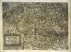
Franciae accurata descriptio
1 Karte : Kupferdruck ; 20 x 27 cm Quad Johannes Bussemacher
France I.
1 : 1800000 Society for the Diffusion of Useful Knowledge (Great Britain)

La Manche, ou le Canal, entre la France et l'Angleterre
1 Karte : Kupferdruck ; 49 x 59 cm Jaillot; Goere H. Jaillot
Britannia & Normandia cum confinibus regionibus [Karte], in: Gerardi Mercatoris Atlas, sive, Cosmographicae meditationes de fabrica mundi et fabricati figura, S. 220.
1 Karte aus Atlas Mercator, Gerhard Montanus, Petrus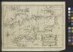
A Chart of the English Channel with the adjacent coasts of England and France.
from Atlantic Ocean
Cartes et coupe du Canal de la Manche et d'une partie de la mer d'Allemagne qui présentent par une nouvelle méthode la pente du fonds de ces deux mers
1 Karte : Kupferdruck ; 16 x 23 cm, Blattgrösse 46 x 61 cm Buache Philippe Buache

Der Nord-Westliche Theil von Frankreich
Hand-Atlas über alle Theile der Erde nach dem neuesten Zustande und über das Weltgebäude Stieler, Adolf bei Justus Perthes