Maps of Pontic Steppe
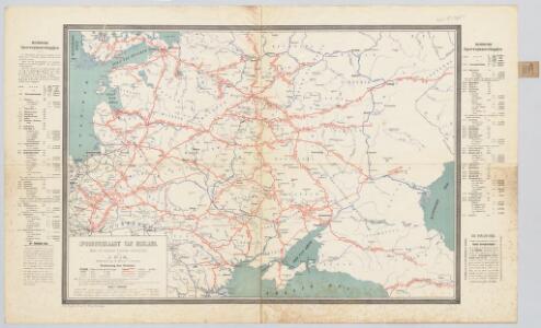
Spoorwegkaart van Rusland / naar de nieuwste bronnen vervaardigd door J. Pik
1 : 2500000 Annotatie: Met informatie over Russische spoorwegmaatschappijen en over het Russische geld; Annotatie geografische gegevens: Met drie maatstokken: Duitsche mijlen, Kilometers en Wersten J. Pik Groningen : De Financier
Das europæische Russland nach seiner allmähligen Vergrösserung seit 1462
1 : 38500000 Russland / Europäischer Teil Expansion
Karta rossijskich želěznych dorog
1 : 5250000 Charkov-oblast (Ukrajina) Bangof, Eduard v artističeskom zavedenija A.F. Marksa
Europäisches Russland 1801-1855
1 : 15500000 Russland / Europäischer Teil
Russisches Reich. Verwaltungsgrenzen von 1914. Europäischer Teil
Russland / Europäischer Teil Verwaltungsgliederung
Carte des peuplements slaves, au début du 5e siècle de notre ère, lors des invasions des Huns
Ostmitteleuropa Slawen Bevölkerung Hunnen
Das europaeische Russland
1 : 6500000 entworfen von C.F. Weiland C.J. Maedel sen. sc. Weimar : im Verlage des Geographischen Instituts
Charte des europäischen Russlands
Russland / Europäischer Teil
Europäisches Russland

Europäisches Russland
1 : 14500000 Russland / Europäischer Teil
Evropa raného středověku: do konce VI. století po Kr.
Kašpar, Jan
Uebersicht über die Stabsquartiere der russischen Armee
Russland Militär
Europaeisches Russland mit Kasan, Astrachan und Georgien
Schul-Atlas über alle Theile der Erde nach dem neuesten Zustande, und über das Weltgebäude Stieler, Adolf bei Justus Perthes
Russland
1 : 15000000 Russland / Europäischer Teil
Russland
Russland / Europäischer Teil
Russland
Russland / Europäischer Teil Skizzenbuch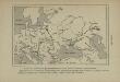
Carte des peuplements slaves au 6e siècle de notre ère, selon Jordanes
Ostmitteleuropa Slawen Bevölkerung Völkerwanderungszeit Jordanides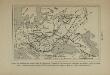
Carte du monde slave à l’époque de l’apogée de la domination mongole (an 1230 à 1450 de notre ère), et indication de la marche de l’invasion mongole d’Asie en Europe
Osteuropa Goldene Horde Mongolen
Standorte der höheren Kommandos in Europa und Kaukasus
Russland Russland / Europäischer Teil Kaukasus Militär
[Secunda Asie tabula] [Karte], in: Clavdii Ptholomei Viri Alexandrini Cosmographie, S. 167.
1 Karte aus Atlas Nicolaus Germanus [und Ptolemaeus, Claudius]
Europaeisches Russland mit Kasan, Astrachan und Georgien
Russland / Europäischer Teil
Russland
1 : 16000000 Russland / Europäischer Teil
La Russie d'Europe
Russland Bielaerts, J. B.
Russia.
1 : 7760000 Johnson, A.J.
Russia.
1 : 7760000 Johnson, A.J.
Russland
1 : 15225000 Russland / Europäischer Teil
Europäisches Russland
1 : 20500000 Russland / Europäischer Teil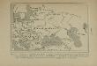
Carte de la répartition des Slaves en Europe, montrant leur séparation en deux troncons, dont l’un s’échelonne de l’Elbe au Don et de la mer Baltique à la mer Noire, et dont l’autre s’étend entre la Drave et la mer Adriatique (9e et 10e siècles de notre ère)
Europa Slawen Bevölkerung
Ruszland
1 : 18000000 Russland / Europäischer Teil