Maps of powiat łomżyński

69. Friedrichshof, uit: Topographische Uebersichtskarte des Deutschen Reiches / herausgegeben v. d. Kartogr. Abt. d. Königl. Preuß. Landesaufnahme
1 : 200000 titelvariant: Topogr. Übersichtskarte des Deutschen Reiches; Annotatie: Titel boven bladen ook: Topogr. Übersichtskarte des Deutschen Reiches; Annotatie geografische gegevens: Op elk blad twee maatstokken: 10 Kilometer = 5,5 cm; 1 geogr. Meile = 3,6 cm; Legenda onder op elk blad Königlich Preußische Landesaufnahme. Kartographische Abtheilung [S.l : Königlich Preußische Landesaufnahme, Kartographische Abtheilung]
Meßtischblatt 2597 : Gehsen, 1938
1 : 250000 Gehsen. - Hrsg. 1910 ?. - 1:25000. - [Berlin]: Reichsamt für Landesaufnahme, 1938. - 1 Kt.
Meßtischblatt 2595 : Karpa, 1938
1 : 250000 Karpa. - Hrsg. 1910, bericht. 1927. - 1:25000. - [Berlin]: Reichsamt für Landesaufnahme, 1938. - 1 Kt.
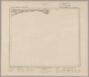
Meßtischblatt 2594 : Friedrichshof, 1938
1 : 250000 Friedrichshof. - Hrsg. 1910, bericht. 1927. - 1:25000. - [Berlin]: Reichsamt für Landesaufnahme, 1938. - 1 Kt.
Meßtischblatt 2596 : Wondollek, 1938
1 : 250000 Wondollek. - Aufn. 1910, bericht. 1927. - 1:25000. - [Berlin]: Reichsamt für Landesaufnahme, 1938. - 1 Kt.
Sraženīe pri Ostrolenkě
Polen Ostrołęka Novemberaufstand <1830-1831>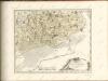

Sect. 11: Allenstein, uit: Geologische Karte des Deutschen Reichs in 27 Blaettern / [von] Richard Lepsius ; Red. von C. Vogel
1 : 500000 Annotatie: Blad 18 ontbreekt; Een aantal bladen op linnen; Een aantal bladen gereviseerd 1913-1914; Annotatie geografische gegevens: Met schaalstokken o.a. in kilometers; Legenda Carl Vogel 1828-1897 Gotha : Justus Perthes
Obwod Białostocki
Białystok-oblast (Polsko)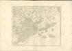

Nr. 21a. Weitere Ergebnisse der Winterschlacht in Masuren
Masuren Weltkrieg <1914-1918>, Ostfront
Neidenburg 40, uit: Special-Karte von Mittel-Europa / nach amtlichen Quellen bearbeitet von W. Liebenow
1 : 300000 titelvariant: W. Liebenow's Mittel-Europa; Annotatie: Titel boven de bladen: W. Liebenow's Mittel-Europa Johannes Wilhelm Liebenow 1822-1897 Frankfurt a. M. : Ludwig Ravenstein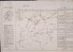
Feldzug der Russen und Polen zwischen Bug und Narew vom 13ten bis 26sten Mai 1831

Regni Borussiae Episcopatus Warmiensis Palatinatus Mariaeburgensis et Culmensis cum Territorio Dantiscano et Ichnographia Urbis Regiomontis].
Mollova mapová sbírka
Bialystok 41, uit: Special-Karte von Mittel-Europa / nach amtlichen Quellen bearbeitet von W. Liebenow
1 : 300000 titelvariant: W. Liebenow's Mittel-Europa; Annotatie: Titel boven de bladen: W. Liebenow's Mittel-Europa Johannes Wilhelm Liebenow 1822-1897 Frankfurt a. M. : Ludwig Ravenstein
Composite: 202.1. (170. Bialla). Gehsen. (Germany)
1 : 100000 Reichsamt fur Landesaufnahme
Composite: 170.1. Bialla (202. Gehsen) (Germany)
1 : 100000 Reichsamt fur Landesaufnahme
170.1. Bialla (202. Gehsen). (Germany)
1 : 100000 Reichsamt fur Landesaufnahme
202.1. (170. Bialla). Gehsen. (Germany)
1 : 100000 Reichsamt fur Landesaufnahme
Composite: 169. Johannisburg. (Germany)
1 : 100000 Reichsamt fur Landesaufnahme
170. Bialla (202. Gehsen). (Germany)
1 : 100000 Reichsamt fur Landesaufnahme
Königsberg, Guttstadt, Biełostok, Suwałki
1 : 750000 Białystok (Polsko : oblast) Konrad, Adalbert K. u. k. Militärgeographisches Institut
Königsberg, Guttstadt, Bielostok, Suwalki
1 : 750000 Białystok (Polsko : oblast) K. k. militär-geographisches Institut
Übersichtskarte von Mittel - Europa

Übersichtskarte von Mittel - Europa

Plan einer trigonometrischen Ausmessung welche in den Jahren 1796 und 1797 in Ostpreussen und Lithauen ausgeführt worden
1 : 800000 Landes-Industrie-Comptoir
Regnum Borussiae gloriosis auspiciis serenissimi et potentissimi princip. Friderici III primi Borussiae regis march. et elect. Brandenburg inauguratum die 18 Jan A 1701
1 : 760000 Prusko Homann, Johann Baptist J.B. Homann
REGNUM BORUSSIAE Gloriosis auspiciis Serenissimi et Potentissimi Pri. FRIDERICI III PRIMI BORUSSIAE REGIS, MARCH. ET ELECT. BRAN. inauguratum die 18. Ian A. 1701 Geographice cum vicinis Regionibus adumbratum
1 : 750000 Prusko Homann, Johann Baptist a Ioh. Baptista Homanno
Regnum Borussiae gloriosis auspiciis serenissimi et potentissimi prin Friderici III primi Borussiae regis, march. et elect. Brandenburg inauguratum die 18. Ian A. 1701
1 : 760000 Prusko Homann, Johann Baptist a Ioh Baptista Homanno
Regnum Borussiae gloriosis auspiciis serenissimi et potentissimi prin Friderici III primi Borussiae regis, march. et elect. Bran inauguratum die 18. Ian. A. 1701
1 : 760000 Prusko Homann, Johann Baptist a Ioh. Baptista Homanno
Regnum Borussiae gloriosis auspiciis serenissimi et potentissimi princ. Friderici III primi Borussiae regis, march. et elect. Brand. inauguratum die 18. Ian. A. 1701
1 : 760000 Prusko Homann, Johann Baptist a Ioh. Baptista Homanno