Maps of Kalimantan Tengah

X a, uit: Topographical and geological sketch-map of the Samba-river / comp. from croquis, made by the author [G.A.F. Molengraaff] during his flying survey in October 1894
1 : 40000 Annotatie: Verschenen als kaart X a-c in: Geologische verkenningstochten in Centraal-Borneo (1893-94) / G.A.F. Molengraaff. - Leiden : Brill ; [etc.], 1900; Blad X c ontbreekt Molengraaff, G. A. F. [Leiden : Brill etc.]
Sheet A, uit: Topographical and geological sketch-map of the Samba-river / comp. from croquis, made by the author [G.A.F. Molengraaff] during his flying survey in October 1894
1 : 40000 Annotatie: "Sketch-map" in de titel foutief gespeld als "scetch-map; Proefdruk; Later verschenen als kaart X a-c in: Geologische verkenningstochten in Centraal-Borneo (1893-94) / G.A.F. Molengraaff. - Leiden : Brill ; [etc.], 1900; Met aanvullingen en verbeteringen in rode inkt en potlood Molengraaff, G. A. F. [S.l. : s.n.]
Sheet A, uit: Topographical and geological sketch-map of the Samba-river / comp. from croquis, made by the author [G.A.F. Molengraaff] during his flying survey in October 1894
1 : 40000 Annotatie: Proefdruk; Later verschenen als kaart X a-c in: Geologische verkenningstochten in Centraal-Borneo (1893-94) / G.A.F. Molengraaff. - Leiden : Brill ; [etc.], 1900; Met aanvullingen en verbeteringen in rode inkt en potlood Molengraaff, G. A. F. [S.l. : s.n.]
Blad XXIV Boven Serawai, uit: Residentie Wester-Afdeeling van Borneo / Topographisch Bureau
1 : 200000 titelvariant: Residentie Westerafdeeling van Borneo; Annotatie: Titelvariant: Residentie Westerafdeeling van Borneo; Voor aanwezige bladen zie overzichtsblad; Annotatie geografische gegevens: Opname: 1886-1895 Topographisch Bureau, Batavia Batavia : Topographisch Bureau
Bija / Topographisch Bureau
Topographisch Bureau Batavia Batavia : Topographisch Bureau
Nangapinoh / Survey of India
Survey of India [S.l.] : Survey of India
[Peta Kalimantan (Indonesian Borneo)

Blad XXV Boengan, blad e, uit: Residentie Wester-Afdeeling van Borneo : weg- en rivierkaart / Topographisch Bureau
1 : 50000 Annotatie: Voor aanwezige bladen zie overzichtsblad Topographisch Bureau, Batavia Batavia : Topographisch Bureau
Blad XII Ketoengau, blad k, uit: Residentie Wester-Afdeeling van Borneo : weg- en rivierkaart / Topographisch Bureau
1 : 50000 Annotatie: Voor aanwezige bladen zie overzichtsblad Topographisch Bureau, Batavia Batavia : Topographisch Bureau
Westkust van Borneo
[S.l. : s.n.]
Blad XIII Sanggau, blad l, uit: Residentie Wester-Afdeeling van Borneo : weg- en rivierkaart / Topographisch Bureau
1 : 50000 Annotatie: Voor aanwezige bladen zie overzichtsblad Topographisch Bureau, Batavia Batavia : Topographisch Bureau
Blad XVIII Batang Loepar, blad g, uit: Residentie Wester-Afdeeling van Borneo : weg- en rivierkaart / Topographisch Bureau
1 : 50000 Annotatie: Voor aanwezige bladen zie overzichtsblad Topographisch Bureau, Batavia Batavia : Topographisch Bureau
Blad XVIII Batang Loepar, blad d, uit: Residentie Wester-Afdeeling van Borneo : weg- en rivierkaart / Topographisch Bureau
1 : 50000 Annotatie: Voor aanwezige bladen zie overzichtsblad Topographisch Bureau, Batavia Batavia : Topographisch Bureau
Blad IX Soekadana, blad l, uit: Residentie Wester-Afdeeling van Borneo : weg- en rivierkaart / Topographisch Bureau
1 : 50000 Annotatie: Voor aanwezige bladen zie overzichtsblad Topographisch Bureau, Batavia Batavia : Topographisch Bureau
Kaart van de residentie Wester Afdeeling van Borneo. Opgenomen en in kaart gebracht in de jaren 1886 tot 1895. Bijgewerkt tot 1911 / Topographisch Bureau
Topografische Inrichting Batavia Batavia : Topographisch Bureau
Pontianak / samengesteld en gedrukt bij den Topografischen Dienst
Topografische Dienst Batavia Batavia : Topografische Dienst
Pontianak / U.S. Army Map Service
U.S. Army Map Service Washington D.C. Washington D.C. : U.S. Army Map Service
Bladwijzer van Zuider- en Ooster Afd[eling] v[an] Borneo
[S.l. : s.n.]
Mission map of South Borneo

Geologische overzichtskaart van den Nederlandsch Oost-Indischen Archipel : Billiton, Zuidwest-Borneo Blad 1X / bewerkt door L.J.C. van Es Jr
Landsdrukkerij Batavia Weltevreden : Landsdrukkerij
12. Kaart der residentie Wester-Afdeeling van Borneo, uit: Atlas van Nederlandsch Oost-Indië / samengest. door Topographisch Bureau te Batavia van 1897-1904
Annotatie: Omgewerkte versie van: Atlas der Nederlandsche bezittingen in Oost-Indië / naar de nieuste bronnen samengest. door J.W. Stemfoort en J.J. ten Siethoff. - 's-Gravenhage : Topographische Inrichting, [ca. 1885] Topographisch Bureau, Batavia 's-Gravenhage : Topographische Inrichting
Blad XXII Boven-Kapoewas, blad g, uit: Residentie Wester-Afdeeling van Borneo : weg- en rivierkaart / Topographisch Bureau
1 : 50000 Annotatie: Voor aanwezige bladen zie overzichtsblad Topographisch Bureau, Batavia Batavia : Topographisch Bureau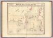
Partie, Borneo. Oceanique no. 20.
1 : 1641836 Vandermaelen, Philippe, 1795-1869
Blad XXIII Boven Melawi, blad o, uit: Residentie Wester-Afdeeling van Borneo : weg- en rivierkaart / Topographisch Bureau
1 : 50000 Annotatie: Voor aanwezige bladen zie overzichtsblad Topographisch Bureau, Batavia Batavia : Topographisch Bureau
Blad XII Ketoengau, blad p, uit: Residentie Wester-Afdeeling van Borneo : weg- en rivierkaart / Topographisch Bureau
1 : 50000 Annotatie: Voor aanwezige bladen zie overzichtsblad Topographisch Bureau, Batavia Batavia : Topographisch Bureau
Blad XXII Boven-Kapoewas, blad o, uit: Residentie Wester-Afdeeling van Borneo : weg- en rivierkaart / Topographisch Bureau
1 : 50000 Annotatie: Voor aanwezige bladen zie overzichtsblad Topographisch Bureau, Batavia Batavia : Topographisch Bureau
Geologische kaart van zuidelijk Borneo / door H. von Gaffron
Aardrijkskundig Genootschap [Amsterdam : G.L. Brinkman]
Blad XVIII Batang Loepar, blad n, uit: Residentie Wester-Afdeeling van Borneo : weg- en rivierkaart / Topographisch Bureau
1 : 50000 Annotatie: Voor aanwezige bladen zie overzichtsblad Topographisch Bureau, Batavia Batavia : Topographisch Bureau
Overzichtskaart van de administratieve indeeling der Residentie Zuider- en Oosterafdeeling van Borneo / Top[ographische] Inr[ichting]
Topographische Inrichting Batavia Batavia : Top[ographische] Inr[ichting]
![X a, uit: Topographical and geological sketch-map of the Samba-river / comp. from croquis, made by the author [G.A.F. Molengraaff] during his flying survey in October 1894](https://images-0.georeferencer.com/images/iiif/445540870608/full/,300/0/native.jpg)

