Cataloged map
Geologische overzichtskaart van den Nederlandsch Oost-Indischen Archipel : Billiton, Zuidwest-Borneo Blad 1X / bewerkt door L.J.C. van Es Jr
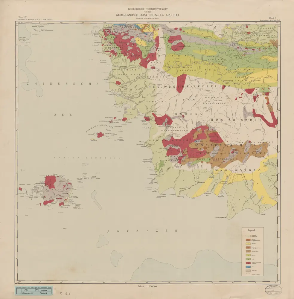

Full title:Geologische overzichtskaart van den Nederlandsch Oost-Indischen Archipel : Billiton, Zuidwest-Borneo Blad 1X / bewerkt door L.J.C. van Es Jr
Depicted:1918
Publisher:Weltevreden : Landsdrukkerij
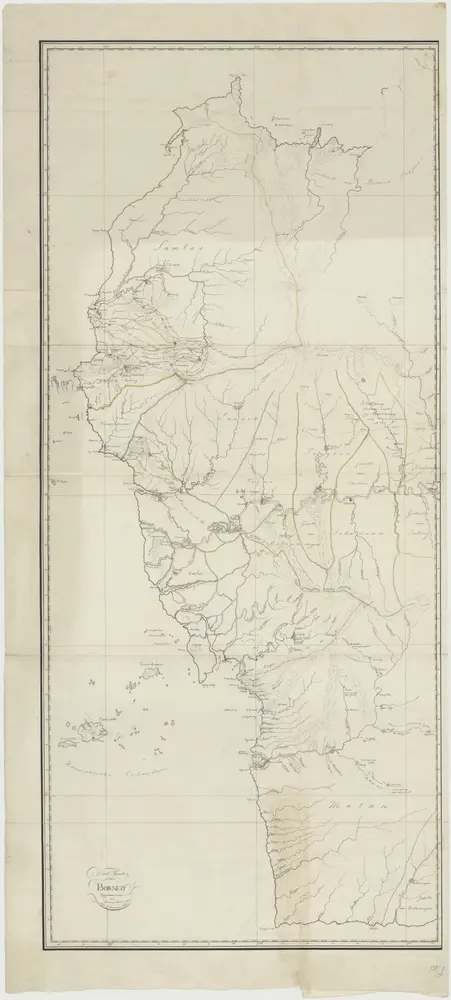
Kaart van de residentie Wester Afdeeling van Borneo. Opgenomen en in kaart gebracht in de jaren 1886 tot 1895. Bijgewerkt tot 1911 / Topographisch Bureau
1911
Topografische Inrichting Batavia
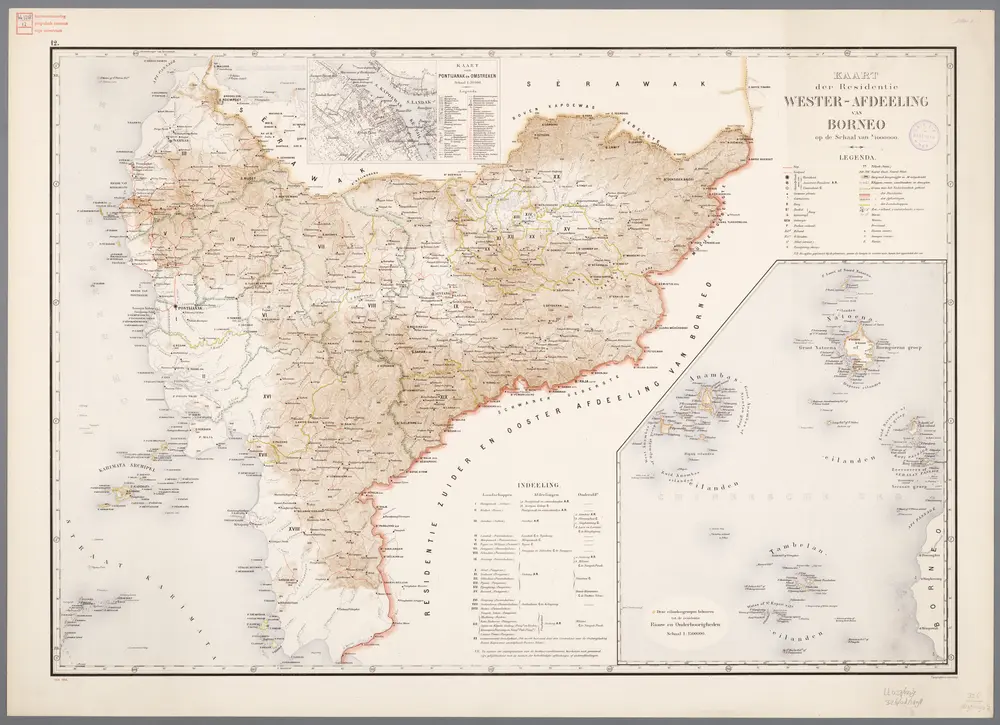
12. Kaart der residentie Wester-Afdeeling van Borneo, uit: Atlas van Nederlandsch Oost-Indië / samengest. door Topographisch Bureau te Batavia van 1897-1904
1898
Topographisch Bureau, Batavia
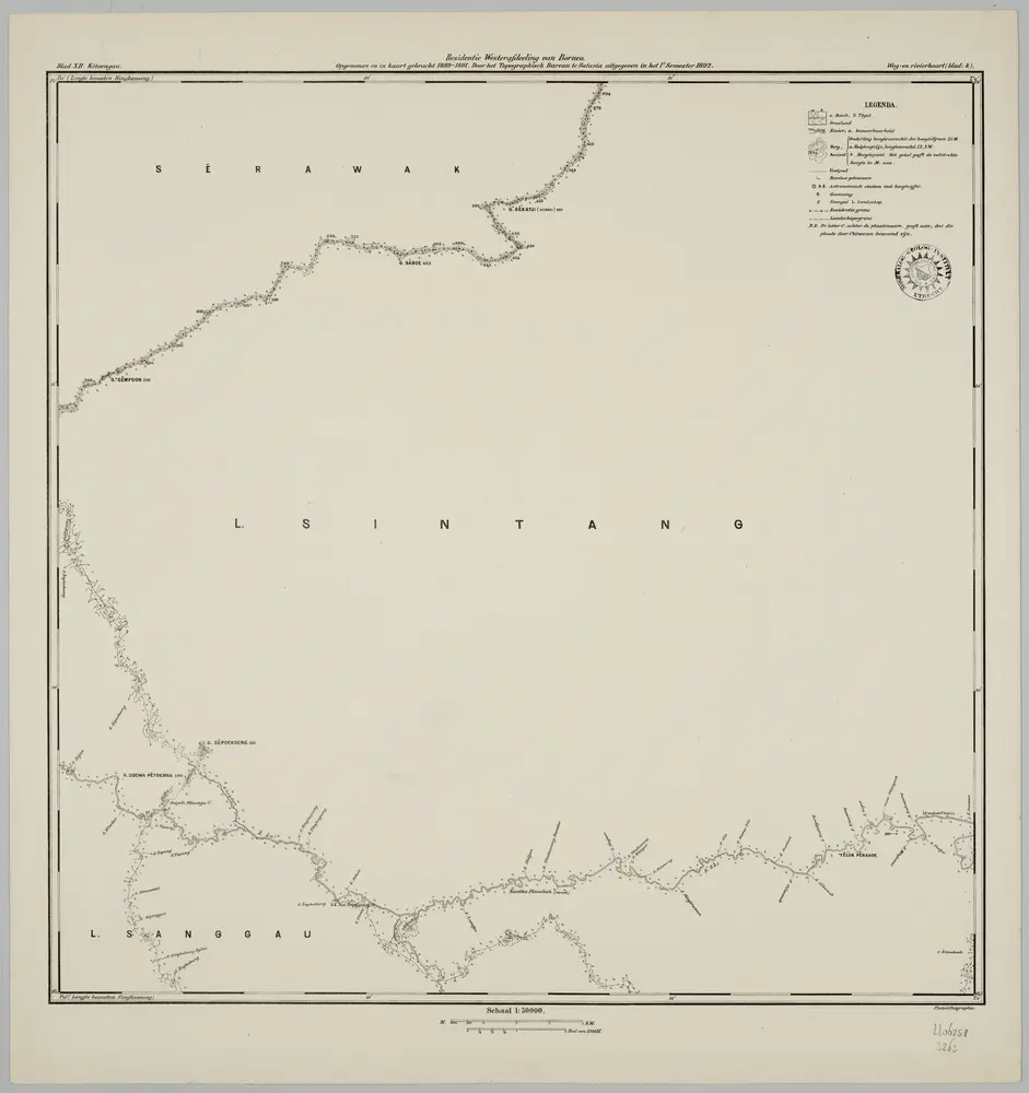
Blad XII Ketoengau, blad k, uit: Residentie Wester-Afdeeling van Borneo : weg- en rivierkaart / Topographisch Bureau
1889
Topographisch Bureau, Batavia
1:50k
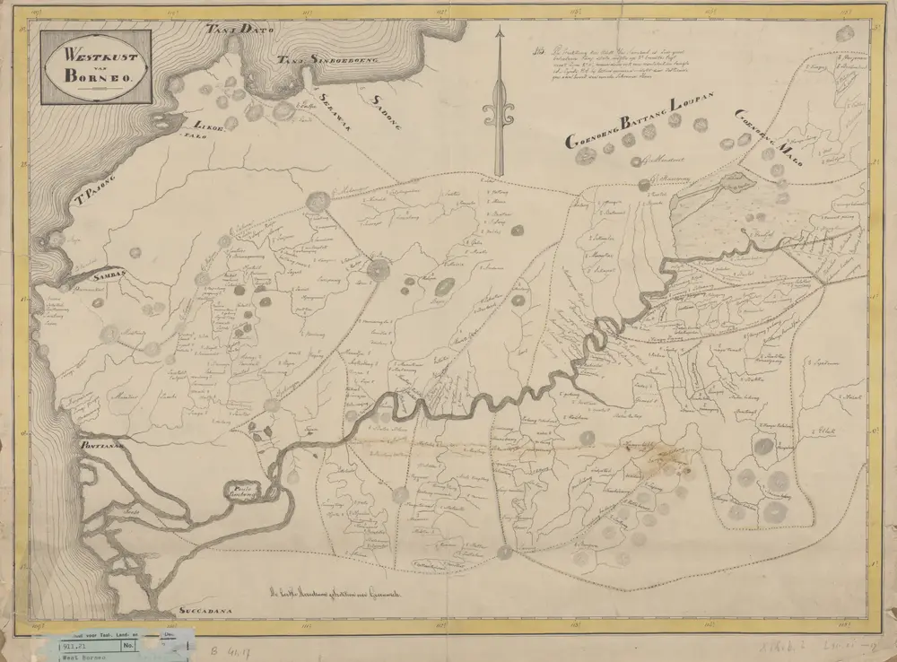
Westkust van Borneo
1880
[S.l. : s.n.]
"Kaart van de westkust van Borneo."
1824
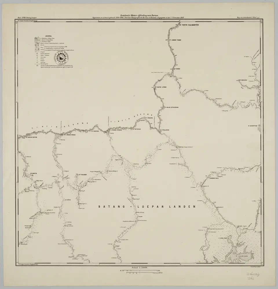
Blad XVIII Batang Loepar, blad g, uit: Residentie Wester-Afdeeling van Borneo : weg- en rivierkaart / Topographisch Bureau
1889
Topographisch Bureau, Batavia
1:50k
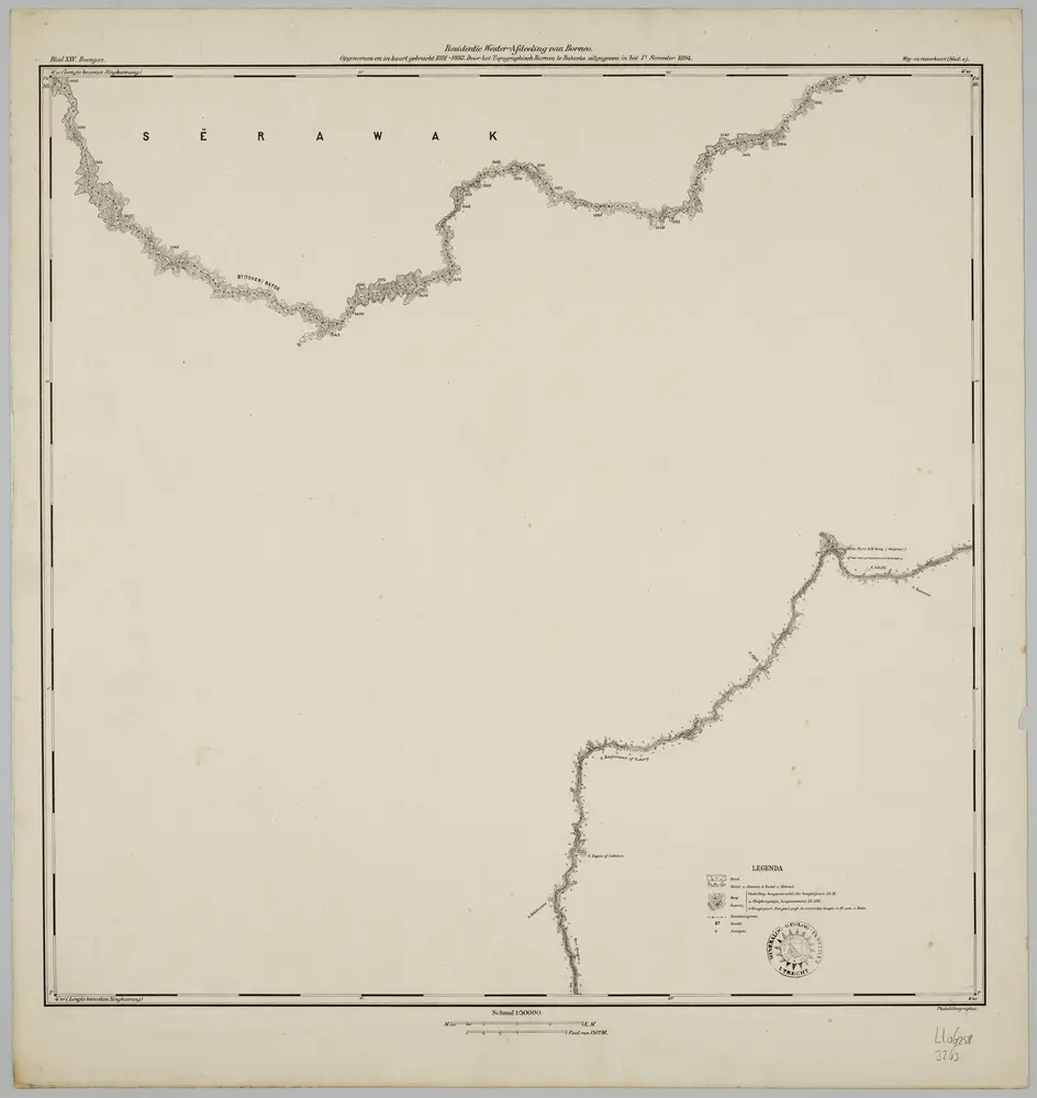
Blad XXV Boengan, blad e, uit: Residentie Wester-Afdeeling van Borneo : weg- en rivierkaart / Topographisch Bureau
1889
Topographisch Bureau, Batavia
1:50k
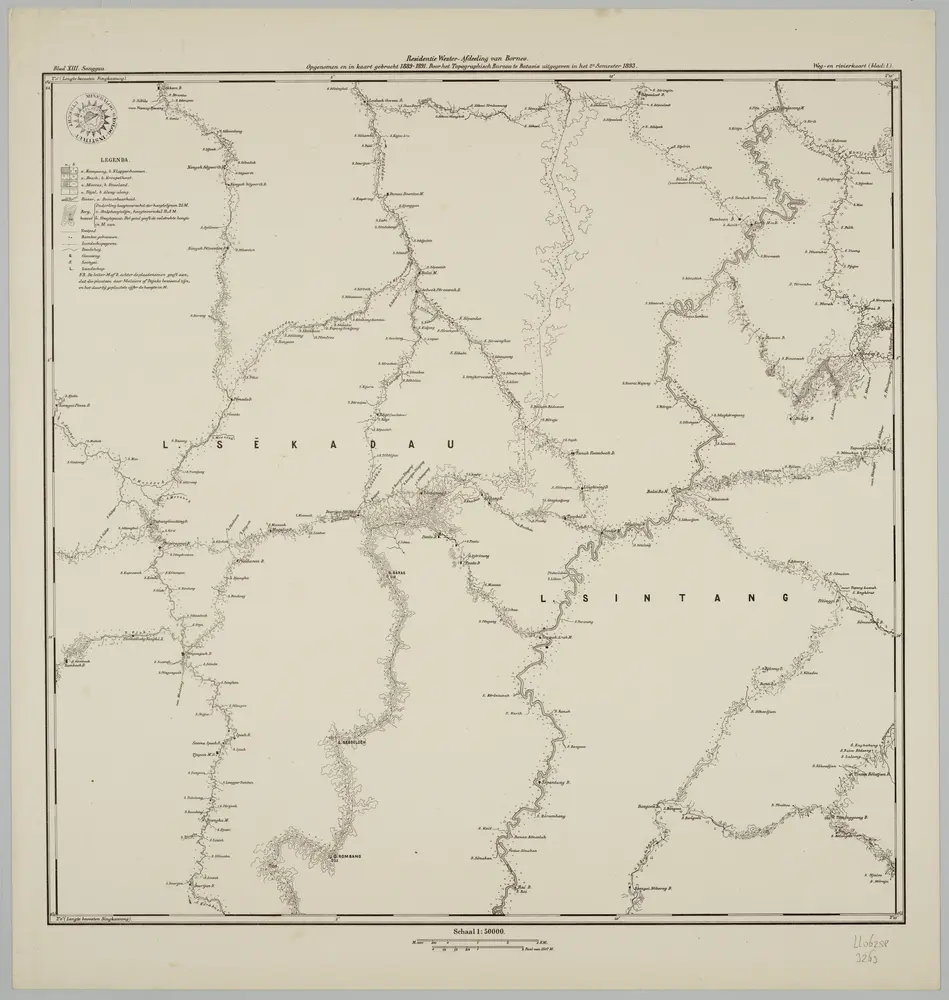
Blad XIII Sanggau, blad l, uit: Residentie Wester-Afdeeling van Borneo : weg- en rivierkaart / Topographisch Bureau
1889
Topographisch Bureau, Batavia
1:50k
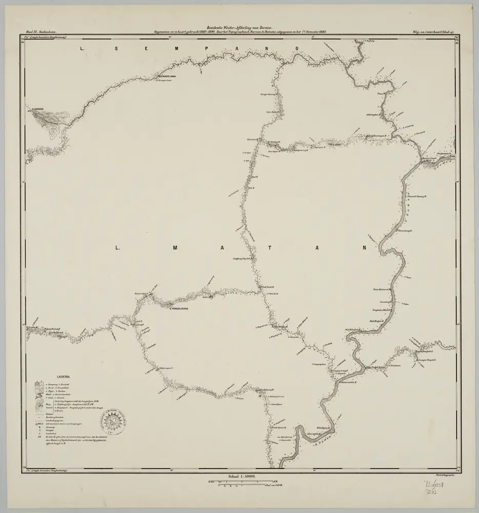
Blad IX Soekadana, blad q, uit: Residentie Wester-Afdeeling van Borneo : weg- en rivierkaart / Topographisch Bureau
1889
Topographisch Bureau, Batavia
1:50k
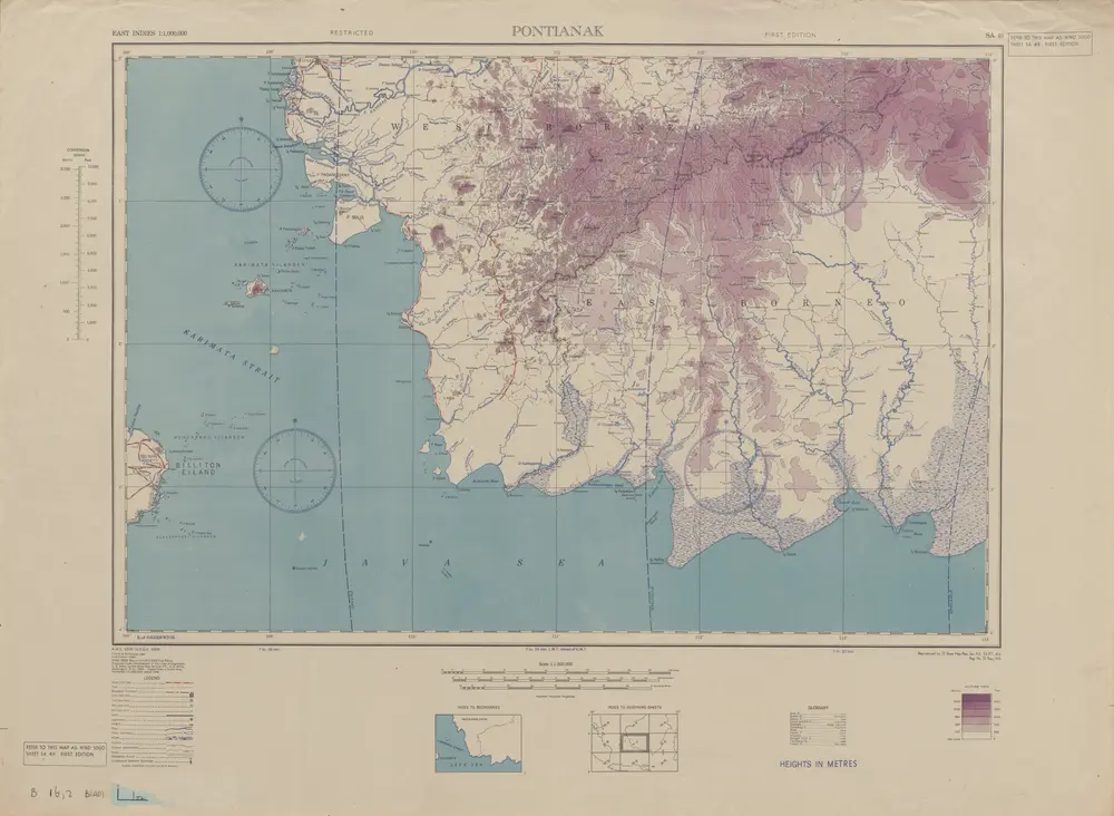
Pontianak / U.S. Army Map Service
1944
U.S. Army Map Service Washington D.C.