Mapa catalogado
Bladwijzer van Zuider- en Ooster Afd[eling] v[an] Borneo
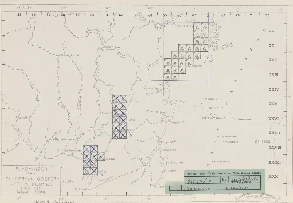

Título completo:Bladwijzer van Zuider- en Ooster Afd[eling] v[an] Borneo
Año de ilustración:1946
Editorial:[S.l. : s.n.]
Tamaño físico:20 x 30 cm
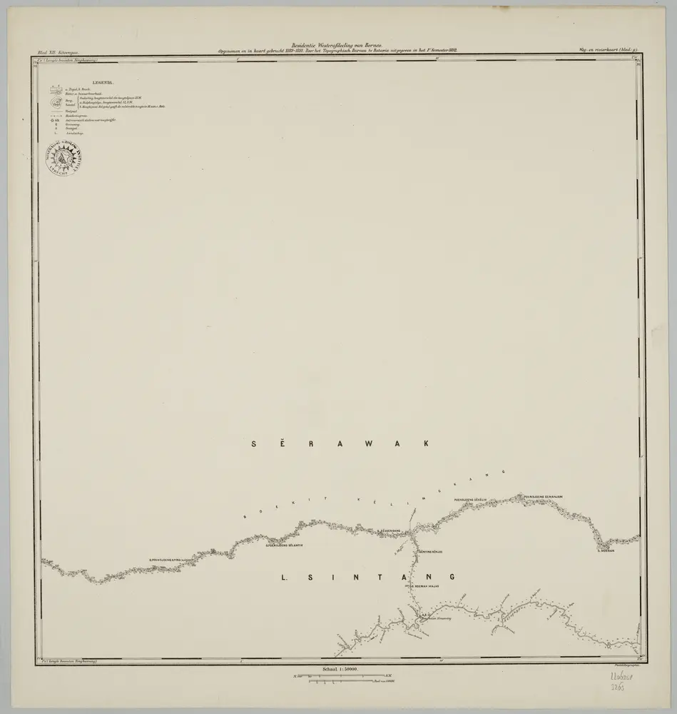
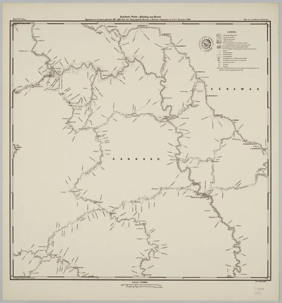
Blad XII Ketoengau, blad g, uit: Residentie Wester-Afdeeling van Borneo : weg- en rivierkaart / Topographisch Bureau
1889
Topographisch Bureau, Batavia
1:50k
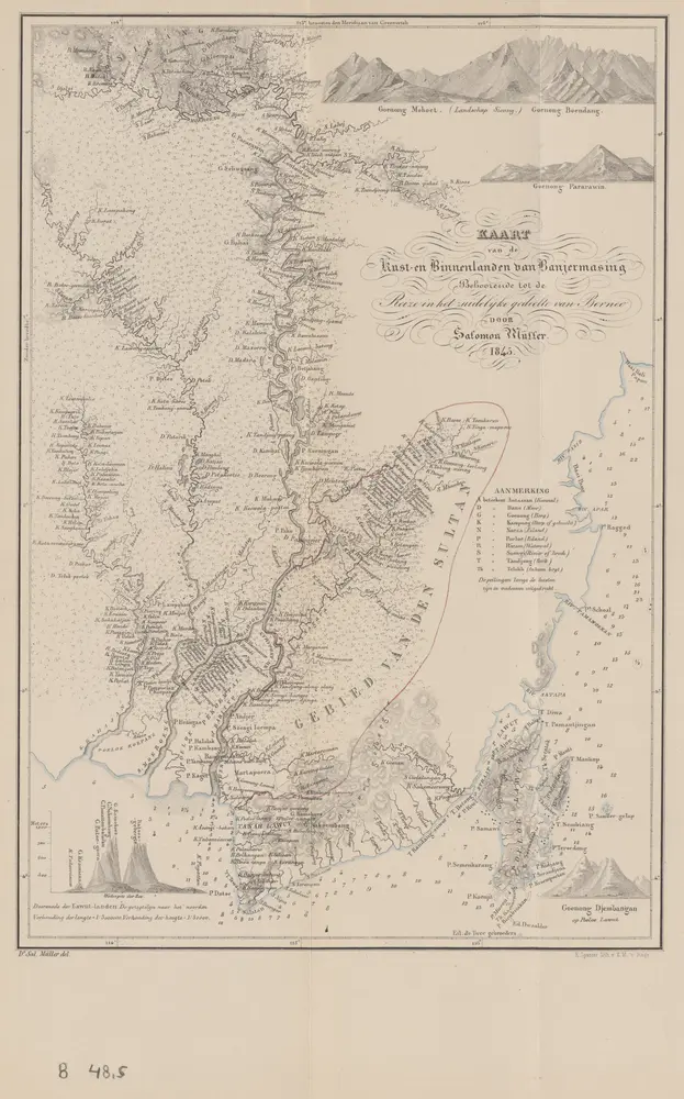
Kaart van de kust- en binnenlanden van Bandjermasing : behoorende tot de reize in het zuidelijk gedeelte van Borneo / Sal. Müller
1845
[S.l. : s.n.]
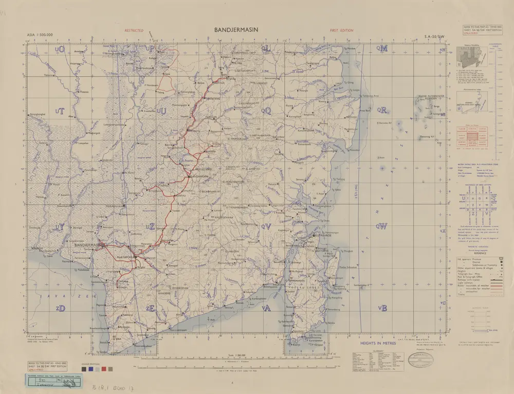
Bandjermasin / Survey of India
1945
Survey of India
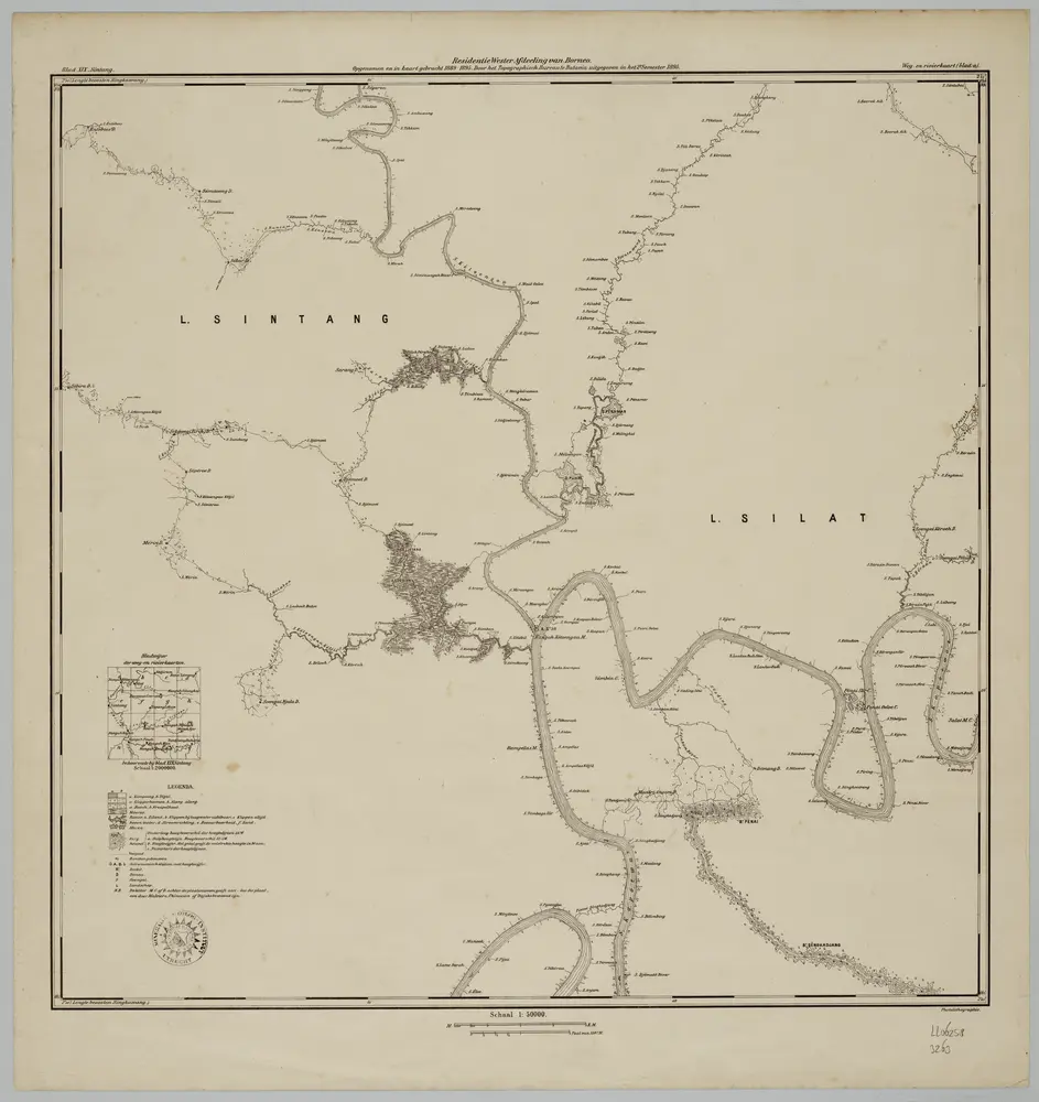
Blad XIX Sintang, blad a, uit: Residentie Wester-Afdeeling van Borneo : weg- en rivierkaart / Topographisch Bureau
1889
Topographisch Bureau, Batavia
1:50k
Blad VII Siding, blad m, uit: Residentie Wester-Afdeeling van Borneo : weg- en rivierkaart / Topographisch Bureau
1889
Topographisch Bureau, Batavia
1:50k
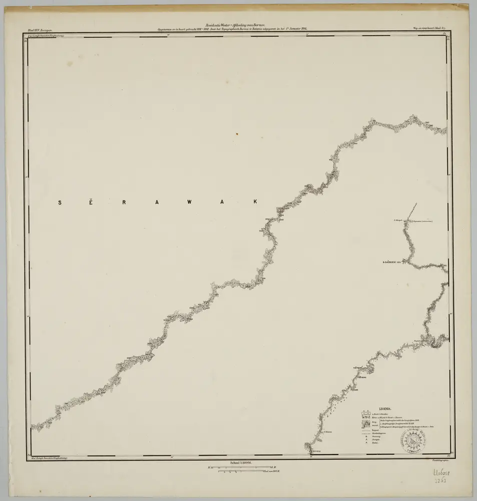
Blad XXV Boengan, blad b, uit: Residentie Wester-Afdeeling van Borneo : weg- en rivierkaart / Topographisch Bureau
1889
Topographisch Bureau, Batavia
1:50k
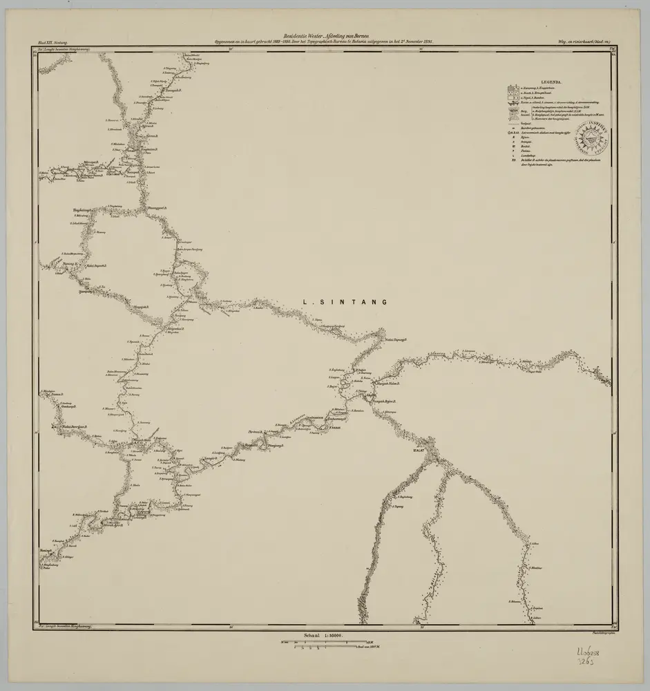
Blad XIX Sintang, blad m, uit: Residentie Wester-Afdeeling van Borneo : weg- en rivierkaart / Topographisch Bureau
1889
Topographisch Bureau, Batavia
1:50k
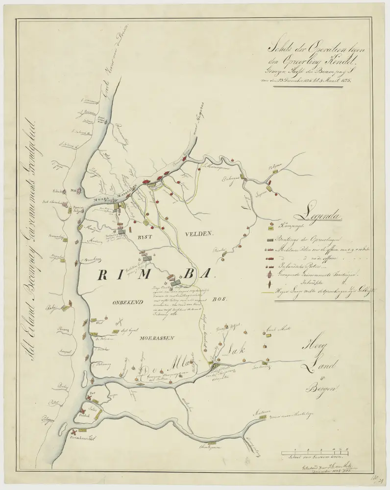
"Schets der operatiën tegen den oproerling Kendet, gewezen hoofd der Becompaij's, van den 28 December 1824 tot 3 Maart 1825."
1825
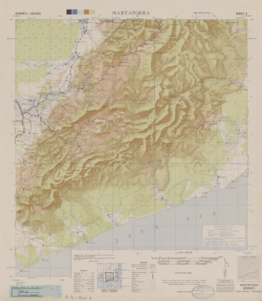
Martapoera / compilation: LHQ Cartographic Coy., Aust. Svy. Corps
1945
Australian Survey Corps . LHQ Cartographic Company
Blad XXVI Boven Mandai, uit: Residentie Wester-Afdeeling van Borneo / Topographisch Bureau
1889
Topographisch Bureau, Batavia
1:200k