Maps of Péronne
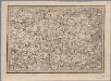
[20], uit: Hydro-Oro und Chorographische General Karte des Koenigreichs der Niederlande und der angrenzenden Länder bis Paris : mit der Angabe der Kunst und Heer-Strassen und der Entfernung der Poststationen / ... zusammengetragen und reducirt von ... Wilhelm Müller
1 : 400000 titelvariant: Generalkarte des Koenigreichs Hannover; Annotatie: 1e supplement bij: Generalkarte des Koenigreichs Hannover (1818) Müller, Wilhelm (fl. 1818) [Hannover : Wilhelm Müller]
Carte topographique d'Allemagne
1 : 224000 Artois (Francie) Jaeger, Johann Wilhelm Abraham I. W. A. Iaeger
Picardia
1 Karte : Kupferdruck ; 14 x 19 cm Lambert Andreae
Arras, Peronne, Noyon, uit: Le conflict mondial : front occidental
1 : 170000 Annotatie: Ontbreekt: no. 1 en 5-8 Gand : Th. de Graeve
Archiepiscopatus Cameracensis. Archebesché de Cambray. [Karte], in: Novus Atlas, das ist, Weltbeschreibung, Bd. 2, S. 26.
1 Karte aus Atlas Blaeu, Joan Blaeu, Willem Janszoon

L'Archevesche de Cambray [Karte], in: Gerardi Mercatoris et I. Hondii Newer Atlas, oder, Grosses Weltbuch, Bd. 2, S. 26.
1 Karte aus Atlas Mercator, Gerhard und Hondius, Jodocus Jansson, Jan
Archiepiscopatus Cameracensis. Archevesché de Cambray. [Karte], in: Le théâtre du monde, ou, Nouvel atlas contenant les chartes et descriptions de tous les païs de la terre, Bd. 2, S. 26.
1 Karte aus Atlas Blaeu, Willem Janszoon und Blaeu, Joan Blaeu, Willem Janszoon
Archiepiscopatus Cameracensis. Archevesché de Cambray. [Karte], in: Theatrum orbis terrarum, sive, Atlas novus, Bd. 2, S. 41.
1 Karte aus Atlas Blaeu, Joan Blaeu, Willem Janszoon
Arcihiepiscopatus Cameracensis. Archevesche de Cambray. [Karte], in: Novus atlas absolutissimus, Bd. 3, S. 150.
1 Karte aus Atlas Janssonius Offizin
ARCHIEPISCOPATVS | CAMERACENSIS. | Archevesché de | CAMBRAY
AMSTERDAMI | Apud Guiljelmum Blaeuw
Arcihiepiscopatus Cameracensis ; Archevesche de Cambray
1 : 59000
Cambrai-Saint Quentin. Scale, 1 : 100,000 or 1 inch to 1.58 miles
Cambrai-Saint Quentin.
Carte particulière des environs de Cambray, Bappaumes, St. Quentin, Pérone
1 : 125000 A Bruxelles : ches Eugene Henry Fricx, ruë de la Madelene
Carte particuliere des environs de Cambray, Bappaumes, St. Quentin, Perone
1 : 115000 A Amsterdam : chez Cóvens et Mortier
Partie Meridionale de Picardie
1 : 208000 Mollova mapová sbírka Delisle, Guillaume L'Isle, Guillaume de
Stanford's half-inch map of the British front in France and Flanders
1 : 126720 Shows line of battle in June 1916 and updated line of battle in June 1917.Relief shown as gradient tints.Shows: railways, roads, woods. Edward Stanford Ltd. [London] : Edward Stanford Ltd.
Amiens 95, uit: Special-Karte von Mittel-Europa / nach amtlichen Quellen bearbeitet von W. Liebenow
1 : 300000 titelvariant: W. Liebenow's Mittel-Europa; Annotatie: Titel boven de bladen: W. Liebenow's Mittel-Europa Johannes Wilhelm Liebenow 1822-1897 Frankfurt a. M. : Ludwig Ravenstein
Archiepiscopatvs Cameracensis
1 Karte : Kupferdruck ; 37 x 48 cm Blaeu apud Guiljelmum Blaeuw
L'archevesche de Cambray
1 Karte : Kupferdruck ; 35 x 48 cm Tavernier; Hondius imprimé ches Henrÿ Hondius, ches Melchior Tavernier aupres du palais
Carte particuliere des environs de Cambray, Bappaumes, St. Quentin, Perone
1 : 110000 Bapaume (Francie) Fricx, Eugene Henry chez Eugene Henry Fricx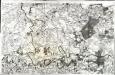
[Cambray]
1 Blatt : 60 x 91 cm Seguin; Desbruslins s.n.
Carte particuliere des environs de Cambray, Bappaumes, S. Quentin, Perone
1 : 116600 Mollova mapová sbírka Fricx, Eugène Henry Harrewyn, Jacques Fricx, Eugené Henry
Veromanduorum Eorumque Confinium Exactissima Descript. [Karte], in: Theatrum orbis terrarum, S. 137.
1 Karte aus Atlas Ortelius, Abraham Vrients, Jan Baptista
Veromanduorum Eorumque Confinium Exactissima Descriptio. [Karte], in: Theatrum orbis terrarum, S. 80.
1 Karte aus Atlas Ortelius, Abraham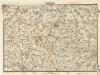
Cambrai

Vero Manduorum Eorum Que Confinium Exactissima Descriptio. [Karte], in: Theatrum orbis terrarum, S. 35.
1 Karte aus Atlas Ortelius, Abraham
Atrebates: Evesché d'Arras comté d'Artois subdivisé en toutes ses Iurisdictions scav. Gouvernance d'Arras, com.te de St Pol ... Bappaumes &c.
1 : 211000
Le Cambresis comté et le duché de Cambray, avec le marq.at du chasteau de Cambray
1 Karte : Kupferdruck ; 37 x 48 cm Duval chez l'auteur proche le palais sur le quay de l'Orloge
![[20], uit: Hydro-Oro und Chorographische General Karte des Koenigreichs der Niederlande und der angrenzenden Länder bis Paris : mit der Angabe der Kunst und Heer-Strassen und der Entfernung der Poststationen / ... zusammengetragen und reducirt von ... Wilhelm Müller](https://images-2.georeferencer.com/images/iiif/810062034706/full/,300/0/native.jpg)

