Maps of Sweden

[VIII], uit: Geognostische Karte des Oesterreichischen Kaiserstaates mit einem grossen Theile Deutschland's u. Italien / hauptsachlich nach ... Haidinger's geognostischer Karte dieses Staates bearb. von Josef Scheda
1 : 3000000 titelvariant: General-Karte von Europa in 25 Blättern; Annotatie: Bijlage bij: General-Karte von Europa in 25 Blättern. - 1:2.592.000. - 1845-1847 Scheda, Joseph Wien : K.K. Militär. Geografisch. Institut
Scandanavie Flle. S.
1 : 2500000 Vivien St Martin, L.
Ice Chart, Baltic Sea, May.
U.S. Navy
Ice Chart, Baltic Sea, January.
U.S. Navy
Ice Chart, Baltic Sea, December.
U.S. Navy
Ice Chart, Baltic Sea, November.
U.S. Navy
Ice Chart, Baltic Sea, February.
U.S. Navy
Ice Chart, Baltic Sea, March.
U.S. Navy
Ice Chart, Baltic Sea, June.
U.S. Navy
Ice Chart, Baltic Sea, April.
U.S. Navy
Ice Chart, Baltic Sea, October.
U.S. Navy
Schweden, Norwegen 2.
1 : 4500000 Flemming, Carl

55-56. Scandanavia, South. The World Atlas.
1 : 2500000 USSR (Union of Soviet Socialist Republics).
[Schweden und Norwegen auch Dänemark, Südliches Blatt]
Hand-Atlas über alle Theile der Erde nach dem neuesten Zustande und über das Weltgebäude Stieler, Adolf bei Justus Perthes
Svea ock Göta Riken med Finland ock Norland
1 : 1680000 Finsko Biurman, G.
Statistikk kart 6 sør: Norvége. Densité de la population en 1865
1 : 1000000
Schweden und Norwegen auch Daenemark
Stieler's Hand-Atlas Stieler, Adolf bei Justus Perthes
Charta öfver Sverige
1 : 6500000 utg. en 1789 af Fredr. Akrel förbättrad af Dan. Djurberg Stockholm : [s.n.]
Post Karte von Schweden und Norwegen nach Meilen
Norsko Hallberg, von Santjohanser, N.
Sweden, Norway.
1 : 2200000 Arrowsmith, John
Uebersichtskarte von der Ost - See und den anliegenden Ländern
Turkart over Hallingskarvet
Statens Kartverk
Spesielle kart 18 Sør-øst: Telegrafkart over Norge
1 : 1000000 Den Private Opmaaling, Kristiania
Karta pochodov galernago flota 1712 - 1721 gg.
Ostsee Nordischer Krieg <1700-1721> Seeschlacht Galeere
Baltic Sea.
1 : 3400000 Faden, William, 1750?-1836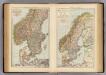
S. Scandinavia, Norway, Sweden.
1 : 4000000 Andree, Richard; Times (London, England)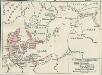
Nord- und Ostseeherrschaft II: Reich Waldemars II.
1 : 10000000 Ostseeraum Valdemar II., Danmark, Konge
Denmark Sweden and Russia on the Baltic.
1 : 3380000 Sharpe, J.
![[VIII], uit: Geognostische Karte des Oesterreichischen Kaiserstaates mit einem grossen Theile Deutschland's u. Italien / hauptsachlich nach ... Haidinger's geognostischer Karte dieses Staates bearb. von Josef Scheda](https://images-2.georeferencer.com/images/iiif/883539131480/full/,300/0/native.jpg)

