Maps of Sweden

Schweden, Norwegen 2.
1 : 4500000 Flemming, Carl
Kaart van de Oost-Zee met hare golven, baaijen, eilanden, rotsen, klippen, diepten, enz. enz. benevens den platten grond op groote schaal van de voornaamste zee-plaatsen krijgs- en handelhavens
1 : 2584000 uit de naauwkeurigste bronnen geput en uit de beste zee- en landkaarten opgemaakt door A.J. Bogaerts lithograaph Breda : Bogaerts
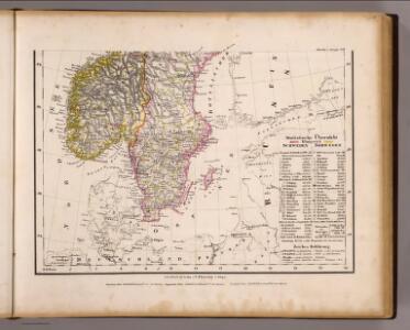
[Schweden und Norwegen auch Dänemark, Südliches Blatt]
Hand-Atlas über alle Theile der Erde nach dem neuesten Zustande und über das Weltgebäude Stieler, Adolf bei Justus Perthes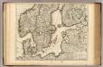
Courones du Nord (sud)
1 : 2600000 L'Isle, Guillaume de, 1675-1726
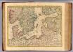
Schweden und Norwegen auch Daenemark
Stieler's Hand-Atlas Stieler, Adolf bei Justus Perthes
Scandanavie Flle. S.
1 : 2500000 Vivien St Martin, L.
Courones du nord 2.
1 : 2500000 Covens et Mortier
Denmark Sweden and Russia on the Baltic.
1 : 3380000 Sharpe, J.
Museumskart 46: Kart over Østersjøen
1 : 500000 Jens Sørensen
55-56. Scandanavia, South. The World Atlas.
1 : 2500000 USSR (Union of Soviet Socialist Republics).
Uebersichtskarte von der Ost - See und den anliegenden Ländern

Ice Chart, Baltic Sea, March.
U.S. Navy
Ice Chart, Baltic Sea, October.
U.S. Navy
Ice Chart, Baltic Sea, June.
U.S. Navy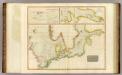
North, Baltic seas.
1 : 3600000 Thomson, John
Ice Chart, Baltic Sea, February.
U.S. Navy
Ice Chart, Baltic Sea, April.
U.S. Navy
Schweden und Norwegen
1 : 3343000 entworfen und gezeichnet von C.F. Weiland Schrift und Situation gestochen von Mädel III., die Berge von Mädel I. Weimar : im Verlage des Geograph. Instituts
Ice Chart, Baltic Sea, November.
U.S. Navy
Nord- und Ostseeherrschaft II: Reich Waldemars II.
1 : 10000000 Ostseeraum Valdemar II., Danmark, Konge
Ice Chart, Baltic Sea, December.
U.S. Navy
Ice Chart, Baltic Sea, January.
U.S. Navy
Die Ost See
1 : 500000 Baltské moře-oblast Flemming, Carl C. Flemming
Die Ost See
1 : 5000000 Baltské moře-oblast Flemming, Carl C. Flemming
Ice Chart, Baltic Sea, May.
U.S. Navy
Die Ostsee
Grosser Hand-Atlas über alle Theile der Erde in 170 Karten Meyer, J. Verlag des Bibliographischen Instituts
Ostsee.
1 : 2150000 Radefeld, Carl Christian Franz, 1788-1874
Karta öfver Sverige och Norrige
1 : 4200000 [S.l.] : [s.n.]