Maps of Nordrhein-Westfalen

[No. 4. Cöln], uit: [Carte de l'Europe]
1 : 490000 Paris : Piquet
Le cours du Rhin
1 : 750000 dressée sur les nouvelles observations par Le Rouge A Paris : [Le Rouge], Rue des Augustins

Westphalia.
1 : 2000000 Bowen, Frances
Patriae Antique Inter Iuly et Caroli Magni Caesarum Romanorum Tempora Descriptio
1 : 1100000 Mollova mapová sbírka Ewich, Hermann Saevry, S.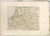
Brabantia III. Rheni Et X. Nova Tabula. [Karte], in: Claud. Ptolemaeus. Geographia lat. cum mappis [...], S. 371.
1 Karte aus Atlas Münster, Sebastian [und Ptolemaeus, Claudius]
Tabula Geographica qua Pars Septentrionalis sive Inferior Rheni, Mosae et Moselle
1 : 1100000 Mollova mapová sbírka Visscher, Nicolaes Jansz. Visscher, Nicolaus
Tabula Geographica qua Pars Septentrionalis sive Inferior Rheni, Mosae et Moselle
1 : 1100000 Mollova mapová sbírka Visscher, Nicolaes Jansz. Visscher, Nicolaus
Kriegsschauplatz der Maas und Sambre Armeen
1 : 2780000 Belgie
Estat et Seigneurie de l'Eves.ché de Lyege
1 : 240000 Mollova mapová sbírka Sanson, Guillaume Jaillot, Alexis Hubert
Geologische Übersichtskarte der Rheinprovinz und der Provinz Westfalen / bearb. von H. von Dechen
1 : 500000 Annotatie: Oorspr. uitg.: 1866 Heinrich von Dechen Berlin : Schropp
Tabula Episcopatuum Leodiensis et Coloniensis Trevirensis ut et Ducatuum Iuliacensis et Montensis Novissima et Accuratissima
1 : 470000 Mollova mapová sbírka Danckerts, Theodorus Danckerts, Justus
Charte über die saemtlichen zum Westphaelischen Kreis gehörige Laender
1 : 834000 Vestfálsko (Německo) Güssefeld, Franz L. Homaenischen Erben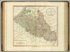
Netherlands, part of Germany.
1 : 880000 Cary, John, ca. 1754-1835
Cercle de Westphalie
1 : 1720000 Vestfálsko (Německo) Bonne, Rigobert André
Regionum Urbium et fluminum quae potissimum Comitatum Mürs ambiunt brevis descriptio. [Karte], in: Gerardi Mercatoris et I. Hondii Newer Atlas, oder, Grosses Weltbuch, Bd. 1, S. 212.
1 Karte aus Atlas Mercator, Gerhard und Hondius, Jodocus Jansson, Jan
Charte von den Grosherzogthümern Berg und Hessen, den Fürstlich-Primatischen Laendern; dem Herzogthume Nassau und den übrigen darinne begränzten, zum Theil noch uneingetheilten Laendern
1 : 820000 Streit, Friedrich Wilhelm Verl. des Geograph. Inst.
Der gantze Rhein Strom Von Seinem Ursprung biß zu seinem Ausfluß
1 : 1100000 Mollova mapová sbírka Haupt, Gottfried Jacob Haupt, Gottfried Jacob
Geologische Übersichtskarte der Rheinprovinz und der Provinz Westfalen / bearb. von H. von Dechen
1 : 500000 Heinrich von Dechen Berlin : Schropp
Belgii Universi seu Inferioris Germaniae quam XVII Provinciae Aistriaco, Gallico et Batavo Sceptro parentes constituunt nova Tabula Geographica
1 : 1050000 Mollova mapová sbírka Mayer, Tobias Homann, Johann Baptista - dědici
Novissima et accuratissima decem Austriacarum in Belgio provinciarum tabula
1 : 590000 Belgie Ottens, Josua Ottens, Reinier R.& I. Ottens
Operationen der alliirten und französischen Armee 1759

Die preussischen Provinzen Westphalen und Rheinprovinz, das Kurfürstenthum Hessen, das Grossherzogthum Hessen und das Herzogthum Nassau, das Fürstenthum Waldeck, die Landgrafschaft Hessen Homburg und die freie Stadt Frankfurt
1 : 540000 Frankfurt nad Mohanem (Německo) Gräf, A. Luther. Th. Geographisches Institut

Netherlands, Germany W. of Rhine.
1 : 1620000 Darton, William
Charte über die sæmtlichen zum Westphælischen Kreis gehörige Lænder
1 Karte : Kupferdruck ; 52 x 47 cm Güssefeld bey den Homænnischen Erben
Regionum Urbium et fluminum quae potissimus Comitatum Mürs ambiunt brevis descriptio. [Karte], in: Gerardi Mercatoris Atlas, sive, Cosmographicae meditationes de fabrica mundi et fabricati figura, S. 352.
1 Karte aus Atlas Mercator, Gerhard Montanus, Petrus
Rheinprovinz, Westfalen, Hessen-Nassau, Waldeck, Grossherzogthum Hessen.
1 : 1000000 Andree, Richard
XVII Provinciarum Inferioris Germaniae
1 : 1200000 Mollova mapová sbírka Visscher, Nicolaes Fuchs, Jobst Christoph
![[No. 4. Cöln], uit: [Carte de l'Europe]](https://images-2.georeferencer.com/images/iiif/787581045927/full/,300/0/native.jpg)

