Maps of Rueil-Malmaison
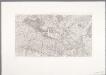
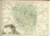
[5.] Versailles, uit: Carte topographique des environs de Versailles dite "Carte des chasses du Roi"
1 : 28800 titelvariant: Carte des chasses du Roi; Annotatie: Herdruk van originele koperplaten; Oorspr. uitg.: 1764-1807; Voor aanwezige bladen zie overzichtsblad; Annotatie geografische gegevens: Opname: 1764-1773 [Paris : IGN]
Nouveau plan de Versailles
Contant de la Motte; Croisey, Jean-Baptiste
Parc de Meudon
Le Rouge, Georges-Louis; Le Dreux de la Chatre, Louis Le Rouge
Bois de Boulogne

Nouveau plan des ville, chateau et jardins de Versailles
1 : 8200 Versailles (Francie) Demortain, Gilles Demortain
Plan du parc de Saint-Cloud et de ses environs / levé en 1845 par les officiers du Corps Royal d'Etat-Major ; sous la dir de B[aron] Pelet ; le trait gravé par Thierry
1 : 5000 Annotatie: Herdruk van originele koperplaat Pelet, Jean Jacques Germaine; Thierry, ...; Corps Royal d'Etat-Major, Frankrijk [Paris : IGN]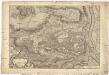
Plan de St. Cloud
1 : 7000 Delagrive, Jean Charbonnier l'imprimerie de Charbonnier

Plan Paris banlieue

Nord-Ouest: Paris Et Ses Environs.
1 : 40000 Service Geologique Des Mines (France)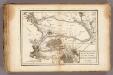
La Seine.
1 : 54000 Vincent
Paris.
1 : 95000 Colton, G.W.
Composite: Paris Et Ses Environs.
1 : 40000 Service Geologique Des Mines (France)
Carte des environs de Paris, Versailles, St. Germain, et de Poissy
1 Karte : Kupferdruck ; 22 x 33 cm Crépy; Crépy chez Crepy rue S. Jacques à S. Pierre près la rue de la parcheminerie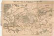
Carte pour suivre les opérations du siége de Paris
Paříž (Francie : oblast) Dupont, Paul
Paris.
1 : 95000 Colton, G.W.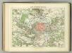
Camp Retranche de Paris.
1 : 100000 Jouvet et Cie.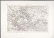
Paris
1 : 80000 Annotatie: Herdruk van originele koperplaat; Oorspr. uitg.: [Paris] : Dépôt de la Guerre, 1832 [Paris : IGN]
Li contorni di Parigi
1 Karte : Kupferdruck ; 26 x 41 cm Zatta presso Antonio Zatta

Nordost Frankreich, Belgien und Luxemburg Deutsche Rheinländer

Environs de Paris dans un rayon de 30 kilomètres
1 : 66670 Antoine E. Andriveau-Goujon
Carte dv pays et forest d'Yveline
1 Karte : Kupferdruck ; 39 x 49 cm Valck; Schenk apud G. Valk et P. Schenk
1 Paris.
1 : 86400 Cassini family; Cassini, Cesar-Francois, 1714-1784
66. Paris, Lorraine, and Saar. The World Atlas.
1 : 250000 USSR (Union of Soviet Socialist Republics).
Plan de Paris XII.
[Paris]
1 Blatt : 60 x 91 cm Bourgoin s.n.
Les environs de Paris
1 Karte : Kupferdruck ; 50 x 73 cm Desnos chez Desnos géographe et ingénieur pour les globes spheres et instruments de mathematiques rue St. Jacques a l'enseigne du globe
![[5.] Versailles, uit: Carte topographique des environs de Versailles dite](https://images-2.georeferencer.com/images/iiif/191746137089/full/,300/0/native.jpg)

