Maps of Puteaux

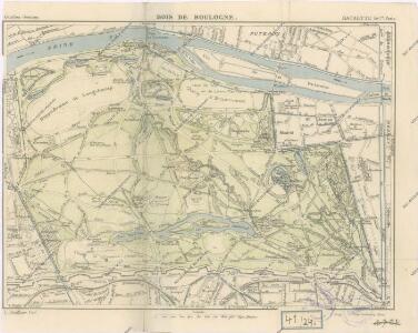
Bois de Boulogne
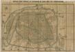
Plan de St. Cloud
1 : 7000 Delagrive, Jean Charbonnier l'imprimerie de Charbonnier
PLAN VON PARIS mit seinen nächsten Umgebungen
1 : 51000 Paříž (Francie)
Plan Paris banlieue

[Département de la Seine]. Paris, No. 5
1 : 40000 Annotatie: Herdruk van originele koperplaat; Oorspr. uitg.: [Paris] : Dépôt de la Guerre, [ca. 1850] [Paris : I.G.N.]
Plan de Paris
Paříž (Francie : oblast) Société S. Quentinoise d'Imprimerie
French Ports & Harbours, and Plan of Paris.
Fullarton, A. & Co.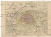
Paříž a okolí
Paříž (Francie) Weiland, Karl Ferdinand Pražák, K.
Paříž a okolí
La Seine.
1 : 54000 Vincent
Carte topographique des environs & du plan de Paris
1 : 25200 Paříž (Francie) Delagrive, Jean von Homaen[n]ischen Erben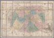
[Kaart], uit: Nouveau plan de Paris divisé en 20 arrondissements : dans un rayon de 10 kilomètres / le plan par Ch. Smith
1 : 17700 titelvariant: Paris et ses environs dans un rayon de dix kilomètres; Annotatie: Omslagtitel: Paris et ses environs dans un rayon de dix kilomètres Smith, Ch. Paris : Logerot
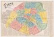
Nouveau plan complet de Paris avec ses fortifications
1 : 18000 Paříž (Francie) Henriot, J. N. A. Bes et F. Dubreuil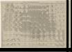
Noveau plan complet et historique de Paris, avec ses fortifications

Nouveau plan illustré de la ville de Paris
Paříž (Francie) Vuillemin, A. Testard, A. Fatout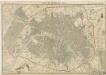
Plan de Paris en 1855
Paris 1867
1 : 12800 Dumas-Vorzet, Ed. (Eduard) Librairie du Petit Journal
Paris illustré et ses fortifications / dressé par Maillard
1 : 10000 titelvariant: Plan de Paris; Annotatie: Omslagtitel: Plan de Paris; Met straatnamenregister Maillard, ... Paris : Logerot
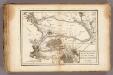
[5.] Versailles, uit: Carte topographique des environs de Versailles dite "Carte des chasses du Roi"
1 : 28800 titelvariant: Carte des chasses du Roi; Annotatie: Herdruk van originele koperplaten; Oorspr. uitg.: 1764-1807; Voor aanwezige bladen zie overzichtsblad; Annotatie geografische gegevens: Opname: 1764-1773 [Paris : IGN]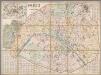
Paris et ses environs / dressé par E.D. Vorzet
1 : 12800 Annotatie: Met straatnaamregister Vorzet, E. D. [S.l.] : [s.n.]

Nouveau plan illustré de la ville de Paris : avec le système complet de ses fortifications et forts détachés, et des communes de la banlieue / dressé par A. Vuillemin ; gravé sur acier par Bénard
1 : 11000 Annotatie: Met straatnamenregister en lijst van 'communes' Vuillemin, A.; Bénard, ... A Paris : chez Fatout
Plan de Paris
1 : 16000 Vuillemin, A. A. (Alexandre A.), b. 1812 Hachette & Cie.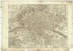
Nouveau plan routier de la ville et fabourg de Paris
Paříž (Francie) Crepy Crepy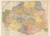
Paris ses Monuments

[Recto], uit: Nouveau Paris monumental : itinéraire pratique de l'étranger à Paris / gravé par L. Poulmaire
1 : 15000 Poulmaire, L. Paris : Garnier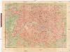
Nouveau plan de Paris
Paříž (Francie) Lanée Editerour-Geograph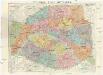
Nouveau plan de Paris
1 : 9000 Paříž (Francie) Dufrenoy