Maps of Arrondissement of Nanterre
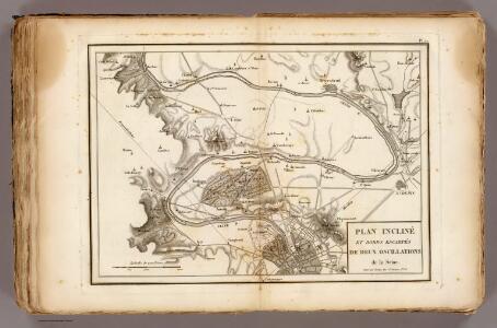
La Seine.
1 : 54000 Vincent
Plan Paris banlieue
Karte der Befestigung von Paris

Topografische Karte von Paris ung Gegend

Paříž a okolí

French Ports & Harbours, and Plan of Paris.
Fullarton, A. & Co.
Paříž a okolí
Paříž (Francie) Weiland, Karl Ferdinand Pražák, K.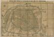
Noveau plan complet et historique de Paris, avec ses fortifications

[Recto], uit: Nouveau Paris monumental : itinéraire pratique de l'étranger à Paris / gravé par L. Poulmaire
1 : 15000 Poulmaire, L. Paris : Garnier
Paris illustré et ses fortifications / dressé par Maillard
1 : 10000 titelvariant: Plan de Paris; Annotatie: Omslagtitel: Plan de Paris; Met straatnamenregister Maillard, ... Paris : Logerot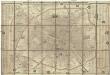
Nouveau plan complet de Paris avec ses fortifications
1 : 18000 Paříž (Francie) Henriot, J. N. A. Bes et F. Dubreuil
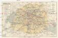
[Département de la Seine]. Paris, No. 5
1 : 40000 Annotatie: Herdruk van originele koperplaat; Oorspr. uitg.: [Paris] : Dépôt de la Guerre, [ca. 1850] [Paris : I.G.N.]
Plan de Paris
Paříž (Francie : oblast) Société S. Quentinoise d'Imprimerie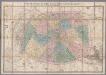
[Kaart], uit: Nouveau plan de Paris divisé en 20 arrondissements : dans un rayon de 10 kilomètres / le plan par Ch. Smith
1 : 17700 titelvariant: Paris et ses environs dans un rayon de dix kilomètres; Annotatie: Omslagtitel: Paris et ses environs dans un rayon de dix kilomètres Smith, Ch. Paris : Logerot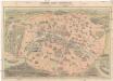
Nouveau Paris monumental
Paříž (Francie) Dufour, F. Garnier Freres
Carte topographique des environs & du plan de Paris
1 : 25200 Paříž (Francie) Delagrive, Jean von Homaen[n]ischen Erben
Plan touristique de Paris: chemin de fer métropolitain et principales lignes dautobus et de tramways, permettant la visite de la ville, de ses monuments, de ses musées et de ses promenades / fond de plan dressé et dessiné par G. Peltier
Syndicat dInitiative de Paris et du Département de la Seine ; Peltier, G.
Plan‘‘sraženija pod’’ Parižem‘‘, 18 marta 1814 g.
Frankreich Paris Befreiungskriege <1813-1815>
Plan de Paris
1 : 16000 Vuillemin, A. A. (Alexandre A.), b. 1812 Hachette & Cie.
Nouveau plan itinéraire de Paris comprenant toutes les rues, et les edifices publics
Paříž (Francie) Charpentier Danlos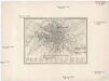
Plan von Paris 1835
Paříž (Francie) Meyer, Joseph Bibliographisches Institut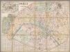
Paris et ses environs / dressé par E.D. Vorzet
1 : 12800 Annotatie: Met straatnaamregister Vorzet, E. D. [S.l.] : [s.n.]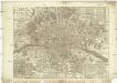
Nouveau plan routier de la ville et fabourg de Paris
Paříž (Francie) Crepy Crepy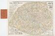
[Kaart], uit: Nouveau plan de Paris avec toutes les lignes du Métropolitain et du Nord-Sud / P. Bineteau del.
1 : 15000 titelvariant: Nouveau plan de Paris contenant toutes les lignes du Métropolitain et du Nord-Sud; Annotatie: Omslagtitel: Nouveau plan de Paris contenant toutes les lignes du Métropolitain et du Nord-Sud Bineteau, P. Paris : Taride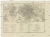
PLAN VON PARIS mit seinen nächsten Umgebungen
1 : 51000 Paříž (Francie)
Nouveau plan de Paris en relief
1 : 10900 Paříž (Francie) Bauerkeller & Co. Bauerkeller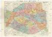
Nouveau plan de Paris
1 : 9000 Paříž (Francie) Dufrenoy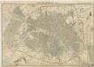
Plan de Paris en 1855