Maps of Seine-Saint-Denis

Nordost Frankreich, Belgien und Luxemburg Deutsche Rheinländer

Environs de Paris dans un rayon de 30 kilomètres
1 : 66670 Antoine E. Andriveau-Goujon
Plan de Paris XII.
Environs de Paris
1 : 25000 Picquet, Charles Ch. Piquet, Géographie ordinaire du Roi et de S.A.S. Monseig.r le Duc d'Orleans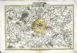
Li contorni di Parigi
1 Karte : Kupferdruck ; 26 x 41 cm Zatta presso Antonio Zatta
Plan de Paris
[Paris]
1 Blatt : 60 x 91 cm Bourgoin s.n.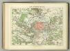
Camp Retranche de Paris.
1 : 100000 Jouvet et Cie.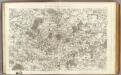
1 Paris.
1 : 86400 Cassini family; Cassini, Cesar-Francois, 1714-1784
66. Paris, Lorraine, and Saar. The World Atlas.
1 : 250000 USSR (Union of Soviet Socialist Republics).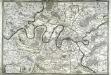
Les environs de Paris
1 Karte : Kupferdruck ; 50 x 73 cm Desnos chez Desnos géographe et ingénieur pour les globes spheres et instruments de mathematiques rue St. Jacques a l'enseigne du globe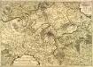
Carte nouvelle des environs de Paris contenant aussy la Brie
1 Karte : Kupferdruck ; 49 x 71 cm Crépy chez Crepy rue St. Jacques près la rue de la parcheminerie a St. Pierre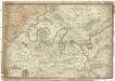
Les environs de Paris
1 : 101000 Paříž-oblast (Francie) Fer, Nicolas de Liébaux de Fer
Composite: Paris Et Ses Environs.
1 : 40000 Service Geologique Des Mines (France)
Nieuwe kaart van de buitenstreeken van Parys : meetkundig opgenomen in 1792 en 1793 met alle de nieuwe sterkten, verschansingen en versperringen tusschen de rivieren de Seine en de Marne
1 : 80000 Allart, J. (Johannes), 1754-1816 by Johannes Allart
Carte des environs de Paris, Versailles, St. Germain, et de Poissy
1 Karte : Kupferdruck ; 22 x 33 cm Crépy; Crépy chez Crepy rue S. Jacques à S. Pierre près la rue de la parcheminerie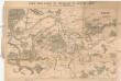
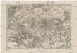
Carte pour suivre les opérations du siége de Paris
Paříž (Francie : oblast) Dupont, Paul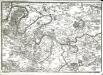
Environs de Paris
1 Karte : Kupferdruck ; 24 x 34 cm Fer; Starckman s.n.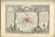

Paris.
1 : 95000 Colton, G.W.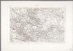
Paris
1 : 80000 Annotatie: Herdruk van originele koperplaat; Oorspr. uitg.: [Paris] : Dépôt de la Guerre, 1832 [Paris : IGN]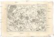
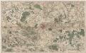
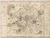
Environs de Paris
1 : 130000 Paříž-oblast (Francie) Bonne, Rigobert André
Environs de Paris
1 Karte : Kupferdruck ; 51 x 65 cm Le Rouge; Roussel; Delavigne chez le Rouge ing. geogr. rue des g.ds Augustins
Environs de Paris
1 Karte : Kupferdruck ; 51 x 65 cm Le Rouge; Roussel; Delavigne chez le Rouge ing. geogr. rue des g.ds Augustins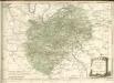
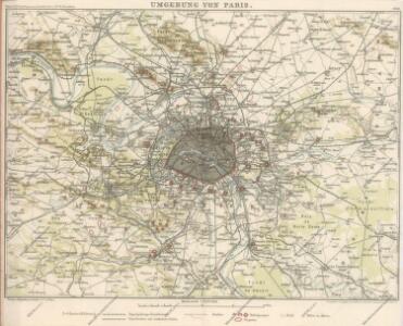
Plan von Paris
1 : 49240 Paříž (Francie) Fritz Rudolf Lechner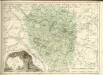
Département de la Seine
1 : 70500 Paříž-oblast (Francie) Chanlaire, P. G. P.G. Chanlaire
Paris.
1 : 95000 Colton, G.W.