Maps of Arrondissement of Nanterre

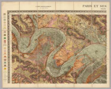
Nord-Ouest: Paris Et Ses Environs.
1 : 40000 Service Geologique Des Mines (France)
Flle. 2. Poissy, uit: Carte topographique des environs de Versailles dite "Carte des chasses du Roi"
1 : 28800 titelvariant: Carte des chasses du Roi; Annotatie: Herdruk van originele koperplaten; Oorspr. uitg.: 1764-1807; Voor aanwezige bladen zie overzichtsblad; Annotatie geografische gegevens: Opname: 1764-1773 [Paris : IGN]
La Seine, l'Oise.
1 : 57000 Vincent
La Seine.
1 : 54000 Vincent
Bois de Boulogne

Exposition universelle de 1900 : plan général / P. Bineteau del.
1 : 3300 Annotatie geografische gegevens: Met schaalstok; Legenda P. Bineteau fl. 1900 Paris : A. Taride / (Paris : Imp. P. Dupont)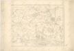
Ville de Paris

Exposition universelle de 1900
1 : 3500 Paříž (Francie) Bineteau, P. A. Taride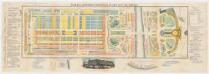
Plan de l'exposition universelle de 1878 avec ses annexes
Appel, F
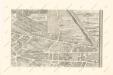
La Topographie de Paris ou Plan détaillé de la Ville de Paris 2

La Topographie de Paris ou Plan détaillé de la Ville de Paris 6

La Topographie de Paris ou Plan détaillé de la Ville de Paris 1
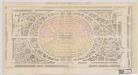
Exposition universelle de 1867, à Paris : plan d'ensemble du palais, du parc et du jardin
Guitton, Em
Plan Monumental de Paris au XVII siécle IX.
Paris au XVIII siécle 12
Plan de St. Cloud
1 : 7000 Delagrive, Jean Charbonnier l'imprimerie de Charbonnier
La Topographie de Paris ou Plan détaillé de la Ville de Paris 16

Westliche Hälfte von Paris
Grosser Hand-Atlas über alle Theile der Erde in 170 Karten Meyer, J. Verlag des Bibliographischen Instituts
Paris.
1 : 95000 Colton, G.W.
Environs de Paris
1 Karte : Kupferdruck ; 51 x 65 cm Le Rouge; Roussel; Delavigne chez le Rouge ing. geogr. rue des g.ds Augustins
Environs de Paris
1 Karte : Kupferdruck ; 51 x 65 cm Le Rouge; Roussel; Delavigne chez le Rouge ing. geogr. rue des g.ds Augustins
Stanford's map of the environs of Paris : shewing the fortifications
1 : 61000 Edward Stanford Ltd Edward Stanford
Paris
Paříž-oblast (Francie) Landes Industrie Comptoirs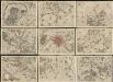
Environs de Paris : levés geometriquement
1 : 18500 Lagrive, Jean de, 1689-1757 De l'imprimerie de Charbonnier, rue S. Jacques au Chariot d'or
PARIS mit seinen ferneren Umgebungen
Paříž-oblast (Francie)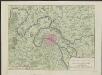
Nieuwe kaart van de buitenstreeken van Parys : meetkundig opgenomen in 1792 en 1793 met alle de nieuwe sterkten, verschansingen en versperringen tusschen de rivieren de Seine en de Marne
Te Amsterdam : by Johannes Allart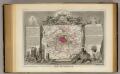
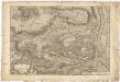
Dept. De La Siene.
1 : 194000 Levasseur, Victor.
The Environs Of Paris.
1 : 95040 Colton, G.W.
Paris environs.
1 : 92000 Society for the Diffusion of Useful Knowledge (Great Britain)