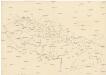
Maps of Hungary

VII, uit: General-Karte von Mittel-Europa in 12 Blättern, im Masse 1:1.200.000 / entworfen, bearb. und hrsg. von Josef Schlacher
1 : 1200000 Annotatie: Blad 6 ontbreekt; Annotatie geografische gegevens: 21 maatstokken op blad 9; Legenda op blad 9 Wien : K.K. Militär Geografisches Institut
Le Royaume de Hongrie

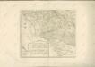
Galizien, Nord-Ungarn, Siebenburgen.
1 : 1863880 Flemming, Carl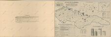
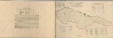
Atlas d'industrie de la république tchécoslovaque
Atlas d'industrie de la république tchécoslovaque

Karte der Rüben-Zucker-Fabriken der Oesterreich-Ungarischen-Monarchie
Rakousko-Uhersko Eduard Hölzel's Kunstanstalt
Zuid Gouv.Gen., Slowakije en Hongarije
1 : 3000000 Den Haag : Kompas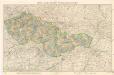
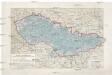
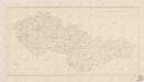
Mapa republiky Československé
Českoslov. stát malý
Československo
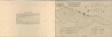
Sbírka map a diagramů použitých na mírových konferencích v Paříži v letech 1919 - 1920
Composite III, IV, V, VIII, IX, X: Karte Des Oesterreichischen Kaiserstaates.
1 : 576000 Scheda, Josef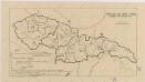
Sbírka map a diagramů použitých na mírových konferencích v Paříži v letech 1919 - 1920

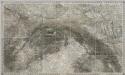
[Russischer Vormarsch auf Budapest]
Ungarn Militärische Planung, Strategische Offensive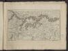
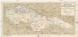
Théatre de la guerre actuelle, en Allemagne, en Pologne et en Turquie. n11, Hte. Hongrie, Vienne
1 : 900000 Chanlaire, Pierre Grégoire 1758-1817 Paris : chez l'auteur P. G. Chanlaire
Karte des Oesterreichisch - ungarischen Reiches

Galizien, Nord Ungarn und ein Theil von Siebenbürgen
1 : 1863880 Druck u. Verlag von C. Flemming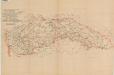
Mapa o stavu čs. silnic
Pays Tcheques
1 : 1850000 Československo Larouse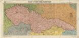
Stát československý
[Hydrologická mapa Československa]
1 : 1000000 Československo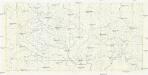
[Hydrologická mapa Československa]
1 : 1250000 Československo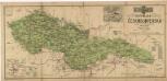
Republika Československá
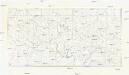
Bez titulu: Československo
Železniční mapa Republiky československé
1 : 1000000 Československo Machát, František V. Neubert
Atlas d'industrie de la république tchécoslovaque
Atlas d'industrie de la république tchécoslovaque


Pérehledná mapa éCeskoslovenské Republiky / provedeno a vydáno éCeskoslov. Vojenský Zeméepisným Ústavem ; kresbu terénu navrhli a kreslili mjr. Semík a nadp. Leixner
1 : 1000000 Annotatie: Uitg. 1920, met toevoegingen 1921 Matěj Semík; František Leixner 1884-1957; éCeskoslovenský Vojenský Zeméepisný Ústav [Praag : M. Schulz]