Maps of Czech Republic
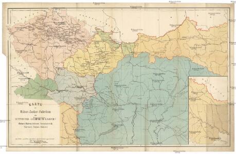
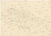
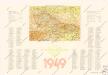
Karte der Rüben-Zucker-Fabriken der Oesterreich-Ungarischen-Monarchie
Rakousko-Uhersko Eduard Hölzel's Kunstanstalt
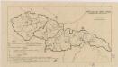
Atlas d'industrie de la république tchécoslovaque
Českoslov. stát malý
Československo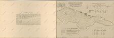
Atlas d'industrie de la république tchécoslovaque

Atlas d'industrie de la république tchécoslovaque

Československo v mapách
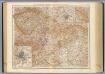
G. Freytags Karte von Deutschösterreich
1 : 1500000 Německo G. Freytag & Berndt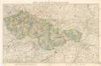
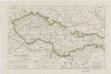
Mapa republiky Československé
Československá republika
Sbírka map a diagramů použitých na mírových konferencích v Paříži v letech 1919 - 1920

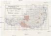
Die Bilanz der Wanderbewegung in den politischen Bezirken der Reichsratsländer im Jahrzent 1901 – 1910
Österreich Bevölkerungsentwicklung Migration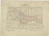
Přehled listů mapy generální 1:200 000, speciální 1:75 000 a původního vyměřování (topogr. sekcí) 1:25 000

Finland. Poland. Austria, Czechoslovakia, and Hungary. Yugoslavia.
1 : 4127000 Hammond, C.S.
Natürliche Zu- und Abnahme der anwesenden Bevölkerung in den politischen Bezirken der Reichsratsländer im Jahrzehnt 1901 – 1910
Österreich Bevölkerungsentwicklung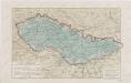
Sbírka map a diagramů použitých na mírových konferencích v Paříži v letech 1919 - 1920
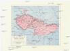
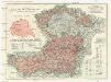
Les Pays Tchéques
Morava (Česko) Conseil National Tschécoslovaque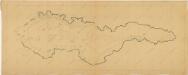
Bez titulu: Československo
Sbírka map a diagramů použitých na mírových konferencích v Paříži v letech 1919 - 1920
59-60. Cecoslovacchia, Ungheria.
1 : 1500000 Touring club italiano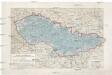
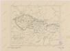
Pays Tcheques
1 : 1850000 Československo Larouse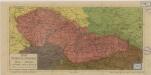
Stát československý

Völker-, Telegrafen- und Eisenbahn- Karte des Keiserthumes Öesterreich
Österreichische Karte 1:25 000
1 : 25000 Rakousko Militärgeographisches Institut
Österreichische Karte 1:25 000
1 : 25000 Rakousko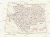
[Oesterreichisch-Ungarischen Monarchie]
1 : 25000 Rakousko-Uhersko Militärgeographisches Institut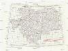
[Oesterreichisch-Ungarischen Monarchie]
1 : 50000 Rakousko-Uhersko K. u. k. Militärgeographisches Institut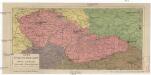
Stát československý
Československo Lepař, Zdeněk Müller, Johann Christoph V. Neubert
Postup při tisku příruční mapy školní ČSR
Sbírka map a diagramů použitých na mírových konferencích v Paříži v letech 1919 - 1920