Maps of Slovakia
Théatre de la guerre actuelle, en Allemagne, en Pologne et en Turquie. n11, Hte. Hongrie, Vienne
1 : 900000 Chanlaire, Pierre Grégoire 1758-1817 Paris : chez l'auteur P. G. Chanlaire
[Russischer Vormarsch auf Budapest]
Ungarn Militärische Planung, Strategische Offensive
Composite III, IV, V, VIII, IX, X: Karte Des Oesterreichischen Kaiserstaates.
1 : 576000 Scheda, Josef
Übersichtskarte von Böhmen, Mähren und Schlesien
Mapa o stavu čs. silnic
Českoslov. stát malý
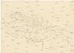
Československo
VII, uit: General-Karte von Mittel-Europa in 12 Blättern, im Masse 1:1.200.000 / entworfen, bearb. und hrsg. von Josef Schlacher
1 : 1200000 Annotatie: Blad 6 ontbreekt; Annotatie geografische gegevens: 21 maatstokken op blad 9; Legenda op blad 9 Wien : K.K. Militär Geografisches Institut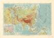
Asie
Karte der Rüben-Zucker-Fabriken der Oesterreich-Ungarischen-Monarchie
Rakousko-Uhersko Eduard Hölzel's Kunstanstalt
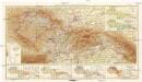
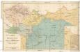
Galizien, Nord-Ungarn, Siebenburgen.
1 : 1863880 Flemming, Carl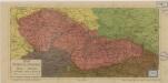
Stát československý
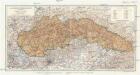
Šo[lcov]a mapa Slovenska
Slovensko Mareš, Vojtěch Haas, František Koppe-Bellmann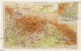
Slovensko a Zakarpatská Ukrajina
1 : 1250000 Bratislava (Slovensko) Kuchař, Karel V. Neubert a synové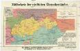
Völkerkarte der nördlichen Karpathenländer
1 : 1000000 Československo Dietrich Reimer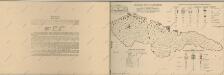
Atlas d'industrie de la république tchécoslovaque
A felvidék közigazgatási térképe
1 : 900000 Podkarpatská Rus (Ukrajina) Kogutowicz, Manó Magyar földrajzi intézet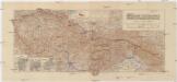
République Tchécoslovaque
1 : 1000000 Československo Section Cartogr. Tchécoslovaque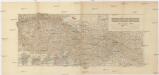
République Tchécoslovaque
1 : 1000000 Československo Section Cartogr. Tchécoslovaque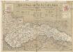
Šolcova mapa Slovenska
1 : 550000 Bratislava (Slovensko) Mareš, Vojtěch Šolc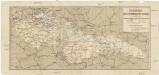
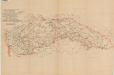
Eisenbahnkarte der Čechoslowakischen Republik
1 : 1000000 Československo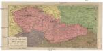
Stát československý
Československo Lepař, Zdeněk Müller, Johann Christoph V. Neubert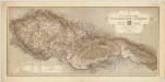
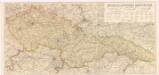
Pérehledná mapa éCeskoslovenské Republiky / provedeno a vydáno éCeskoslov. Vojenský Zeméepisným Ústavem ; kresbu terénu navrhli a kreslili mjr. Semík a nadp. Leixner
1 : 1000000 Annotatie: Uitg. 1920, met toevoegingen 1921 Matěj Semík; František Leixner 1884-1957; éCeskoslovenský Vojenský Zeméepisný Ústav [Praag : M. Schulz]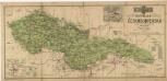
Republika Československá
Československá republika
1 : 1000000
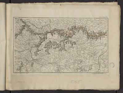
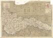
Partie Septentrionale du Royme. de Hongrie tirée de divers Autheurs.
1 : 880000 Mollova mapová sbírka Sanson, Nicolas Sanson, Nicolas
Partie Meridionalle du Rme. de Hongrie tirée de divers Autheurs
1 : 880000 Mollova mapová sbírka Sanson, Nicolas Mariette, Pierre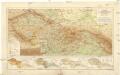
Handkarte der Čechoslovakischen Republik
1 : 1500000 Československo Paul Sollor's Nachf.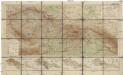
Handkarte der Čechoslovakischen Republik
1 : 1500000 Československo Paul Sollor's Nachf.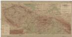
Handkarte der Tschechoslowakischen Republik
1 : 1500000 Československo Paul Sollors Nachf.