Maps of Czech Republic

[Österreich-Ungarn, Blatt 1]
Adolf Stieler's Handatlas über alle Theile der Erde und über das Weltgebäude Stieler, Adolf Justus Perthes
Übersichtskarte der territorialen Friedensbedingungen für Deutschösterreich
1 : 750000 Rakousko R. Lechner
The South East Part of Germany
1 : 3500000 Mollova mapová sbírka Moll, Herman Moll, Hermann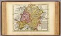
The south east part of Germany.
1 : 3500000 Moll, Herman, d. 1732
[Rakousko]
1 : 2115000 Evropa střední
Völker-, Telegrafen- und Eisenbahn- Karte des Keiserthumes Öesterreich

Süd-Östliches Deutschland, enthält die Oesterreichischen Lande
Schul-Atlas über alle Theile der Erde nach dem neuesten Zustande, und über das Weltgebäude Stieler, Adolf bei Justus Perthes
Evropa]
1 : 2100000 Mollova mapová sbírka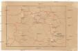
Karte mehrer Eisenbahnen Oesterreichs & Deutschlands
Německo jižní
Karte des Oesterreichisch - ungarischen Reiches

Theatre de la Guerre en Austriche, Baviere, Souabe, le Tirol et le Pays aux Environs
1 : 565000 Mollova mapová sbírka Covens, Johannes Covens, Johannes I
Bez titulu: Čechy

Schema Pochoda Kutuzova v Avstrīi v 1805 g.
Österreich Napoleonische Kriege Kutuzov, Michail I.
Maiestas Austriaca sive circ. archiducat. Austriae
1 : 3400000 Evropa střední Seutter, Matthäus Lotter, Tobias Conrad Tobias Conrad Lotter
[Süd-Deutsches Bergland]
E. von Sydow's Schul-Atlas in sechs und dreissig Karten Sydow, Emil von bei Justus Perthes
Karte der Republik Österreich
1 : 1500000 Wien : Kartographisches, früher Militärgeographisches Institut
Géographie. croquis n5, Bohême et Moravie
1 : 1000000 Molard, Jules, Commandant [Paris] : Service Géographique de l'Armée
SE pt. of Germany.
1 : 2650000 Bowen, Emanuel
Böhmisch-mährisches Stufenland
Tschechische Republik
Verkehrs - Karte von Böhmen, Mähren, Schlesien, Erzh. Oesterreich...

Allemagne du Sud, Autriche.
1 : 1500000 Vivien St Martin, L.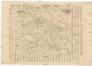
Poštovní mapa korunních zemí Čechy, Morava Slezsko
Česko Rašín, Jan náklad Farského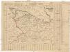
Poštovní mapa korunních zemí Čechy, Morava Slezsko
Česko Rašín, Jan náklad Farského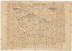
Poštovní mapa korunních zemí Čechy, Morava Slezsko
Česko Rašín, Jan náklad Farského
Politické rozdělení Československé republiky
Vojenský zeměpisný ústav
[Česko a Dolní a Horní Rakousko]
1 : 1000000 Dolní Rakousko (Rakousko)
Republik Österreich
1 : 2000000 Rakousko R. Lechner (Wilh. Müller)
Die Sudetenländer
1 : 750000 Sudety (Česko) Velhagen & Klasing
Die Sudetenländer nach dem 20. November 1938
1 : 750000 Sudety (Česko) Velhagen & Klasing
![[Österreich-Ungarn, Blatt 1]](https://images-2.georeferencer.com/images/iiif/006192567660/full/,300/0/native.jpg)

