Maps of Czech Republic

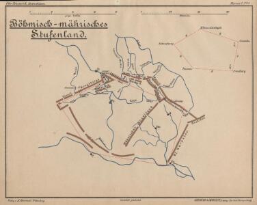
Böhmisch-mährisches Stufenland
Tschechische Republik
Karte mehrer Eisenbahnen Oesterreichs & Deutschlands
Německo jižní
Železniční a národopisná mapa zemí koruny české a rakouska-uherska s vyznačením hranic dicésáních a obvodů obchodních komor

Géographie. croquis n5, Bohême et Moravie
1 : 1000000 Molard, Jules, Commandant [Paris] : Service Géographique de l'Armée
Bez titulu: Čechy
Poštovní mapa korunních zemí Čechy, Morava Slezsko
Česko Rašín, Jan náklad Farského
Poštovní mapa korunních zemí Čechy, Morava Slezsko
Česko Rašín, Jan náklad Farského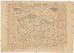
Poštovní mapa korunních zemí Čechy, Morava Slezsko
Česko Rašín, Jan náklad Farského
Bojíště [sic]
Evropa střední Farský
[Böhmen, Mähren, Herzth Schleisien, Prov: Schlesien, Königr: Sachsen]
Schul-Atlas in 36 Karten Völter, Daniel Verlag der J.M. Dannheimer'schen Buchhandlung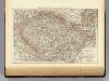
Bohemia, Moravia, Austrian Silesia.
1 : 1500000 Andree, Richard; Times (London, England)
Bez titulu: Rakouské dějiny

Belli ab obitu Caroli VI. Imperatoris usqve ad pacem Dresdae d. 25. Dec. MDCCXLV :
1 : 1300000 Mollova mapová sbírka Kraus, Lorenz Jacob Homann, Johann Baptista - dědici
Mittel-Östliches Deutschland oder Böhmen, Mähren und Schlesien
Hand-Atlas über alle Theile der Erde nach dem neuesten Zustande und über das Weltgebäude Stieler, Adolf bei Justus Perthes
Östliches Deutschland sowie Böhmen, Mähren und Oesterreichisch Schlesien
Handatlas über alle Theile der Erde und über das Weltgebäude Stieler, Adolf Justus Perthes

La Boheme
1 : 1600000 Česko Slaart, Pieter van der Pierre Vander
Mittel-Östliches Deutschland oder Böhmen, Mähren und Schlesien
Stieler's Hand-Atlas Stieler, Adolf bei Justus Perthes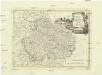
Regno di Boemia, ducato di Silesia, e marchesati di Moravia, e Lusazia
1 : 1800000 Lužice (Německo) Pitteri, Marco Alvise Antonio Zatta
Karten - Skizzen für die Schul - Praxis

[Mittel-Östliches Deutschland]
Hand-Atlas über alle Theile der Erde nach dem neuesten Zustande und über das Weltgebäude Stieler, Adolf bei Justus Perthes
Karte des deuschen Krieggschauplatzes
Prusko Wiligut, Franz Karl Friedrich Beek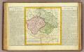
La Boheme, la Silesie.
1 : 3800000 Clouet, J. B. L. (Jean-Baptiste Louis), b. 1730
La Boheme

Nova mappa geographica regni Bohemiae,] duc. [Silesiae marchi. Moraviae, march. Austriae] et Lusatiae ecaet.
1 : 350000 Mollova mapová sbírka Rizzi Zannoni, Giovanni Antonio Probst, Johann Michael
Ostdeutsches Mittelgebirge
Plastischer Schul-Atlas über alle Theile der Erde : in 24 Karten Woldermann, G Verlag von P. Eckerlein
Östliches Deutschland oder Böhmen, Mähren und Schlesien
Hand-Atlas über alle Theile der Erde und über das Weltgebäude Stieler, Adolf Justus Perthes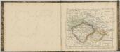

Sbírka map a diagramů použitých na mírových konferencích v Paříži v letech 1919 - 1920