Maps of Bavaria

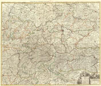
Theatre de la Guerre en Austriche, Baviere, Souabe, le Tirol et le Pays aux Environs
1 : 565000 Mollova mapová sbírka Covens, Johannes Covens, Johannes I
Karte mehrer Eisenbahnen Oesterreichs & Deutschlands
Německo jižní
[Österreich-Ungarn, Blatt 1]
Adolf Stieler's Handatlas über alle Theile der Erde und über das Weltgebäude Stieler, Adolf Justus Perthes
Karte des Oesterreichisch - ungarischen Reiches

[Süd-Deutsches Bergland]
E. von Sydow's Schul-Atlas in sechs und dreissig Karten Sydow, Emil von bei Justus Perthes
Eigentliche Verzeichnuss des Marches
1 : 950000 Evropa střední Kleinsträttl, Georg Wilhelm Merian
Übersichtskarte der territorialen Friedensbedingungen für Deutschösterreich
1 : 750000 Rakousko R. Lechner
Karten zu den deutschen Einheitskriegen II - Kriegsschauplatz 1866 in Deutschland und Italien
1 : 3000000 Mitteleuropa Deutscher Krieg <1866>
Böhmisch-mährisches Stufenland
Tschechische Republik
Eisenbahn-Routen-Karte für Böhmen und die angrenzenden Länder
Čechy (Česko)
Géographie. croquis n5, Bohême et Moravie
1 : 1000000 Molard, Jules, Commandant [Paris] : Service Géographique de l'Armée
Schema Pochoda Kutuzova v Avstrīi v 1805 g.
Österreich Napoleonische Kriege Kutuzov, Michail I.
Poštovní mapa korunních zemí Čechy, Morava Slezsko
Česko Rašín, Jan náklad Farského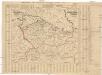
Poštovní mapa korunních zemí Čechy, Morava Slezsko
Česko Rašín, Jan náklad Farského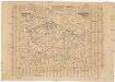
Poštovní mapa korunních zemí Čechy, Morava Slezsko
Česko Rašín, Jan náklad Farského
Allemagne du Sud, Autriche.
1 : 1500000 Vivien St Martin, L.
Republika Československá

Politické rozdělení Československé republiky
Vojenský zeměpisný ústav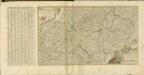

Geologische Übersichtskarte des Österreichischen Monarchie
1 : 576000 Rakousko-Uhersko Hauer, Franz Beck'schen Universitäts Buchhandlung (A. Hölder)
Nástěnná mapa Československé republiky
Machát, František
Železniční a národopisná mapa zemí koruny české a rakouska-uherska s vyznačením hranic dicésáních a obvodů obchodních komor

Wandkarte der Čechoslovakischen republik
Machát, František
Karten - Skizzen für die Schul - Praxis
Bohemia Nova Descriptio Tabula XVII. [Karte], in: Claud. Ptolemaeus. Geographia lat. cum mappis [...], S. 407.
1 Karte aus Atlas Münster, Sebastian [und Ptolemaeus, Claudius]
[Mapa Čech]
Rakousko severní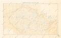
Přehledná mapa meteorologických stanic v Čechách, na Moravě a ve Slezsku

Verkehrs - Karte von Böhmen, Mähren, Schlesien, Erzh. Oesterreich...

Karten zur Statistik des Königreiches Böhmen...