Maps of Polynesia

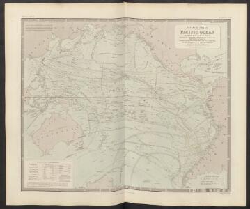
Physical Chart of the Pacific Ocean
The physical atlas Johnston, Alexander Keith William Blackwood & Sons
A correct chart of the terraqueous globe, according to Mercator's, or more properly Wright's projection, on which are describ'd lines, shewing the variation of the magnetic needle according to observations made about the year 1744.; Accuratissima totius terrarum orbis tabula nautica / celeberrimo viro Edmd. Halley, LLD., anno 1700 contructa; indice variationes magneticas denota[m?] ad observationes circiter annu 1744 habitas renovata Gulielmo Mountaine et Jacobo Dodson.
from Charts and maps Halley, Edmund; Mountaine, Guielmo; Dodson, Jacobo,
[Karte vom Grossen Ocean, Zur Übersicht der Strömungen, Temperatur und Handels-Strassen]
Erster Band, enthaltend in vier Abtheilungen die Erscheinungen der anorganischen Natur: 1. Meteorologie und Klimatographie. 2. Hydrologie und Hydrographie. 3. Geologie. 4. Tellurischer Magnetismus Humboldt, Alexander von Verlag von Justus Perthes
Carte nouvelle de la mer du Sud : dressée par ordre des principaux directeurs & tirée des memoires les plus recents et des relations des navigateurs les plus modernes, tant de France, que d'Espagne l'on ÿa joint, diverses remarques curieuses par raport aux decouvertes des graduations des manierres du pais que de la navigation
1 : 30000000 Leth, Andries de, 1662-1731 Donné au public, par And. & Henry de Leth ... sur le Pont de la Bourse au Pescheur
Westlicher Planiglob der Erde
1 : 17000000 Weimar : Verlag des Geographischen Instituts
Mappemonde ou Carte générale de l' univers sur une projection nouvelle d'une sphére ovale pour mieux entendre les distances entre l'Europe et Amerique : avec le tour du monde du lieut. Cook et tous les découvertes nouvelles
1 : 45000000 dessinée et gravée par Mathieu Albert Lotter A Augsbourg : [s.n.]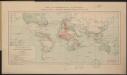
Carte des communications télégraphiques
1 : 70000000 Mager, Henri 1859-19..; L'Expansion française coloniale Paris : L'Expansion coloniale française
Streams, currents and drifts in the Pacific Ocean : mainly from the British Admirality chart No. 2640
1 : 33000000 United States. Hydrographic Office Hydrographic Office
Grosser oder Stiller Ocean
E. von Sydow's Schul-Atlas in sechs und dreissig Karten Sydow, Emil von bei Justus Perthes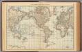
Map of the World.
1 : 85000000 Rand McNally and Company
Americae nova Tabula. [Karte], in: Le théâtre du monde, ou, Nouvel atlas contenant les chartes et descriptions de tous les païs de la terre, Bd. 2, S. 298.
1 Karte aus Atlas Blaeu, Willem Janszoon und Blaeu, Joan Blaeu, Willem Janszoon
Kaart der oude waereld tot verstand van het XXI boek van den Geest der wetten
1 : 40000000 J.C. de Roeder delin. H. Klockhoff sculp. Te Amsterdam : bij Holtrop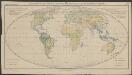
Verbreitung der wichtigsten Formationstypen der Erde
1 : 80000000 Schimper, Andreas Franz Wilhelm Gustav Fischer
Vulkane, Koralleninseln.
1 : 110000000 Andree, Richard
Versuch einer Karte zur Übersicht der Fluthwellen
Erster Band, enthaltend in vier Abtheilungen die Erscheinungen der anorganischen Natur: 1. Meteorologie und Klimatographie. 2. Hydrologie und Hydrographie. 3. Geologie. 4. Tellurischer Magnetismus Humboldt, Alexander von Verlag von Justus Perthes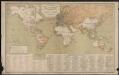
Carte générale des lignes télégraphiques internationales
1 : 40000000 Jaccottey, Paul Paris : Ch. Delagrave
Navigation, les oceans.
1 : 67000000 Garnier, F. A., 1803-1863
Thermometrie.
1 : 70000000 Garnier, F. A., 1803-1863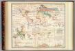
Distribution: plants.
1 : 67000000 Johnston, Alexander Keith, 1804-1871
Oestlicher Planiglob der Erde
1 : 17000000 Weimar : Verlag des Geographischen Instituts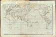
General chart Cook voyages.
1 : 45000000 Roberts, Henry, Lieut.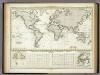
Versuch Einer Karte Zur ?bersicht Der Fluthwellen.
1 : 95000000 Berghaus, Heinrich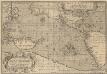
Maris Pacifici, (quod vulgò Mar del Zur) cum regionibus circumiacentibus [...] [Karte], in: Theatrum orbis terrarum, S. 64.
1 Karte aus Atlas Ortelius, Abraham Vrients, Jan Baptista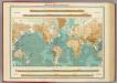
World - bathy-orographical.
1 : 83000000 John Bartholomew and Son
Welt-Karte zur Ubersicht der Luft-Stromungen und der See-Wege.
1 : 115000000 Berghaus, Hermann
Welt-Karte zur Ubersicht der Meeres-Stromungen und des Schnellverkehrs.
1 : 115000000 Berghaus, Hermann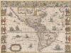
Americae nova Tabula. [Karte], in: Theatrum orbis terrarum, sive, Atlas novus, Bd. 2, S. 307.
1 Karte aus Atlas Blaeu, Joan Blaeu, Willem Janszoon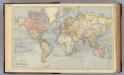
The World.
1 : 65000000 Letts, Son & Co.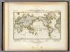
Darstellung Der Isodynamischen Linien.
1 : 130000000 Berghaus, Heinrich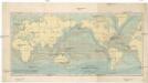
Uebersicht der Strömungen des Meeres
země světa Christmann, Fr. Hartwig Meidinger Sohn