Maps of Polynesia

Versuch einer Karte zur Übersicht der Fluthwellen
Erster Band, enthaltend in vier Abtheilungen die Erscheinungen der anorganischen Natur: 1. Meteorologie und Klimatographie. 2. Hydrologie und Hydrographie. 3. Geologie. 4. Tellurischer Magnetismus Humboldt, Alexander von Verlag von Justus Perthes
Map of the World.
1 : 85000000 Rand McNally and Company
[Historisch-geographischer Atlas zu den allgemeinen Geschichtswerken von C. v. Rotteck, Pölitz u. Becker] : Erdansichten nach den im Mittelalter herrschenden Systemen
von Julius Loewenberg [Freiburg im Breisgau] : [Herder]
Americae nova Tabula. [Karte], in: Le théâtre du monde, ou, Nouvel atlas contenant les chartes et descriptions de tous les païs de la terre, Bd. 2, S. 298.
1 Karte aus Atlas Blaeu, Willem Janszoon und Blaeu, Joan Blaeu, Willem Janszoon
Kaart der oude waereld tot verstand van het XXI boek van den Geest der wetten
1 : 40000000 J.C. de Roeder delin. H. Klockhoff sculp. Te Amsterdam : bij Holtrop
Oestlicher Planiglob der Erde
1 : 17000000 Weimar : Verlag des Geographischen Instituts
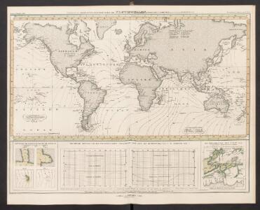
Welt-Karte zur Übersicht der Meeres-Strömungen und des Schnellverkehrs
Hand-Atlas über alle Theile der Erde und über das Weltgebäude Stieler, Adolf Justus Perthes
Mappemonde ou Carte générale de l' univers sur une projection nouvelle d'une sphére ovale pour mieux entendre les distances entre l'Europe et Amerique : avec le tour du monde du lieut. Cook et tous les découvertes nouvelles
1 : 45000000 dessinée et gravée par Mathieu Albert Lotter A Augsbourg : [s.n.]
[Terra]
země světa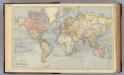
The World.
1 : 65000000 Letts, Son & Co.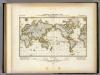
Darstellung Der Isodynamischen Linien.
1 : 130000000 Berghaus, Heinrich
Grosser oder Stiller Ocean
E. von Sydow's Schul-Atlas in sechs und dreissig Karten Sydow, Emil von bei Justus Perthes
India Extrema; XIX. Nova Tabula. [Karte], in: Claud. Ptolemaeus. Geographia lat. cum mappis [...], S. 413.
1 Karte aus Atlas Münster, Sebastian [und Ptolemaeus, Claudius]
[Botanical Geography]
The physical atlas Johnston, Alexander Keith William Blackwood & Sons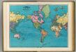
World, Mercator's projection.
1 : 64000000 Rand McNally and Company
Streams, currents and drifts in the Pacific Ocean : mainly from the British Admirality chart No. 2640
1 : 33000000 United States. Hydrographic Office Hydrographic Office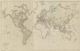
XV. Charte für die allgemeine Geschichte vom zweiter Pariser Frieden 1815 bis zu Ende des Jahres 1822 : d.i. von 1815 bis Ende 1822 n. Chr
Entworfen von F.W. Benicken A. Falger gr. Weimar : im Verlage des L. Industrie-Comptoirs
Typus Orbis A Ptol. Descriptus [Karte], in: Claud. Ptolemaeus. Geographia lat. cum mappis [...], S. 251.
1 Karte aus Atlas Münster, Sebastian [und Ptolemaeus, Claudius]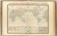
Courants atmospheriques, oceaniques.
1 : 70000000 Garnier, F. A., 1803-1863
Vulkane, Koralleninseln.
1 : 110000000 Andree, Richard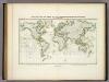
Beobachteten Werthe Der Declination.
1 : 130000000 Berghaus, Heinrich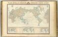
Navigation, les oceans.
1 : 67000000 Garnier, F. A., 1803-1863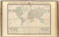
Thermometrie.
1 : 70000000 Garnier, F. A., 1803-1863
[Verbreitungsbezirke der wichtigsten Kulturgewächse]
Zweiter Band, enthaltend in vier Abtheilungen die Vertheilung der Organismen: 5. Pflanzen-Geographie, 6. Thier-Geographie, 7. Anthropographie, 8. Ethnographie Humboldt, Alexander von Verlag von Justus Perthes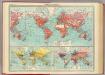
World - commerce.
1 : 92000000 John Bartholomew and Son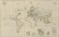
IX. Charte für die allgemeine Geschichte von Carl V. bis auf den Anfang des XXX-jährigen Krieges : d.i. von 1519 bis 1618 n. Christus
Entworfen von F.W. Benicken A. Falger gr. Weimar : im Verlage des L. Industrie-Comptoirs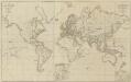
XII. Charte für die allgemeine Geschichte vom Anfange der österr. Erbfolge-Krieges bis auf den Tod Friedrichs des Zweiten : d.i. von 1740 bis 1786 n. Christus
Entworfen von F.W. Benicken in Stein grav. von A. Falger Weimar : im Verlage des L. Industrie-Comptoirs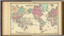
Colton's Map Of The World On Mercator's Projection.
1 : 65000000 Colton, G.W.
Karte für die in den Jahren 1827-1831 Beobachteten Werthe der Declination
Erster Band, enthaltend in vier Abtheilungen die Erscheinungen der anorganischen Natur: 1. Meteorologie und Klimatographie. 2. Hydrologie und Hydrographie. 3. Geologie. 4. Tellurischer Magnetismus Humboldt, Alexander von Verlag von Justus Perthes