Maps of gmina Szczurowa

Ujście Solne
1 : 75000 Polsko Hanel K. u. k. Militärgeographisches Institut
Ujscie Solne.; Spezialkarte der osterreichisch-ungarischen Monarchie.
from Spezialkarte der osterreichisch-ungarischen Monarchie. Austro-Hungarian Monarchy. Militärgeographisches Institut.,

Miechow 93, uit: Special-Karte von Mittel-Europa / nach amtlichen Quellen bearbeitet von W. Liebenow
1 : 300000 titelvariant: W. Liebenow's Mittel-Europa; Annotatie: Titel boven de bladen: W. Liebenow's Mittel-Europa Johannes Wilhelm Liebenow 1822-1897 Frankfurt a. M. : Ludwig Ravenstein
Krakau.
from Spezialkarte der osterreichisch-ungarischen Monarchie.
Tarnów und Dąbrowa
1 : 75000 Dąbrowa Tarnowska-oblast (Polsko) Ansion K. u. k. Militärgeographisches Institut
Krakau
1 : 75000 Krakov-oblast (Polsko) Bayer, R. K. u. k. Militärgeographisches Institut
Tarnow und Dabrowa.
from Spezialkarte der osterreichisch-ungarischen Monarchie.
Bochnia und Cschow.
from Spezialkarte der osterreichisch-ungarischen Monarchie.
Nowy Korczyn
1 : 75000 K. u. k. Militärgeographisches Institut
West Galizien
Bochnia (Polsko) Müller, Karl Metzburg, Georg Ignaz von im Verlage des Kunst und Industrie Comptoirs
West Galizien
Halič (Polsko a Ukrajina) Müller, Karl Metzburg, Georg Ignaz von im Verlage des Kunst und Industrie Comptoirs
Übersichtskarte des Kampfgeländes
1 : 650000 Polen Tarnów Weltkrieg <1914-1918> Verl. Gerhard Stalling, Oldenburg
Nr. 13. Der Durchbruch bei Tarnow-Gorlice. (2. Mai 1915.)
Gorlice (Region) Gorlice / Schlacht, Weltkrieg <1914-1918>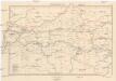
Galizien, Westlicher Theil
1 : 700000 Halič (Polsko a Ukrajina) Karl Fr. Pfau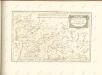

Carte de la Roumanie et pays limitrophes. Cracovie
1 : 500000 France. Service géographique de l'armée [Paris] : Service géographique de l'armée
Krakau, Przemysl, Jaroslau, Kaschau, Leutschau
1 : 750000 Krakov (Polsko : oblast) Geng, K. K. u. k. Militärgeographisches Institut
Krakau, Przemysl, Jaroslau, Kaschau, Leutschau
1 : 750000 Krakov (Polsko : oblast) Geng, K. K. u. k. Militärgeographisches Institut
Krakau, Przemyśl, Jaroslau, Kaschau, Leutschau
1 : 750000 Jarosław (Polsko) R. Lechner
Krakau, Przemyśl, Jaroslau, Kaschau, Leutschau
1 : 750000 Jarosław (Polsko) K. k. militär-geographisches Institut
Übersichtskarte von Mittel - Europa

IV, uit: General-Karte des oesterreichischen Kaiserstaates mit einem grossen Theile der angrenzenden Länder / durch Josef Scheda ... bearb. und hrsg
1 : 576000 Annotatie geografische gegevens: Maatstokken: oesterreichische Meilen, geografische oder deutsche Meilen, preussische Meilen, türkische Berri, französische Lieues, russische Werste; Maatstok per blad: wiener Klafter, öster. Meilen; Blad XIX: statistische en taalkundige informatie; Blad XIX: legenda [Wien : K.K. Militärisch-Geografisches Institut]
Ost Galizien
Halič (Polsko a Ukrajina) Liesganig, Joseph m Verlage des Kunst- und Industrie- Comptoirs
Ungarn. Comitate: Sohler, Trentschin, Thurocz, Arva, Liptau, Zips, Járos, Zemplin. Gallicien Kreise: Wadowicz, Bochnia, Szandecz, Jaszlo, Tarnow
Ungarn Verkehrsweg
Übersichtskarte von Mittel - Europa

Post und Eisenbahnkarte der Österreichisch-Ungarischen Monarchie

Sheet IV: Karte Des Oesterreichischen Kaiserstaates.
1 : 576000 Scheda, Josef