Maps of Tatra Mountains

Maps of Tatra Mountains

$title$

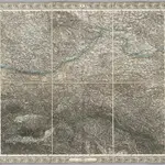
Sheet IV: Karte Des Oesterreichischen Kaiserstaates.

1 : 576000 Scheda, Josef
$title$

$title$

Übersichtskarte von Mittel - Europa

$title$

Übersichtskarte von Mittel - Europa

$title$

Galizien, Westlicher Theil

1 : 700000 Halič (Polsko a Ukrajina) Karl Fr. Pfau
$title$

Post und Eisenbahnkarte der Österreichisch-Ungarischen Monarchie

$title$

Carte de la Roumanie et pays limitrophes. Cracovie

1 : 500000 France. Service géographique de l'armée [Paris] : Service géographique de l'armée
$title$

Krakau, Przemysl, Jaroslau, Kaschau, Leutschau

1 : 750000 Krakov (Polsko : oblast) Geng, K. K. u. k. Militärgeographisches Institut
$title$

Krakau, Przemysl, Jaroslau, Kaschau, Leutschau

1 : 750000 Krakov (Polsko : oblast) Geng, K. K. u. k. Militärgeographisches Institut
$title$

Krakau, Przemyśl, Jaroslau, Kaschau, Leutschau

1 : 750000 Jarosław (Polsko) R. Lechner
$title$

Krakau, Przemyśl, Jaroslau, Kaschau, Leutschau

1 : 750000 Jarosław (Polsko) K. k. militär-geographisches Institut
$title$

Übrige Länder der ehemaligen Österreich-Ung. Monarchie

1 : 900000 Halič (Polsko a Ukrajina) Koch, Wilhelm Opitz, Carl Arnd
$title$

$title$

Halič

Halič (Polsko a Ukrajina)
$title$

Galizien, Karpathen, Bukowina nebst anschließendem Ungarn, Russland u. s. w.

Ravenstein, Hans
$title$

Ungarn. Comitate: Sohler, Trentschin, Thurocz, Arva, Liptau, Zips, Járos, Zemplin. Gallicien Kreise: Wadowicz, Bochnia, Szandecz, Jaszlo, Tarnow

Ungarn Verkehrsweg
$title$

Strategische Übersichts-Karte des polnisch-litaurischen Armee-Bewegungraumes

$title$

Ost-Galizien

Halič (Polsko a Ukrajina) Liesganig, Joseph im Verlage des Kunst und Industrie Comptoirs
$title$

Strecke

Krakov (Polsko) K. k. Österreichische Staatsbahnen
$title$

Übersichtskarte des Kampfgeländes

1 : 650000 Polen Tarnów Weltkrieg <1914-1918> Verl. Gerhard Stalling, Oldenburg
$title$

West Galizien

Bochnia (Polsko) Müller, Karl Metzburg, Georg Ignaz von im Verlage des Kunst und Industrie Comptoirs
$title$

West Galizien

Halič (Polsko a Ukrajina) Müller, Karl Metzburg, Georg Ignaz von im Verlage des Kunst und Industrie Comptoirs
$title$

Die im Stadtbuch von Zipser Neudorf genannten Orte

Zips, Spišská Nová Ves, Stadtbuch
$title$

Ost Galizien

Halič (Polsko a Ukrajina) Liesganig, Joseph m Verlage des Kunst- und Industrie- Comptoirs
$title$

Projectirte Strasse von Billiz bis Lemberg

1 : 560000 Bielsko-Biała (Polsko) Gross
$title$

Die Donau, der Fürst aller Europaeischen Flüsse :

Mollova mapová sbírka Hoffmann, Johannes Hoffmann, Johann
$title$

Nr. 13. Der Durchbruch bei Tarnow-Gorlice. (2. Mai 1915.)

Gorlice (Region) Gorlice / Schlacht, Weltkrieg <1914-1918>
$title$

Mappa generalis regni Hungariae partiumque adnexarum Croatiae, Slavoniae...

$title$

Východní Slovensko

1 : 300000 Banská Štiavnica (Slovensko) Fastr Eduard
$title$

Východné Slovensko

1 : 300000 Banská Štiavnica (Slovensko) Edv. Fastr
© MapTiler © OpenStreetMap contributors
How does it work?
These instructions will show you how to find historical maps online.
Getting started
Type the place name in the search box to find the exact location. You can further adjust the search by zooming in and out.
Zoom
Zoom in and out with the buttons or use your mouse or touchpad natively.
Exact Area tool
Click here and draw a rectangle over the map to precisely define the search area.
Set filters
Narrow your search with advanced settings, such as Years (from/to), Fulltext, Publisher, etc.
Results
See the results of your search on the right side. You can scroll down to find more maps of this location.
?

Download OldMapsOnline Mobile