Maps of Tatra Mountains
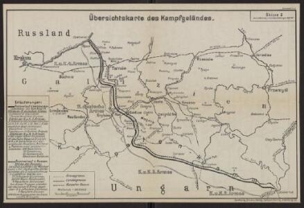
Übersichtskarte des Kampfgeländes
1 : 650000 Polen Tarnów Weltkrieg <1914-1918> Verl. Gerhard Stalling, Oldenburg
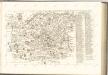
Galizien, Westlicher Theil
1 : 700000 Halič (Polsko a Ukrajina) Karl Fr. Pfau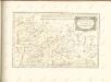

Ost-Galizien
Halič (Polsko a Ukrajina) Liesganig, Joseph im Verlage des Kunst und Industrie Comptoirs
Strecke
Krakov (Polsko) K. k. Österreichische Staatsbahnen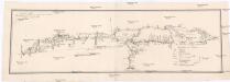
Projectirte Strasse von Billiz bis Lemberg
1 : 560000 Bielsko-Biała (Polsko) Gross
Generalkarte von Zentraleuropa

Übersichtskarte von Mitteleuropa 1:300 000
1 : 300000 Levoča-oblast (Slovensko) Reichsamt für Landesaufnahme
Sanok 108, uit: Special-Karte von Mittel-Europa / nach amtlichen Quellen bearbeitet von W. Liebenow
1 : 300000 titelvariant: W. Liebenow's Mittel-Europa; Annotatie: Titel boven de bladen: W. Liebenow's Mittel-Europa Johannes Wilhelm Liebenow 1822-1897 Frankfurt a. M. : Ludwig Ravenstein
Die vom 2. bis 7. Mai 1915 abends erreichten Linien
1 : 515000 Polen Tarnów Weltkrieg <1914-1918> Verl. Gerhard Stalling, Oldenburg
Generalkarte von Zentraleuropa


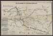
Vom Dunajec bis zum Wislok
1 : 160000 Polen Dunajec-Gebiet Weltkrieg <1914-1918> Verl. Gerhard Stalling, Oldenburg
Comitat Sáros
1 : 290000 Šariš (Slovensko : oblast)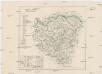
Comitat Sáros
1 : 280000 Šariš-oblast (Slovensko)
Reliefkarte Gorlice-Tarnów
Polen Tarnów Weltkrieg <1914-1918> Verl. Gerhard Stalling, Oldenburg
Krakau 107, uit: Special-Karte von Mittel-Europa / nach amtlichen Quellen bearbeitet von W. Liebenow
1 : 300000 titelvariant: W. Liebenow's Mittel-Europa; Annotatie: Titel boven de bladen: W. Liebenow's Mittel-Europa Johannes Wilhelm Liebenow 1822-1897 Frankfurt a. M. : Ludwig Ravenstein
Terrae sev Comitatvs Scepvsiensis Tabvla
1 : 190000 Mollova mapová sbírka Kray de Rokus, Paul Puschner, Johann Georg Bel, Matej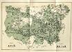
Stolice Spiš. Stolice Šaryš
Šariš, Komitat Zips, ethnische Gruppe

Jonction du Waag au Poprad
1 : 420000 Poprad-oblast (Slovensko)

Das Zipser Gebiet
1 : 2000000 Zips


Rzeszów 94, uit: Special-Karte von Mittel-Europa / nach amtlichen Quellen bearbeitet von W. Liebenow
1 : 300000 titelvariant: W. Liebenow's Mittel-Europa; Annotatie: Titel boven de bladen: W. Liebenow's Mittel-Europa Johannes Wilhelm Liebenow 1822-1897 Frankfurt a. M. : Ludwig Ravenstein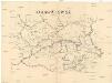
Orawa i Spisz
Orava (Polsko a Slovensko)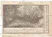
Die Central-Karpaten
1 : 200000 Karpaty Sydow, A. von Wolff