Maps of Carpathian Mountains
Hongrie
1 : 1000000 Maďarsko Senát Národního shromáždění
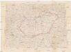
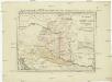
Hungary
1 : 1000000 Hongrie. S.G.A. le 20/12/19. In: Treaty Series No. 10.1920. Treaty of Peace between the Allied and Associated Powers and Hungary. June 4, 1920. War Office
Regnum Hungaria in Omnes suos Comitatus

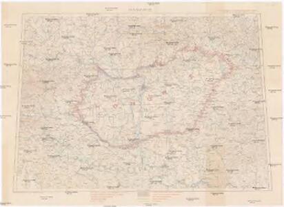
Ungarn und seine Nachbarländer 1919-1938
Ungarn
[80][80] Regnum Hungaria ..., uit: Atlas sive Descriptio terrarum orbis
Annotatie: Gedigitaliseerde versie. Amsterdam. Heiloo : Picturae (vervaardiger), 2015. tiff-bestand. Gedigitaliseerd: 07-01-2015; Origineel: Universiteitsbibliotheek Vrije Universiteit (XL.05127.-) ; Netherlands; Titelpagina ontbreekt Wit, Frederik de Amsterdam : Frederick de Wit
Hungary.
1 : 3800000 Darton, William
Hungariae Regnum. [Karte], in: Novus atlas absolutissimus, Bd. 2, S. 285.
1 Karte aus Atlas Janssonius Offizin
Regnum Hungariae
1 : 2200000 Mollova mapová sbírka Bruggen, Johann van der Brugge, Johannes van der
Regnum Hungariae
1 : 2200000 Mollova mapová sbírka Pfeffel, Johann Andreas Pfeffel, Johann Andreas
Hungaria Regnum. [Karte], in: Gerardi Mercatoris et I. Hondii Newer Atlas, oder, Grosses Weltbuch, Bd. 1, S. 346.
1 Karte aus Atlas Mercator, Gerhard und Hondius, Jodocus Jansson, Jan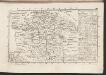
Das Königreich Ungarn nach seiner natürlichen und politischen Ansicht. Übersicht der Komitate
Ungarn Kroatien Verwaltungsbezirk Komitat
Die konservativen Wahlbezirke
Ungarn Wahlbezirk, Wahlverhalten
Postkarte von Nieder Ungarn, Kroatien und Sklavonien
Chorvatsko Kühn, Ignaz im von Reillyschen Landkarten und Kunstwerke Verschleiss Komptoir
Karte der Königreiche Ungarn, Croatien, Slavonien und Militärgrenzen

Le Royaume d'Hongrie - Hungaria
Ungarn, Slowakei Briet, Philippe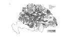
Die Bezirke der Tendenz "B" vor 1875
Ungarn Wahlbezirk, Wahlverhalten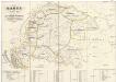
Karte von Ungarn
Maďarsko Torsch, Franz
Magyarország és a' Hozzá kapcsolt tartományok Földabrosza
1 : 970000 Chorvatsko Raffelsperger, Franz Raffelsperger F.
Tabula generalis regni Hungariae, Croatiae et Slavoniae nec non magni principatus Tranylvaniae
1 : 1400000 Chorvatsko Lipský, Ján Marcum Berra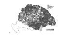
Die Bezirke der Tendenz "A" nach 1875
Ungarn Wahlbezirk, Wahlverhalten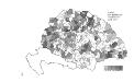
Die Bezirke der Tendenz "B" nach 1875
Ungarn Wahlbezirk, Wahlverhalten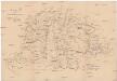
Karte des ungarischen Communikations-Netzes
1 : 1140000 Evropa jihovýchodní
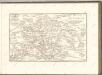
Hungaria in Partes II et Comitatus LII divisa
1 : 4300000 Mollova mapová sbírka Tomka Szászky, János
Hungaria Regnum. [Karte], in: Theatrum orbis terrarum, sive, Atlas novus, Bd. 1, S. 105.
1 Karte aus Atlas Blaeu, Joan Blaeu, Willem Janszoon
Strassen-Karte des Koenigreiches Ungarn
1 : 430000 Uhersko A. Floder
Hungary.
1 : 3041280 Tallis, J. & F.