Maps of Carpathian Mountains
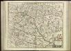
[80][80] Regnum Hungaria ..., uit: Atlas sive Descriptio terrarum orbis
Annotatie: Gedigitaliseerde versie. Amsterdam. Heiloo : Picturae (vervaardiger), 2015. tiff-bestand. Gedigitaliseerd: 07-01-2015; Origineel: Universiteitsbibliotheek Vrije Universiteit (XL.05127.-) ; Netherlands; Titelpagina ontbreekt Wit, Frederik de Amsterdam : Frederick de Wit
Hungaria Regnum. [Karte], in: Gerardi Mercatoris et I. Hondii Newer Atlas, oder, Grosses Weltbuch, Bd. 1, S. 346.
1 Karte aus Atlas Mercator, Gerhard und Hondius, Jodocus Jansson, Jan
Hungariae Regnum. [Karte], in: Novus atlas absolutissimus, Bd. 2, S. 285.
1 Karte aus Atlas Janssonius Offizin
Regnum Hungaria in Omnes suos Comitatus

Hungaria in Partes II et Comitatus LII divisa
1 : 4300000 Mollova mapová sbírka Tomka Szászky, János
Regnum Hungariae
1 : 2200000 Mollova mapová sbírka Bruggen, Johann van der Brugge, Johannes van der
Regnum Hungariae
1 : 2200000 Mollova mapová sbírka Pfeffel, Johann Andreas Pfeffel, Johann Andreas
Hongrie
1 : 1000000 Maďarsko Senát Národního shromáždění
Magyar-ország
1 : 1400000 Chorvatsko Fried, Franz List, Joseph bei Artaria &. Comp.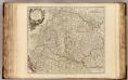
Hongrie, Transilvanie, Sclavonie, Croatie, Valaquie, Bosnie, Bulgarie.
1 : 1450000 Robert de Vaugondy, Gilles, 1688-1766
Hungaria Regnum. [Karte], in: Theatrum orbis terrarum, sive, Atlas novus, Bd. 1, S. 105.
1 Karte aus Atlas Blaeu, Joan Blaeu, Willem Janszoon
Magyarország és a' Hozzá kapcsolt tartományok Földabrosza
1 : 970000 Chorvatsko Raffelsperger, Franz Raffelsperger F.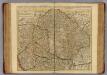
Hongrie, Transilvanie, Croatie, Sclavonie.
1 : 1390000 L'Isle, Guillaume de, 1675-1726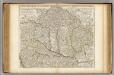
Hongrie, Transilvanie, Croatie, Sclavonie.
1 : 1390000 L'Isle, Guillaume de, 1675-1726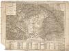
Tabula generalis regni Hungariae Croatiae et Slavoniae, nec non magni principatus Transylvaniae conspectum mappae generalis in IX. sectiones moduli majoris distributae civitates, oppida, stationes et vias postales singillatim accurateque exhibens
1 : 1396000 Chorvatsko Lipský, Ján Karacs, Ferenc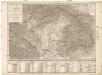
Tabula generalis regni Hungariae Croatiae et Slavoniae, nec non magni principatus Transylvaniae conspectum mappae generalis in IX. sectiones moduli majoris distributae civitates, oppida, stationes et vias postales singillatim accurateque exhibens
1 : 1400000 Chorvatsko Lipský, Ján Festetits de Tolna, Georgio
Hungary
1 : 1000000 Hongrie. S.G.A. le 20/12/19. In: Treaty Series No. 10.1920. Treaty of Peace between the Allied and Associated Powers and Hungary. June 4, 1920. War Office
Carte Particuliere De La Hongrie De La Transilvanie De La Croatie Et De La Sclavonie
1 : 1400000 Mollova mapová sbírka Delisle, Guillaume Schenk, Peter II
Carte Particuliere De La Hongrie De La Transilvanie De La Croatie Et De La Sclavonie
1 : 1400000 Mollova mapová sbírka Delisle, Guillaume L'Isle, Guillaume de
Karte des ungarischen Communikations-Netzes
1 : 1140000 Evropa jihovýchodní
Le Royaume d'Hongrie - Hungaria
Ungarn, Slowakei Briet, Philippe
Karte der Königreiche Ungarn, Croatien, Slavonien und Militärgrenzen

Carte particuliere de la Hongrie de la Transilvanie de la Croatie et de la Sclavonie
1 : 1400000 Chorvatsko Delisle, Guillaume J. Covens et C. Mortier
Postkarte von Nieder Ungarn, Kroatien und Sklavonien
Chorvatsko Kühn, Ignaz im von Reillyschen Landkarten und Kunstwerke Verschleiss Komptoir
Die Bezirke der Tendenz "B" vor 1875
Ungarn Wahlbezirk, Wahlverhalten
Die kaiserlich Oesterreichischen Ungarischen Erbstaaten
1 : 522000 Budapešť-oblast (Maďarsko) Weiland, Karl Ferdinand im Verlage des Geographischen Instituts
Die kaiserlich Oesterreichischen Ungarischen Erbstaaten
Maďarsko Weiland, Karl Ferdinand Prixner, Godofr. im Verlage des Geographischen Instituts
Die kaiserlich Oesterreichischen Ungarischen Erbstaaten
Maďarsko Weiland, Karl Ferdinand Prixner, Godofr. im Verlage des Geographischen Instituts
Die kaiserlich Oesterreichischen Ungarischen Erbstaaten
Maďarsko Weiland, Karl Ferdinand Prixner, Godofr. im Verlage des Geographischen Instituts
Die kaiserlich oesterreichischen ungarischen Erbstaaten
1 : 1522000 Dalmácie (Chorvatsko) Weiland, Karl Ferdinand im Verlage des Geographischen Instituts
Die kaiserlich oesterreichischen ungarischen Erbstaaten
1 : 1522000 Dalmácie (Chorvatsko) Weiland, Karl Ferdinand im Verlage des Geographischen Instituts
![[80][80] Regnum Hungaria ..., uit: Atlas sive Descriptio terrarum orbis](https://images-2.georeferencer.com/images/iiif/200480351678/full/,300/0/native.jpg)

