Maps of Carpathian Mountains
Tabula generalis regni Hungariae Croatiae et Slavoniae, nec non magni principatus Transylvaniae conspectum mappae generalis in IX. sectiones moduli majoris distributae civitates, oppida, stationes et vias postales singillatim accurateque exhibens
1 : 1396000 Chorvatsko Lipský, Ján Karacs, Ferenc
Tabula generalis regni Hungariae Croatiae et Slavoniae, nec non magni principatus Transylvaniae conspectum mappae generalis in IX. sectiones moduli majoris distributae civitates, oppida, stationes et vias postales singillatim accurateque exhibens
1 : 1400000 Chorvatsko Lipský, Ján Festetits de Tolna, Georgio
Tabula generalis regni Hungariae, Croatiae et Slavoniae nec non magni principatus Tranylvaniae
1 : 1400000 Chorvatsko Lipský, Ján Marcum Berra
Carte particuliere de la Hongrie de la Transilvanie de la Croatie et de la Sclavonie
1 : 1400000 Chorvatsko Delisle, Guillaume J. Covens et C. Mortier
Die kaiserlich oesterreichischen ungarischen Erbstaaten
1 : 1522000 Dalmácie (Chorvatsko) Weiland, Karl Ferdinand im Verlage des Geographischen Instituts
Die kaiserlich oesterreichischen ungarischen Erbstaaten
1 : 1522000 Dalmácie (Chorvatsko) Weiland, Karl Ferdinand im Verlage des Geographischen Instituts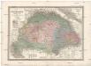
Die kaiserlich oesterreichischen ungarischen Erbstaaten
1 : 1522000 Dalmácie (Chorvatsko) Weiland, Karl Ferdinand im Verlage des Geographischen Instituts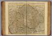
Hongrie, Transilvanie, Croatie, Sclavonie.
1 : 1390000 L'Isle, Guillaume de, 1675-1726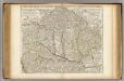
Hongrie, Transilvanie, Croatie, Sclavonie.
1 : 1390000 L'Isle, Guillaume de, 1675-1726
Mappa novissima regnorum Hungariae, Croatiae, Sclavoniae nec non magni principatus Transylvaniae
1 : 700000 Maďarsko Müller, F. Artaria
Königreich Hungarn
1 : 1321000 Bukovina (Rumunsko a Ukrajina) Mollo, Tranquillo T. Mollo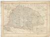
Königreich Hungarn
1 : 1321000 Bukovina (Rumunsko a Ukrajina) Mollo, Tranquillo T. Mollo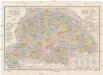
Orts- und Strassenkarte des Königreiches Ungarn
1 : 1296000 Chorvatsko Steinhauser, Anton Artaria
Magyarország és Bosznia automobillal jarható útainak átnézeti térképe
1 : 900000 Bosna Benkö Gyula
Carte Particuliere De La Hongrie De La Transilvanie De La Croatie Et De La Sclavonie
1 : 1400000 Mollova mapová sbírka Delisle, Guillaume Schenk, Peter II
Carte Particuliere De La Hongrie De La Transilvanie De La Croatie Et De La Sclavonie
1 : 1400000 Mollova mapová sbírka Delisle, Guillaume L'Isle, Guillaume de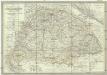
Die kaiserlich oesterreichischen ungarischen Erbstaaten, das ist Ungarn, Siebenbürgen, Dalmatien und die Militair-Graenze
1 : 1522000 Dalmácie (Chorvatsko) Weiland, Karl Ferdinand im Verlage des Geographischen Instituts
Kaiserlich Oesterreichischen Ungarischen Erbstaaten
1 : 1500000 Dalmácie (Chorvatsko) Weiland, Karl Ferdinand Geographischen Instituts
Karte von dem Königreiche Ungarn mit den Königreichen Kroatien und Sklavonien und dem Grossfürstenthum Siebenbürgen
1 : 1390000 Chorvatsko Reilly, Franz Johann Josef von Amon, Anton Franz Joh. Jos. von Reilly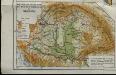
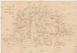
Mountains and plains of the old kingdom of Hungary [Nebenkarte]
Ungarn Topografie Teleki, Pál Teleki, Pál
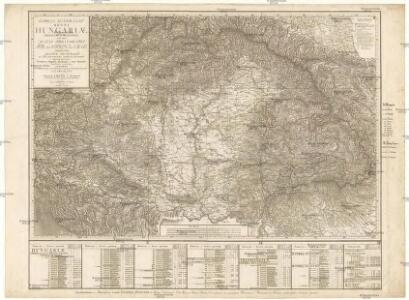
Allgemeine Charte vom Königreiche Ungarn
1 : 1500000 Chorvatsko Liechtenstern, Joseph Marx von Berken von Ottendorff, Johann Kunst und Industrie Comptoirs
Allgemeine Charte vom Königreiche Ungarn
1 : 1500000 Chorvatsko Liechtenstern, Joseph Marx von Berken von Ottendorff, Johann im Verlage des Kunst und Industrie Comptoirs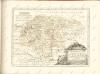
Karte des ungarischen Communikations-Netzes
1 : 1140000 Evropa jihovýchodní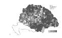
Die Bezirke der Tendenz "A" nach 1875
Ungarn Wahlbezirk, Wahlverhalten
Das Königr. Ungarn mit seinen Nebenländern
Maďarsko Benecke Bormann, E. Ignaz Fuchs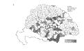
Die Bezirke der Tendenz "C" vor 1875
Ungarn Wahlbezirk, Wahlverhalten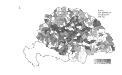
Die Bezirke der Tendenz "B" vor 1875
Ungarn Wahlbezirk, Wahlverhalten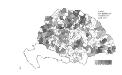
Die Bezirke der Tendenz "B" nach 1875
Ungarn Wahlbezirk, Wahlverhalten