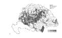
Maps of Carpathian Mountains

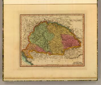
Hungary.
1 : 3800000 Darton, William
Karte von Ungarn
Maďarsko Torsch, Franz
Hungary
1 : 1000000 Hongrie. S.G.A. le 20/12/19. In: Treaty Series No. 10.1920. Treaty of Peace between the Allied and Associated Powers and Hungary. June 4, 1920. War Office
Das Königreich Ungarn nach seiner natürlichen und politischen Ansicht. Übersicht der Komitate
Ungarn Kroatien Verwaltungsbezirk Komitat
Magyarország hegy- és vizrajzi térképe
1 : 3500000 Karpaty (pohoří : oblast) Homolka, Josef Posner Károly Lajos és Fia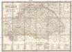
Karte von Königreich Ungarn und den zugehörigen Nebenländern
1 : 1887000 Maďarsko Schmitfeldt, Georg Lipský, Ján Florian Mollo
Provincia Austriaca Societatis Iesu
Evropa jihovýchodní Seutter, Matthäus Mayr, Johann Baptist Matthäus Seutter
Provincia Austriaca Societatis Iesu
Evropa jihovýchodní Seutter, Matthäus Kappus, Marcus Antonius a Matthaeo Seutter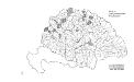
Die konservativen Wahlbezirke
Ungarn Wahlbezirk, Wahlverhalten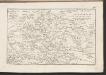
Postkarte des Königreichs Ung.Übersciht von Wien über Ofen bis Kronstadt ; und von Venedig, Triest, Fiume bis Lemberg und Brody
Ungarn Kroatien Postroute Verkehrsweg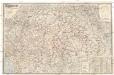
Magyarország és Horvát-Szlavonország
1 : 900000 Evropa východní Eggenberger-féle könyvkereskedés
Karte der Königreiche Ungarn, Croatien, Slavonien und Militärgrenzen

Ungarn und seine Nachbarländer 1919-1938
Ungarn
Natürliche Zu- und Abnahme der anwesenden Bevölkerung in den politischen Bezirken der Reichsratsländer im Jahrzehnt 1901 – 1910
Österreich Bevölkerungsentwicklung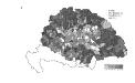
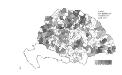
Die Bezirke der Tendenz "A" vor 1875
Ungarn Wahlbezirk, Wahlverhalten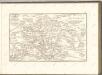
Die Bezirke der Tendenz "B" nach 1875
Ungarn Wahlbezirk, Wahlverhalten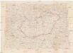
Hongrie
1 : 1000000 Maďarsko Senát Národního shromáždění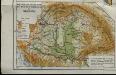
Mountains and plains of the old kingdom of Hungary [Nebenkarte]
Ungarn Topografie Teleki, Pál Teleki, Pál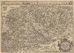
Hungariae Descriptio [Karte], in: Theatrum orbis terrarum, S. 360.
1 Karte aus Atlas Ortelius, Abraham Vrients, Jan Baptista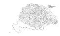
Die Wahlbezirke nach 1878
Ungarn Wahlbezirk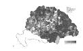
Die Bezirke der Tendenz "A" nach 1875
Ungarn Wahlbezirk, Wahlverhalten
Hungariae Regnum. [Karte], in: Novus atlas absolutissimus, Bd. 2, S. 285.
1 Karte aus Atlas Janssonius Offizin
Magyarország és a' Hozzá kapcsolt tartományok Földabrosza
1 : 970000 Chorvatsko Raffelsperger, Franz Raffelsperger F.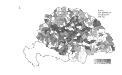
Die Bezirke der Tendenz "B" vor 1875
Ungarn Wahlbezirk, Wahlverhalten
Totius regni Hungariae
1 : 2200000 Dunaj-oblast Visscher, Nicolaus
Totius regni Hungariae
1 : 2200000 Dunaj-oblast Visscher, Nicolaus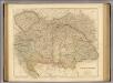
Austrian Empire.
1 : 1750000 Arrowsmith, John