Maps of Peruc

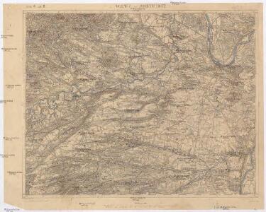
Raudnitz und Jungferteinitz
1 : 75000 Roudnice nad Labem (Česko : oblast) Ahl K. u. k. militär-geographisches Institut
Raudnitz und Jungferteinitz
1 : 75000 Roudnice nad Labem (Česko : oblast) Ahl K. u. k. Militärgeographisches Institut
Raudnitz und Jungferteinitz
1 : 75000 Roudnice nad Labem (Česko : oblast) K. u. k. Militärgeographisches Institut
Roudnice n. Labem
1 : 75000 Roudnice nad Labem (Česko : oblast) Vojenský zeměpisný ústav
Soubor přehledných map pro plánování a statistiku: 3852 – Roudnice n. Labem
Mapy plánování ČSR

Soubor přehledných map pro plánování a statistiku: 3852 – Roudnice n. Labem

III. vojenské mapování 3852
1 : 75000
Budyňský vikariát
Budyně nad Ohří-oblast (Česko)
Mapa politického a školního okresu Roudnického
1 : 100000 Roudnice nad Labem-oblast (Česko) Okresní výbor školní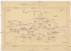
Okresní hejtmanství Roudnické
Roudnice nad Labem-oblast (Česko)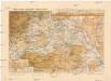
Mapa okres. hejtmanství Roudnického
1 : 100000 Budyně nad Ohří-oblast (Česko) R. Kaška
Bodenkarte des Bezirkes Raudnitz a. d. E
1 : 46000 Roudnice nad Labem-oblast (Česko) Janovský, Josef reprodukce zeměpisného ústavu min. vnitra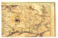

Podrobné mapy zemí Koruny české v měřítku 1:75.000 a mapa vzdáleností všech míst při silnici ležících - Velvary - Slaný - Kralupy. Průvodce statisticko-historický po všech místech na těchto mapách uvedených a rejstřík věcný názvů hor, potoků, řek, rybníků atd/ Sešit 12. List 40,
1 : 75000
Podrobné mapy zemí Koruny české v měřítku 1:75.000 a mapa vzdáleností všech míst při silnici ležících
1 : 75000 Kralupy nad Vltavou-oblast (Česko) Bělohlav, Josef Kučera, Karel F. Topič
Gradkartenblatt
1 : 25000 Roudnice nad Labem-oblast (Česko) Bellschan, Anton
[Kartenblatt]
1 : 25000 Brozany nad Ohří (Česko) Reichsamt für Landesaufnahme
III. vojenské mapování 3852/2
1 : 25000
Gradkartenblatt
1 : 25000 Velvary-oblast (Česko) Albrecht, Julius
III. vojenské mapování 3852/4
1 : 25000

Gradkartenblatt
1 : 25000 Louny-oblast (Česko) Bellschan, Anton
Půdní mapa okresu Roudnice nad Labem

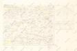
Plan der Gegend zwischen Tursko und Theresienstadt
1 : 61500 Budyně nad Ohří-oblast (Česko)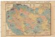
Čeňka Zahálky geologické mapy Podřipska
1 : 25000 Podřipsko (Česko) Zahálka, Čeněk
[Kartenblatt]
1 : 25000 Libochovice (Česko : oblast) Reichsamt für Landesaufnahme
Lager in der Gegend vom Georgen-Berg
1 : 100000 Říp (Česko : hora : oblast)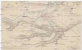
Plan der Gegend von Budin auf 3 Stund in der Länge, und 1/2 Stund in der Breite
1 : 61000 Budyně nad Ohří (Česko) Turati