Maps of Oberösterreich
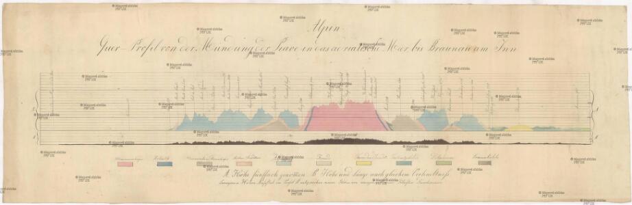
Alpen-Quer-Profil von der Mündung der Piave in das Adriatische Meer bis Braunau am Inn
Alpy
Quer-Profil der Alpen von der Mündung der Piave in das Adriatische Meer, über den Grossglockner, bis Braunau am Inn
Alpy Zeithammer, Antonín Otakar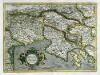
Forvm Ivlivm, Karstia, Carniola, Histria et Windorvm Marchia
1 Karte : Kupferdruck ; 33 x 45 cm Mercator; Hondius Henricus Hondius
Forvm Ivlivm, Karstia, Carniola, Histria et Windorvm Marchia
1 Karte : Kupferdruck ; 33 x 45 cm Mercator s.n.
Forvm Ivlivm, Karstia, Carniola, Histria et Windorvm Marchia
1 Karte : Kupferdruck ; 33 x 45 cm Mercator s.n.
Vetvs Avstria Cisdanvbiana Norica
1 : 2160000 Mollova mapová sbírka Clüver, Philipp Fuhrmann, Mathias
Reiseplan zu Würth's Spaziergang an das Mittelmeer
1 : 550000 Itálie severní Würth, Ludwig Riegel & Wiessner
Salisburgensis Iurisdictionis, locorumque vicinorum vera descriptio [Karte], in: Theatrum orbis terrarum, S. 168.
1 Karte aus Atlas Ortelius, Abraham
Übersichts Karte von Inner Österreich
1 : 575000 Korutansko (Rakousko) Schwab, G.
Vogels Karte des Deutschen Reichs und der Alpenländer
1 : 500000 Augsburg-oblast (Německo) Vogel, Karl Langhans, Paul Justus Perthes
Salisburgensis Iurisdictionis, locorumque vicinorum vera descriptio [Karte], in: Theatrum orbis terrarum, S. 70.
1 Karte aus Atlas Ortelius, Abraham
Salisburgensis Iurisdictionis, locorumque vicinorum vera descriptio [Karte], in: Theatrum orbis terrarum, S. 260.
1 Karte aus Atlas Ortelius, Abraham Vrients, Jan Baptista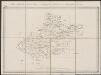
Saltzburg archiepiscopatus cum ducatu Carinthiae [Karte], in: Gerardi Mercatoris Atlas, sive, Cosmographicae meditationes de fabrica mundi et fabricati figura, S. 406.
1 Karte aus Atlas Mercator, Gerhard Montanus, Petrus
Circuli Austriaci in quo Sunt Archiducatus Austriae Ducatus Stiriae Carintiae Carniolae et Episcopatus Tridentini Novissima Descriptio
1 : 900000 Mollova mapová sbírka Danckerts, Justus Danckerts, Justus
Saltzburg Archiepiscopatus, et Carinthia Ducatus. [Karte], in: Novus Atlas, das ist, Weltbeschreibung, Bd. 1, S. 219.
1 Karte aus Atlas Blaeu, Joan Blaeu, Willem Janszoon
Saltzburg archiepiscopatus cum ducatu Carinthiae [Karte], in: Gerardi Mercatoris et I. Hondii Newer Atlas, oder, Grosses Weltbuch, Bd. 1, S. 337.
1 Karte aus Atlas Mercator, Gerhard und Hondius, Jodocus Jansson, Jan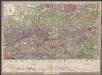
Geologische Uibersichts-Karte zur Reise von Wien durch Oesterreich, Salzburg, Kärnthen, Steyermark und Tyrol bis München, mit Berücksichtigung der österreichischen Alpen und des Bayer. Hochgebirgs
1 : 576000 Morlot, Adolph von Artaria & Co.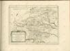

VII, uit: General-Karte des oesterreichischen Kaiserstaates mit einem grossen Theile der angrenzenden Länder / durch Josef Scheda ... bearb. und hrsg
1 : 576000 Annotatie geografische gegevens: Maatstokken: oesterreichische Meilen, geografische oder deutsche Meilen, preussische Meilen, türkische Berri, französische Lieues, russische Werste; Maatstok per blad: wiener Klafter, öster. Meilen; Blad XIX: statistische en taalkundige informatie; Blad XIX: legenda [Wien : K.K. Militärisch-Geografisches Institut]
Die Provinz Inneroesterreich oder die Herzogthümer Steyermark, Kaernten und Krain, die Grafschaften Goerz und Gradisca und das deutsch-oesterreichische Litorale
1 : 730000 Gorice a Gradiška Kindermann, Joseph Karl Junker, Christoph Franz Xaver Miller
St. Lucia und die Luzien-Percht am Südostrande der Alpen
Österreich, Slowenien, Volkskunde Umschaden, Kurt ; Neunteufl, Walter
Karte der Kroländer Steyermark, Kärnthen, Krain und Istrien
1 : 1530000 Istrijský poloostrov (Slovinsko a Chorvatsko) Marco Berra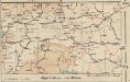
Alpenbahnen und -Pässe
1 : 2000000 Alpenländer Eisenbahnnetz, Pass
Die Provinz Inner-OEsterreich oder die Herzogthümer Steyermark, Kaernten und Krain, die Grafschaften Goerz und Gradisca und das deutsch-oesterreichische Litorale
1 : 740000 Gorice a Gradiška Kindermann, Joseph Karl Junker, Christoph Franz Xaver Miller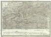
Strassen und Gebirgs-Karte zur Reise von Wien durch Oesterreich, Salzburg, Kärnthen, Steyermark und Tyrol bis München
1 : 576000 Alpy rakouské Schulz, R. A. Biller, Dominik Artaria & Co.
Das Königreich Illyrien und das Herzogthum Steyermark
1 : 700000 Ilýrie Weiland, Karl Ferdinand im Verlage des geographischen Instituts
Herzogthümer Steiermark, Kärnten, Krain, die gefürstete Graftschaft Görz und Gradiska, die Markgraftschaft Istrien, die Stadt Triest mit Gebiet und das ungarische Littorale
1 : 600000 Steiermark, Kärnten Gräf, Carl
Oesterr. Kronlander.
1 : 700000 Weiland, C. F. (Carl Ferdinand), d. 1847
Saltzburg Archiepiscopatus, et Carinthia Ducatus. [Karte], in: Theatrum orbis terrarum, sive, Atlas novus, Bd. 1, S. 274.
1 Karte aus Atlas Blaeu, Joan Blaeu, Willem Janszoon