Maps of Austria
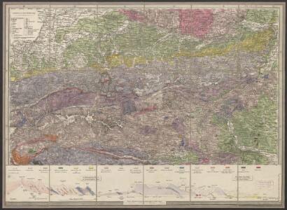
Geologische Uibersichts-Karte zur Reise von Wien durch Oesterreich, Salzburg, Kärnthen, Steyermark und Tyrol bis München, mit Berücksichtigung der österreichischen Alpen und des Bayer. Hochgebirgs
1 : 576000 Morlot, Adolph von Artaria & Co.
Cercle d'Autriche.
1 : 1450000 Clouet, J. B. L. (Jean-Baptiste Louis), b. 1730
Strassen und Gebirgs-Karte zur Reise von Wien durch Oesterreich, Salzburg, Kärnthen, Steyermark und Tyrol bis München
1 : 576000 Alpy rakouské Schulz, R. A. Biller, Dominik Artaria & Co.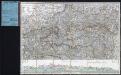
Strassen und Gebirgs-Karte zur Reise von Wien durch Österreich, Salzburg, Kärnthen, Steyermark und Tyrol bis München : mit Berücksichtigung der oesterreichischen Alpen und des Bayerischen Hochgebirgs
Artaria Co.
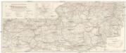
Vogels Karte des Deutschen Reichs und der Alpenländer
1 : 500000 Augsburg-oblast (Německo) Vogel, Karl Langhans, Paul Justus Perthes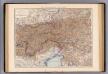
Oesterreich. Alpenlander.
1 : 1125000 Andree, Richard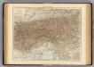
Austrian Alps.
1 : 1125000 Andree, Richard; Times (London, England)
Vindelicia, Rhetia et Noricvm
1 : 1840000 Mollova mapová sbírka Weigel, Christoph Weigel, Christoph I.
Evropa
Wintersportverkehr in Österreich
1 : 600000 Rakousko Kartographisches, früher Militärgeographisches Institut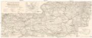
Wintersportverkehr in Österreich
1 : 600000 Rakousko Kartographisches, früher Militärgeographisches Institut
Salisburgensis Iurisdictionis, locorumque vicinorum vera descriptio [Karte], in: Theatrum orbis terrarum, S. 168.
1 Karte aus Atlas Ortelius, Abraham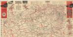
Strassen Zustands-Karte und Stadtpläne mit Durchfahrten von Österreich
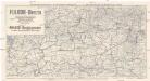
Automobilkarte Österreichs
1 : 600000 Rakousko Automobil Club
Karte der Schutzhäuser, Clubhütten, Alpenwirthshäuser und touristischen Stationen in den österreichischen und deutschen Alpenländern
1 : 1200000 Meurer, Julius Verlag Artaria & Co.
Plann deren Bergwerg Wendelstein, und Stagevoi
Mollova mapová sbírka Geyer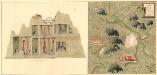
Plan des Bergwergs Weispriach
Mollova mapová sbírka Geyer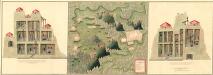
Plan der Bergwerg in der Creitzen
Mollova mapová sbírka Geyer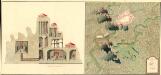
Plan des Bergwergs St. Anna an der Miss
Mollova mapová sbírka Geyer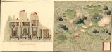
Plan des Bergwergs Wipenstein
Mollova mapová sbírka Geyer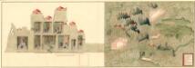
Plan der Bergwerg Schreflhoff, und Theifenegg
Mollova mapová sbírka Geyer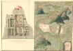
Plan des Bergwergs Serniz
Mollova mapová sbírka Geyer
Circuli Austriaci in quo sunt archiducatus Austriae ducatus Stiriae Carintiae Carniolae comitatus Tirolis et episcopatus Tridentini novissima descriptio
1 : 920000 Evropa střední Danckerts, Justus per Iustinum Danckerts
Circuli Austriaci in quo Sunt Archiducatus Austriae Ducatus Stiriae Carintiae Carniolae et Episcopatus Tridentini Novissima Descriptio
1 : 900000 Mollova mapová sbírka Danckerts, Justus Danckerts, Justus
Vetvs Avstria Cisdanvbiana Norica
1 : 2160000 Mollova mapová sbírka Clüver, Philipp Fuhrmann, Mathias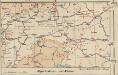
Alpenbahnen und -Pässe
1 : 2000000 Alpenländer Eisenbahnnetz, Pass
Salisburgensis Iurisdictionis, locorumque vicinorum vera descriptio [Karte], in: Theatrum orbis terrarum, S. 260.
1 Karte aus Atlas Ortelius, Abraham Vrients, Jan Baptista
VII, uit: General-Karte des oesterreichischen Kaiserstaates mit einem grossen Theile der angrenzenden Länder / durch Josef Scheda ... bearb. und hrsg
1 : 576000 Annotatie geografische gegevens: Maatstokken: oesterreichische Meilen, geografische oder deutsche Meilen, preussische Meilen, türkische Berri, französische Lieues, russische Werste; Maatstok per blad: wiener Klafter, öster. Meilen; Blad XIX: statistische en taalkundige informatie; Blad XIX: legenda [Wien : K.K. Militärisch-Geografisches Institut]
Austriae ducatus chorographia
1 : 590000 Rakousko Lazius, Wolfgang Ortelius, Abraham A. Ortelius