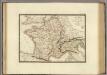
Maps of Metropolitan France

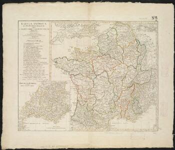
Gallia Antiqua ex Aevi Romani monumentis eruta et serenissimi Carnutum Ducis munificientia publicijuris facta
1 : 2500000
Gaules.
1 : 3000000 Lapie, M. (Pierre), 1779-1850
Nouvelle carte des differents etats de la monarchie françoise sous Iule Cesar, sous les rois de la premiere
4 Karten auf 2 Blättern : Kupferdruck ; Bildgrösse 38 x 96 cm Châtelain s.n.
Gallia transalpina
1 : 3300000 Marzolla, Benedetto [Verlag nicht ermittelbar]
Empire France et Royaume d"Italie, 1812.
1 : 6900000 Malte-Brun, Conrad, 1775-1826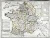
Franciæ status sub regibus primæ stirpis
1 Karte : Kupferdruck ; 48 x 65 cm Robert de Vaugondy; Delamarche chez le Sr. Delamarche géographe rue du Foin Saint Jacques au collége de M.e Gervais
Gaule, Italie septentrionale, Germanie.
1 : 3200000 Andriveau-Goujon, J.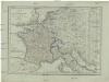
Karte von Frankreich
1 : 4500000 Belgie Mollo, Tranquillo Tranquillo Mollo
Gallae Antiquae in Septem et Decem Provinciis Divisa ... 1825.
1 : 4400000 Delamarche, Felix
France, Germany, Netherlands, Switzerland &c.
1 : 6750000 Worcester, J. E.
France in 1789.
1 : 5900000 Malte-Brun, Conrad, 1775-1826
Le royaume de France
1 Karte auf 2 Blättern : Kupferdruck ; 55 x 87 cm Jaillot; Sanson chez J. Cóvens et C. Mortier
Le royaume de France
1 Karte auf 2 Blättern : Kupferdruck ; 53 x 86 cm Jaillot; Sanson chez H. Iaillot joignant les grands Augustins aux deux globes
Das Königreich Franckreich
1 Karte auf 2 Blättern : Kupferdruck ; 54 x 87 cm Sanson; Hoffmann; Hipschmann zu finden bey Johann Hoffman
Carte itinéraire de l'empire français et du royaume d'Italie
1 Karte : Kupferdruck ; 56 x 71 cm Tardieu; Chanlaire chez l'auteur rue Geoffroy-Langevin n.o 328 (et 7. n.le ordre)
Carte itinéraire de l'empire français et du royaume d'Italie
1 Karte : Kupferdruck ; 56 x 71 cm Tardieu; Chanlaire chez l'auteur rue Geoffroy-Langevin n.o 328 (et 7. n.le ordre)
Gallia et Germania ultimorum Romani Imperii temporum aequalis
1 : 4000000 Mollova mapová sbírka Liebe, Christian Sigismund
Carte de la France : divisée en 133 départements et en arrondissements communaux ... / par J.B. Poirson
1 : 1750000 titelvariant: Carte de l'empire Français; Annotatie: Omslagtitel: Carte de l'empire Français Poirson, J. B. Paris : Jean
Jak vzniká mapa

La France 1328 a 1350.
1 : 6000000 Houze, Antoine Philippe
Carte générale de l'Empire Français et du Royaume d'Italie suivant les nouvelles divisions : avec les chefs-lieux de préfecture et l'indication des principales routes
1 : 2000000 par C.F. Delamarche Barriere sculpsit. À Paris : chez l'auteur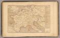
L'Empre. de Charlemagne de 768 a 814.
1 : 5800000 Houze, Antoine Philippe
Die Reiche der Carolinger
1 : 8400000 Evropa západní
Tableau l'historie de France.
1 : 8250000 Duval, Henri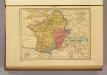
Carte des Gaules.
1 : 6000000 Malte-Brun, Conrad, 1775-1826
La France 1180 a 1223.
1 : 5800000 Houze, Antoine Philippe

La France 987 a 996.
1 : 5800000 Houze, Antoine Philippe
Empire Francais en 1811.
1 : 4840000 Migeon, J.