Maps of Metropolitan France

Gallia transalpina
1 : 3300000 Marzolla, Benedetto [Verlag nicht ermittelbar]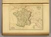
France in 1789.
1 : 5900000 Malte-Brun, Conrad, 1775-1826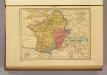
Carte des Gaules.
1 : 6000000 Malte-Brun, Conrad, 1775-1826
Carte de la France : divisée en 133 départements et en arrondissements communaux ... / par J.B. Poirson
1 : 1750000 titelvariant: Carte de l'empire Français; Annotatie: Omslagtitel: Carte de l'empire Français Poirson, J. B. Paris : Jean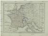
Karte von Frankreich
1 : 4500000 Belgie Mollo, Tranquillo Tranquillo Mollo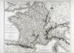
Carte itinéraire de l'empire français et du royaume d'Italie
1 Karte : Kupferdruck ; 56 x 71 cm Tardieu; Chanlaire chez l'auteur rue Geoffroy-Langevin n.o 328 (et 7. n.le ordre)
Carte itinéraire de l'empire français et du royaume d'Italie
1 Karte : Kupferdruck ; 56 x 71 cm Tardieu; Chanlaire chez l'auteur rue Geoffroy-Langevin n.o 328 (et 7. n.le ordre)
Empire France et Royaume d"Italie, 1812.
1 : 6900000 Malte-Brun, Conrad, 1775-1826
Jak vzniká mapa

Gallia Vetus Ad Iulii Caesaris commentaria. [Karte], in: Novus atlas absolutissimus, Bd. 4, S. 23.
1 Karte aus Atlas Janssonius Offizin
Nouvelle carte des differents etats de la monarchie françoise sous Iule Cesar, sous les rois de la premiere
4 Karten auf 2 Blättern : Kupferdruck ; Bildgrösse 38 x 96 cm Châtelain s.n.
La France 843 a 987.
1 : 5800000 Houze, Antoine Philippe
La France 1328 a 1350.
1 : 6000000 Houze, Antoine Philippe
Gaules.
1 : 3000000 Lapie, M. (Pierre), 1779-1850
La France 996 a 1108.
1 : 5800000 Houze, Antoine Philippe
La France sous les enfans de Clovis.
1 : 5800000 Houze, Antoine Philippe
La France 1643 a 1715.
1 : 6000000 Houze, Antoine Philippe
La France 987 a 996.
1 : 5800000 Houze, Antoine Philippe
La France 1108 a 1180.
1 : 5800000 Houze, Antoine Philippe
La France 1589 a 1643.
1 : 6000000 Houze, Antoine Philippe
La France 1380 a 1422.
1 : 6000000 Houze, Antoine Philippe
La France 1422 a 1461.
1 : 6000000 Houze, Antoine Philippe
La France 1364 a 1380.
1 : 6000000 Houze, Antoine Philippe
Empire Francais et Royaume d'Italie en 1809.
1 : 6000000 Houze, Antoine Philippe
La Gaule Romaine.
1 : 5800000 Houze, Antoine Philippe
La France 1547 a 1589.
1 : 6000000 Houze, Antoine Philippe
La France 1223 a 1270.
1 : 5800000 Houze, Antoine Philippe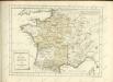

La France 1461 a 1483.
1 : 6000000 Houze, Antoine Philippe


