Maps of Metropolitan France
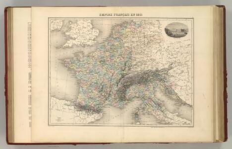
Empire Francais en 1811.
1 : 4840000 Migeon, J.
Empire de Charlemagne.
1 : 5000000 Migeon, J.
France 1789, 1813.
1 : 3700000 Lapie, M. (Pierre), 1779-1850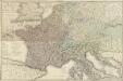
Carte géographique et administrative du Royaume de France comprenant en outre le Royaume des Pays-Bas, l'Allemagne, l'Empire d'Autriche, la Suisse, les Etats du Roi de Sardaigne sur le continent, les duchés de Parme et de Toscane, l'Etat de l'Eglise, l'Ile d'Elbe, les Sept-Iles Ioniennes en supplement et une partie de l'Empire Turc, des Royaumes de Prusse, de Naples, d'Angleterre, d'Espagne jusqu'à Madrid
1 : 1200000 dessinée par Hérisson Paris : chez Desray, J. Goujon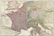
Composite: France.
1 : 1170000 Herisson, Eustache, b. 1759
Tableau l'historie de France.
1 : 8250000 Duval, Henri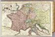
France &c.
1 : 2400000 Brue, Adrien Hubert, 1786-1832
[Historisch-geographischer Atlas zu den allgemeinen Geschichtswerken von C. v. Rotteck, Pölitz u. Becker] : Das Reich Karls des Grossen nach der Theilung seiner Enkel zu Verdun 843
von Julius Loewenberg Lithographie von B. Herder in Freiburg im Breisgau [Freiburg im Breisgau] : [Herder]
Gallia et Germania ultimorum Romani Imperii temporum aequalis
1 : 4000000 Mollova mapová sbírka Liebe, Christian Sigismund
Die Reiche der Karolinger.
1 : 5300000 Spruner von Merz, Karl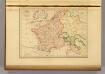
Empire France et Royaume d"Italie, 1812.
1 : 6900000 Malte-Brun, Conrad, 1775-1826

Gallia Germania Britannia
Schul-Atlas der alten Welt bei Justus Perthes
Die Republik und das Kaiserthum Frankreich mit seinen Bundes-Staaten.
1 : 5200000 Spruner von Merz, Karl

Die Zeit der ersten franz. Republik
Frankreich, Deutschland, Französische Revolution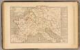
Demembrement de l'Empre. de Charlemagne.
1 : 5800000 Houze, Antoine Philippe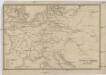
Übersichtskarte des Eisenbahn- und Telegraphen-Verbindungen von Mittel-Europa
1 : 6170000 Evropa střední Mayer, Alexander
Neueste Eisenbahn-Karte von Central-Europa
1 : 4000000 Evropa střední Issleib & Rietzschel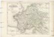
Die Reiche der Carolinger
1 : 8400000 Evropa západní
[Historisch-geographischer Atlas zu den allgemeinen Geschichtswerken von C. v. Rotteck, Pölitz u. Becker] : Deutschland und Frankreich während und nach der Reformation
von Julius Loewenberg Lithographie von B. Herder in Freiburg im Breisgau [Freiburg im Breisgau] : [Herder]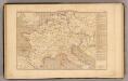
L'Empre. de Charlemagne de 768 a 814.
1 : 5800000 Houze, Antoine Philippe
France, Germany, Netherlands, Switzerland &c.
1 : 6750000 Worcester, J. E.
Napoleon's Kaiserreich im Jahre 1812
Evropa západní
Gallia, Britannia, Germania, Provinciae danuvienses.
1 : 5000000 Kiepert, Heinrich, 1818-1899
Itineraire-Karte
1 : 6000000 Evropa
Napoleon's Kaiserreich im Jahre 1812
Frankreich, Mitteleuropa, Napoleon I., Frankreich, Kaiser
Carte des routes de postes de l'Empire francais du royaume d'Italie et de la Confédération du Rhin
Evropa západní Tardieu, Pierre François
Západní Evropa při konci XIV. věku