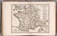
Maps of Metropolitan France
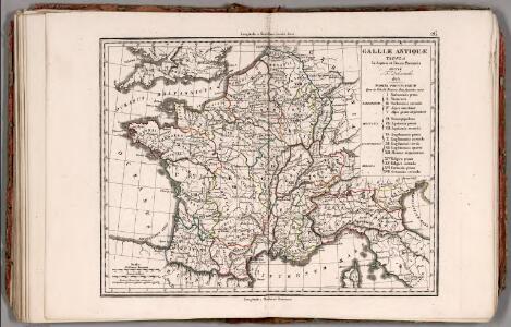
Gallae Antiquae in Septem et Decem Provinciis Divisa ... 1825.
1 : 4400000 Delamarche, Felix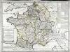
Franciæ status sub regibus primæ stirpis
1 Karte : Kupferdruck ; 48 x 65 cm Robert de Vaugondy; Delamarche chez le Sr. Delamarche géographe rue du Foin Saint Jacques au collége de M.e Gervais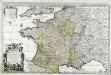
Le royaume de France
1 Karte auf 2 Blättern : Kupferdruck ; 55 x 87 cm Jaillot; Sanson chez J. Cóvens et C. Mortier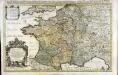
Le royaume de France
1 Karte auf 2 Blättern : Kupferdruck ; 53 x 86 cm Jaillot; Sanson chez H. Iaillot joignant les grands Augustins aux deux globes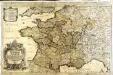
Das Königreich Franckreich
1 Karte auf 2 Blättern : Kupferdruck ; 54 x 87 cm Sanson; Hoffmann; Hipschmann zu finden bey Johann Hoffman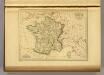
France in 1789.
1 : 5900000 Malte-Brun, Conrad, 1775-1826
Nouvelle carte des differents etats de la monarchie françoise sous Iule Cesar, sous les rois de la premiere
4 Karten auf 2 Blättern : Kupferdruck ; Bildgrösse 38 x 96 cm Châtelain s.n.
La France 987 a 996.
1 : 5800000 Houze, Antoine Philippe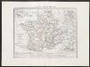
Gallia transalpina
1 : 3300000 Marzolla, Benedetto [Verlag nicht ermittelbar]
La France apres l'invasion des Barbares.
1 : 5800000 Houze, Antoine Philippe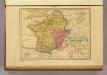
Carte des Gaules.
1 : 6000000 Malte-Brun, Conrad, 1775-1826
La France 1380 a 1422.
1 : 6000000 Houze, Antoine Philippe
La France 1364 a 1380.
1 : 6000000 Houze, Antoine Philippe
La Gaule Romaine.
1 : 5800000 Houze, Antoine Philippe
La France 1547 a 1589.
1 : 6000000 Houze, Antoine Philippe
La France 613 a 768.
1 : 5800000 Houze, Antoine Philippe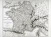
Carte itinéraire de l'empire français et du royaume d'Italie
1 Karte : Kupferdruck ; 56 x 71 cm Tardieu; Chanlaire chez l'auteur rue Geoffroy-Langevin n.o 328 (et 7. n.le ordre)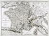
Carte itinéraire de l'empire français et du royaume d'Italie
1 Karte : Kupferdruck ; 56 x 71 cm Tardieu; Chanlaire chez l'auteur rue Geoffroy-Langevin n.o 328 (et 7. n.le ordre)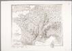
Carte de la France : avec ses établissements politiques, militaires, civils et religieux / dressée au Dépôt Général de la Guerre ...
1 : 1800000 Annotatie: Afdruk van koperplaat; Oorspr. uitg.: Paris, 1811 Dépôt de la Guerre, Frankrijk [Paris : IGN]
La France 1461 a 1483.
1 : 6000000 Houze, Antoine Philippe
La France 996 a 1108.
1 : 5800000 Houze, Antoine Philippe
La France 1180 a 1223.
1 : 5800000 Houze, Antoine Philippe
La France 1589 a 1643.
1 : 6000000 Houze, Antoine Philippe
La France 1328 a 1350.
1 : 6000000 Houze, Antoine Philippe
La France 1422 a 1461.
1 : 6000000 Houze, Antoine Philippe
La France 1223 a 1270.
1 : 5800000 Houze, Antoine Philippe
La France 1108 a 1180.
1 : 5800000 Houze, Antoine Philippe
Jak vzniká mapa

La France 1814 a 1840.
1 : 6000000 Houze, Antoine Philippe