Maps of United States

Republics Of North America
1 : 3041280 Colton, J. H.
Republics Of North America
1 : 3041280 Johnson, D. Griffing
New National Map Exhibiting The United States
1 : 3800000 Mitchell, Samuel Augustus
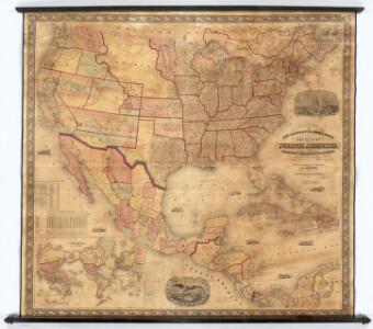
Map of the United States and Mexico
1 : 6000000 Johnson & Browning
Colton's Railroad and Military Map, United States.
1 : 6500000 Colton, G.W & C.B.
Map Of The United States, Canada, Mexico, Central America, and the West India Islands.
1 : 12500000 Atwood, J.M.
Washington Map of the United States.
1 : 13000000 Taintor, S. & Co.
Our Country, Present & Prospective.
1 : 3801600 Gaston, Samuel N.
Vereinigte Staaten, Central-Amerika und Westindien
Volksschul-Atlas über alle Teile der Erde Lange, Henry Druck und Verlag von Georg Westermann
Our Country Present And Prospective.
1 : 3168000 Gaston, Samuel N.
New National Map Exhibiting The United States
1 : 3800000 Mitchell, Samuel Augustus
Diagram of the United States of America, Mexico, the West India Islands and Isthmus of Darien : showing proposed routes of the Pacific Rail Road ...
1 : 6500000 Steiger, W. T. United States. General Land Office
America septentrionalis
1 Karte : Kupferdruck ; 45 x 53 cm Janssonius excudit Ioannes Janssonius
America septentrionalis
1 Karte : Kupferdruck ; 45 x 53 cm Valck; Schenk penes Gerardum Valk et Petrum Schenk
Naval And Military Map Of The United States.
1 : 3300000 Smith, Robert P.
Washington Map of the United States.
1 : 13000000 Taintor, S. & Co.
Map Of The United States Of America.
1 : 16526080 Colton, J. H.
Map of the United States of America, the British provinces, Mexico, the West Indies and Central America, with part of New Granada and Venezuela / map drawn by Geo. W. Colton ; engraved by John M. Atwood ; border desig'd. & eng'd. by W. S. Barnard.
From Parts
Map Of The United States, Canada, Mexico, Central America, West Indies, &c.
1 : 3380000 Williams, G. Washington.
Johnson's new illustrated & embellished county map of the republics of North America : with the adjacent islands & countries / compiled, drawn & engraved from U. States land & coast surveys, British Admiralty & other reliable sources by D. Griffing Johns
from Parts
Mitchell's new national map exhibiting the United States : with the north American British provinces, Sandwich Islands, Mexico and Central America, together with Cuba and other West India Islands
1 : 2500000 Williams, W. (Wellington) S. Augustus Mitchell
[Vereinigte Staaten von Nord-Amerika]
Hypsometrischer Atlas Ziegler, Jakob Melchior Topogr. Anstalt v. J. Wurster u. Comp.
Map of the United States of America, the British Provinces, Mexico, the West Indies and Central America, with part of New Granada and Venezuela
1 : 6400000 Colton, George Woolworth Colton, J. H. (Joseph Hutchins)
A new map of the north parts of America claimed by France under ye names of Louisiana, Mississipi, Canada and New France, with ye adjoyning territories of England and Spain ... / ... laid down according to the newest and most exact observations by H. Mol
from The world described, or, A new and correct sett of maps : shewing the kingdoms and states in all the known parts of the earth, with the principal cities, and most considerable towns in the world ... / ... by Herman Moll, geographer ...
Map of the United States of America, the British provinces, Mexico, the West Indies and Central America, with part of New Granada and Venezuela / map drawn by Geo. W. Colton; engraved by John M. Atwood; border desig'd. & eng'd. by W.S. Barnard.
from Parts George W. Colton; John M. Atwood; W. S. Barnard,
Regni Mexicani seu Novae Hispaniae, Floridae, Novae Angliae, Carolinae, Virginiae et Pensylvaniae necnon insularum archipelagi Mexicani in America Septentrionali
from Charts and maps
Washington Map of the United States.
1 : 3000000 Taintor, S. & Co.
Special -Karte der Vereinigten Staaten von Nord - America No 16.

Verein-Staaten von Nord-America, Mexico, Yucatan u.A.
Hand-Atlas über alle Theile der Erde nach dem neuesten Zustande und über das Weltgebäude Stieler, Adolf bei Justus Perthes