Maps of Canadian Shield
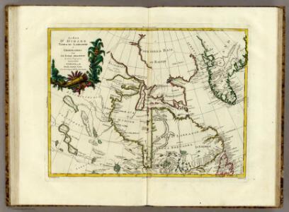
La Baja D'Hudson Terra di Labrador e Groenlandia.
1 : 9750000 Zatta, Antonio
L'Amerique Septentrionale 1.
1 : 10050000 Bonne, Rigobert, 1727-1794
Canada - East. Pergamon World Atlas.
1 : 10000000 Polish Army Topography Service
North America...N.E. Sheet.
1 : 7500000 Tanner, Henry S.
North America...N.E. Sheet.
1 : 7500000 Tanner, Henry S.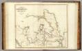
Arctic Regions.
1 : 19000000 Thomson, John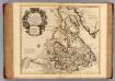
Canada, Nouvelle France.
1 : 9000000 L'Isle, Guillaume de, 1675-1726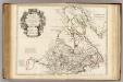
Canada, Nouvelle France.
1 : 9000000 L'Isle, Guillaume de, 1675-1726
Greenland, Labrador.
1 : 15000000 Peterson, Augusts
Septemtrionaliora Americæ à Groenlandia, per freta Davidis et Hudson, ad Terram Novam
1 Karte : Kupferdruck ; 48 x 55 cm Renard Louis Renard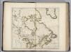
British Possessions in North America.
1 : 9100000 Carey, Mathew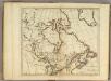
British Possessions in North America.
1 : 9000000 Carey, Mathew
British Possessions in North America.
1 : 6969600 Carey, Mathew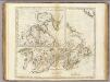
British Possessions in North America.
1 : 7603200 Carey, Mathew
British Possessions in North America.
1 : 7286400 Lewis, Samuel
British Possessions in North America.
1 : 7603200 Carey, Mathew
[142][145] Septemtrionaliora Americae à Groenlandia, ..., uit: Atlas sive Descriptio terrarum orbis
Annotatie: Gedigitaliseerde versie. Amsterdam. Heiloo : Picturae (vervaardiger), 2015. tiff-bestand. Gedigitaliseerd: 07-01-2015; Origineel: Universiteitsbibliotheek Vrije Universiteit (XL.05127.-) ; Netherlands; Titelpagina ontbreekt Wit, Frederik de Amsterdam : Frederick de Wit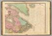
North America, N.E.. Sheet.
1 : 7600000 Tanner, Henry S.
Groenland und die angraenzenden Laender nach den Charten und Berichten von Cranz, Egede, Gieseke, Graah, Olavsen, Parry, Ross, Scoresby, Thorhallesen u.a.
1 : 5000000 entworfen und gezeichnet von Theodor Gliemann Weimar : Verlag des Geograph. Instituts
Carte marine, de la B. de Baffin, et une partie d'Hudson, d'Island et Groenland
1 Karte : Kupferdruck ; 42 x 48 cm Königliche Akademie der Wissenschaften
A General Chart ... Davis Straits & Baffin Islands Bay.
1 : 19000000 Melish, John
The north west part of America / by Robt. Morden.; Geography rectified, or, A description of the world: in all its kingdoms, provinces, countries, islands, cities, towns, seas, rivers, bayes, capes, ports: their antient and present names, inhabitants, situations, histories, customs, governments, &c.: as also their commodities, coins, weights, and measures, compared with those at London: illustrated with above sixty new maps: the whole work performed according to the more accurate discoveries of modern authors / by Robert Morden.
from Geography rectified, or, A description of the world : in all its kingdoms, provinces, countries, islands, cities, towns, seas, rivers, bayes, capes, ports : their antient and present names, inhabitants, situations, histories, customs, governments, &c. : as also their commodities, coins, weights, and measures, compared with those at London : illustrated with above sixty new maps : the whole work performed according to the more accurate discoveries of modern authors / by Robert Morden. Morden, Robert; Cockerill, Thomas,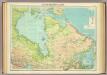
North-eastern Canada.
1 : 5000000 John Bartholomew and Son
Gletscherkarte
Atlas der Geologie Zittel, K.v. ; Berghaus, Hermann Justus Perthes
Paskaert van de Noordelijckste kuste van America van Groenland door de Straet Davis en de Straet Hudson tot Terra Neuf
1 : 8000000 Colom, Jacob Aertsz Colom, Jacob Aertsz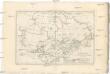
Canada
1 : 10120000 Kanada Bonne, Rigobert André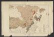
Geology. East sheet
1 : 6336000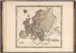
Europe.
1 : 11721600 Tanner, Henry S.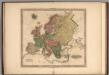
Europe.
1 : 11721600 Tanner, Henry S.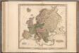
Europe.
1 : 11721600 Tanner, Henry S.