Maps of Kommuneqarfik Sermersooq

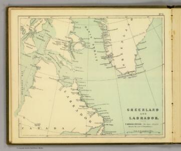
Greenland, Labrador.
1 : 15000000 Peterson, Augusts
North America, N.E.. Sheet.
1 : 7600000 Tanner, Henry S.
North America...N.E. Sheet.
1 : 7500000 Tanner, Henry S.
North America...N.E. Sheet.
1 : 7500000 Tanner, Henry S.
L'Amerique Septentrionale 1.
1 : 10050000 Bonne, Rigobert, 1727-1794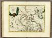
La Baja D'Hudson Terra di Labrador e Groenlandia.
1 : 9750000 Zatta, Antonio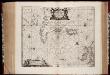
Typus Maritimus Groenlandiae, Islandiae, Freti Davidis, Insulae Iohannis Mayen, et Hitlandiae, Scotiae, et Hiberniae litora maritima Septentrionalia
1 : 7000000 Annotatie: Paskaart van de noordelijke Atlantische Oceaan met de kusten van met name het gebied tussen de Faeroër Eilanden, Groenland en Baffin Island; Origineel is Blad 149 in atlas factice; Kaart bevat diverse kompasrozen en is gedecoreerd met afbeeldingen van schepen en een walvis; Annotatie geografische gegevens: Met drie schaalstokken [Amstelodami] : [Apud Ioannem Ianßonium]
[142][145] Septemtrionaliora Americae à Groenlandia, ..., uit: Atlas sive Descriptio terrarum orbis
Annotatie: Gedigitaliseerde versie. Amsterdam. Heiloo : Picturae (vervaardiger), 2015. tiff-bestand. Gedigitaliseerd: 07-01-2015; Origineel: Universiteitsbibliotheek Vrije Universiteit (XL.05127.-) ; Netherlands; Titelpagina ontbreekt Wit, Frederik de Amsterdam : Frederick de Wit
The north west part of America / by Robt. Morden.; Geography rectified, or, A description of the world: in all its kingdoms, provinces, countries, islands, cities, towns, seas, rivers, bayes, capes, ports: their antient and present names, inhabitants, situations, histories, customs, governments, &c.: as also their commodities, coins, weights, and measures, compared with those at London: illustrated with above sixty new maps: the whole work performed according to the more accurate discoveries of modern authors / by Robert Morden.
from Geography rectified, or, A description of the world : in all its kingdoms, provinces, countries, islands, cities, towns, seas, rivers, bayes, capes, ports : their antient and present names, inhabitants, situations, histories, customs, governments, &c. : as also their commodities, coins, weights, and measures, compared with those at London : illustrated with above sixty new maps : the whole work performed according to the more accurate discoveries of modern authors / by Robert Morden. Morden, Robert; Cockerill, Thomas,
Septemtrionaliora Americæ à Groenlandia, per freta Davidis et Hudson, ad Terram Novam
1 Karte : Kupferdruck ; 48 x 55 cm Renard Louis Renard
Gletscherkarte
Atlas der Geologie Zittel, K.v. ; Berghaus, Hermann Justus Perthes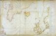
Carte réduite des mers du Nord
1 Karte : Kupferdruck ; 54 x 76 cm Verdun de la Crenne; Borda; Pingré; Petit s.n.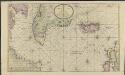
Nieuwe platte pas kaart van de Noord Occiaan van Hitland tot in de Straat Davids seer dienstig voor de Straat Davids vaarders
1 : 3800000 welke straat nu nieulijks en naaukeurig afgeteekent en beschreeven door schipper Laurens Feykes Haan en verder in 't ligt gebragt door G. van Keulen Tot Amsterdam : bij Gerard van Keulen, boek en zee-kaart verkooper, aan de Nieuwen-brug [...]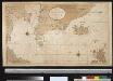
Nieuwe afteekening van de Straat Davits van Hitland tot aen de Straet Davids
Atlantic Ocean Gerard van Keulen
Pascaert om van Texel na de Straet Davids en Hutson te zijlen zijnde ook seer dienstig voor de gene die agterom koomen voornamentlijk voor de Westindise en Guneese schipvaert
Atlantic Ocean Gerard van Keulen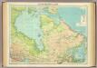
North-eastern Canada.
1 : 5000000 John Bartholomew and Son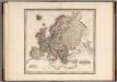
Europe.
1 : 11721600 Tanner, Henry S.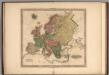
Europe.
1 : 11721600 Tanner, Henry S.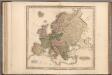
Europe.
1 : 11721600 Tanner, Henry S.
Europe.
1 : 11721600 Tanner, Henry S.
Old Greenland.
1 : 9850000 Bowen, Emanuel
Paskaert van de Noordelijckste kuste van America van Groenland door de Straet Davis en de Straet Hudson tot Terra Neuf
1 : 8000000 Colom, Jacob Aertsz Colom, Jacob Aertsz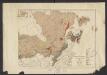
Geology. East sheet
1 : 6336000
British Provinces of North America.
1 : 10000000 Cornell, S. S. (Sarah S.)
EXTREMA AMERICÆ | Versus Boream, ubi | TERRA NOVA | NOVA FRANCIA, Adjacentiaq.
Amstelaedami Io. Blaeu Exc.
188-189. Canada, East. The World Atlas.
1 : 5000000 USSR (Union of Soviet Socialist Republics).
Museumskart 15 Nieuwe Wassende kaart van een Gedeelte der Noorder Atlantische Oceaan
1 : 3000000 Gerard Hulst van Keulen
Oud Groenland van Staaten Hoek of C. Farawel tot de Visch Baij of Straet Davids int groot
Greenland Gerard van Keulen
Karten-Skizze des Treibeises bei Newfundland während der Zeit vom 11. März bis zum 5. Mai 1891, nach den Berichten, welche bis zum 20. Mai eingegangen sind
Newfoundland (Kanada : ostrov)